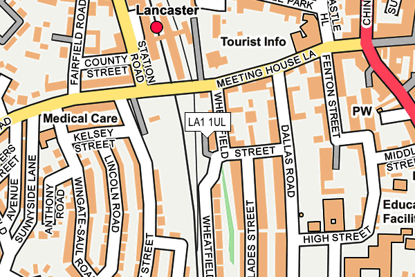
LA1 1UL is located in the Castle electoral ward, within the local authority district of Lancaster and the English Parliamentary constituency of Lancaster and Fleetwood. The Sub Integrated Care Board (ICB) Location is NHS Lancashire and South Cumbria ICB - 01K and the police force is Lancashire. This postcode has been in use since March 2017.


GetTheData
Source: OS OpenMap – Local (Ordnance Survey)
Source: OS VectorMap District (Ordnance Survey)
Licence: Open Government Licence (requires attribution)
| Easting | 347286 |
| Northing | 461572 |
| Latitude | 54.047414 |
| Longitude | -2.806573 |
GetTheData
Source: Open Postcode Geo
Licence: Open Government Licence
| Country | England |
| Postcode District | LA1 |
➜ See where LA1 is on a map ➜ Where is Lancaster? | |
GetTheData
Source: Land Registry Price Paid Data
Licence: Open Government Licence
| Ward | Castle |
| Constituency | Lancaster And Fleetwood |
GetTheData
Source: ONS Postcode Database
Licence: Open Government Licence
| Railway Station (Meeting House Lane) | Lancaster City Centre | 70m |
| Meeting House Lane | Lancaster City Centre | 93m |
| Sibsey Street (Westbourne Road) | Lancaster City Centre | 163m |
| Post Office (Meeting House Lane) | Lancaster City Centre | 175m |
| Railway Station (Station Road) | Lancaster City Centre | 180m |
| Lancaster Station | 0.2km |
| Bare Lane Station | 3.6km |
| Morecambe Station | 4.8km |
GetTheData
Source: NaPTAN
Licence: Open Government Licence
| Percentage of properties with Next Generation Access | 100.0% |
| Percentage of properties with Superfast Broadband | 100.0% |
| Percentage of properties with Ultrafast Broadband | 0.0% |
| Percentage of properties with Full Fibre Broadband | 0.0% |
Superfast Broadband is between 30Mbps and 300Mbps
Ultrafast Broadband is > 300Mbps
| Median download speed | 15.4Mbps |
| Average download speed | 15.7Mbps |
| Maximum download speed | 19.09Mbps |
| Median upload speed | 1.1Mbps |
| Average upload speed | 1.1Mbps |
| Maximum upload speed | 1.22Mbps |
| Percentage of properties unable to receive 2Mbps | 0.0% |
| Percentage of properties unable to receive 5Mbps | 0.0% |
| Percentage of properties unable to receive 10Mbps | 0.0% |
| Percentage of properties unable to receive 30Mbps | 0.0% |
GetTheData
Source: Ofcom
Licence: Ofcom Terms of Use (requires attribution)
GetTheData
Source: ONS Postcode Database
Licence: Open Government Licence


➜ Get more ratings from the Food Standards Agency
GetTheData
Source: Food Standards Agency
Licence: FSA terms & conditions
| Last Collection | |||
|---|---|---|---|
| Location | Mon-Fri | Sat | Distance |
| Lancaster Post Office | 18:45 | 13:00 | 196m |
| Lancaster Post Office | 18:45 | 13:00 | 199m |
| Fairfield Hall | 16:00 | 12:30 | 255m |
GetTheData
Source: Dracos
Licence: Creative Commons Attribution-ShareAlike
The below table lists the International Territorial Level (ITL) codes (formerly Nomenclature of Territorial Units for Statistics (NUTS) codes) and Local Administrative Units (LAU) codes for LA1 1UL:
| ITL 1 Code | Name |
|---|---|
| TLD | North West (England) |
| ITL 2 Code | Name |
| TLD4 | Lancashire |
| ITL 3 Code | Name |
| TLD44 | Lancaster and Wyre |
| LAU 1 Code | Name |
| E07000121 | Lancaster |
GetTheData
Source: ONS Postcode Directory
Licence: Open Government Licence
The below table lists the Census Output Area (OA), Lower Layer Super Output Area (LSOA), and Middle Layer Super Output Area (MSOA) for LA1 1UL:
| Code | Name | |
|---|---|---|
| OA | E00127400 | |
| LSOA | E01025099 | Lancaster 014C |
| MSOA | E02005234 | Lancaster 014 |
GetTheData
Source: ONS Postcode Directory
Licence: Open Government Licence
| LA1 1BE | Wheatfield Court | 44m |
| LA1 1UN | St James Court | 63m |
| LA1 1TT | Blades Street | 89m |
| LA1 1TJ | Meeting House Lane | 108m |
| LA1 1TX | Meeting House Lane | 110m |
| LA1 1TN | Dallas Road | 121m |
| LA1 5DF | Sibsey Street | 131m |
| LA1 5DE | Sibsey Street | 133m |
| LA1 5DJ | Lincoln Road | 155m |
| LA1 1TW | Dallas Road | 161m |
GetTheData
Source: Open Postcode Geo; Land Registry Price Paid Data
Licence: Open Government Licence