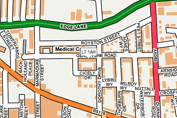
L7 1AH is located in the Edge Hill electoral ward, within the metropolitan district of Liverpool and the English Parliamentary constituency of Liverpool, Wavertree. The Sub Integrated Care Board (ICB) Location is NHS Cheshire and Merseyside ICB - 99A and the police force is Merseyside. This postcode has been in use since November 2017.


GetTheData
Source: OS OpenMap – Local (Ordnance Survey)
Source: OS VectorMap District (Ordnance Survey)
Licence: Open Government Licence (requires attribution)
| Easting | 336767 |
| Northing | 390359 |
| Latitude | 53.406259 |
| Longitude | -2.952625 |
GetTheData
Source: Open Postcode Geo
Licence: Open Government Licence
| Country | England |
| Postcode District | L7 |
➜ See where L7 is on a map ➜ Where is Liverpool? | |
GetTheData
Source: Land Registry Price Paid Data
Licence: Open Government Licence
| Ward | Edge Hill |
| Constituency | Liverpool, Wavertree |
GetTheData
Source: ONS Postcode Database
Licence: Open Government Licence
2021 16 APR £155,000 |
2019 26 JUL £131,995 |
8, GLADSTONE ROAD, LIVERPOOL, L7 1AH 2018 29 NOV £189,995 |
24, GLADSTONE ROAD, LIVERPOOL, L7 1AH 2017 21 JUL £182,995 |
22, GLADSTONE ROAD, LIVERPOOL, L7 1AH 2017 21 JUL £182,995 |
20, GLADSTONE ROAD, LIVERPOOL, L7 1AH 2017 20 JUL £182,995 |
26, GLADSTONE ROAD, LIVERPOOL, L7 1AH 2017 10 JUL £182,995 |
GetTheData
Source: HM Land Registry Price Paid Data
Licence: Contains HM Land Registry data © Crown copyright and database right 2024. This data is licensed under the Open Government Licence v3.0.
| Marmaduke Street (Edge Lane) | Kensington | 108m |
| Jubilee Drive (Edge Lane) | Kensington | 119m |
| Janet Street (Wavertree Road) | Kensington | 155m |
| Overton Street (Wavertree Road) | Edge Hill | 194m |
| Wavertree Road (Overton Street) | Edge Hill | 207m |
| Edge Hill Station | 0.6km |
| Liverpool Lime Street Station | 1.7km |
| Liverpool Lime Street Low Level Station | 1.7km |
GetTheData
Source: NaPTAN
Licence: Open Government Licence
| Percentage of properties with Next Generation Access | 100.0% |
| Percentage of properties with Superfast Broadband | 100.0% |
| Percentage of properties with Ultrafast Broadband | 100.0% |
| Percentage of properties with Full Fibre Broadband | 0.0% |
Superfast Broadband is between 30Mbps and 300Mbps
Ultrafast Broadband is > 300Mbps
| Median download speed | 39.7Mbps |
| Average download speed | 44.3Mbps |
| Maximum download speed | 100.00Mbps |
| Median upload speed | 1.0Mbps |
| Average upload speed | 8.3Mbps |
| Maximum upload speed | 19.83Mbps |
| Percentage of properties unable to receive 2Mbps | 0.0% |
| Percentage of properties unable to receive 5Mbps | 0.0% |
| Percentage of properties unable to receive 10Mbps | 0.0% |
| Percentage of properties unable to receive 30Mbps | 0.0% |
GetTheData
Source: Ofcom
Licence: Ofcom Terms of Use (requires attribution)
GetTheData
Source: ONS Postcode Database
Licence: Open Government Licence


➜ Get more ratings from the Food Standards Agency
GetTheData
Source: Food Standards Agency
Licence: FSA terms & conditions
| Last Collection | |||
|---|---|---|---|
| Location | Mon-Fri | Sat | Distance |
| Durning Road | 17:15 | 12:00 | 297m |
| Chatsworth Drive | 17:15 | 12:00 | 326m |
| Holt Road Post Office | 17:30 | 12:00 | 396m |
GetTheData
Source: Dracos
Licence: Creative Commons Attribution-ShareAlike
The below table lists the International Territorial Level (ITL) codes (formerly Nomenclature of Territorial Units for Statistics (NUTS) codes) and Local Administrative Units (LAU) codes for L7 1AH:
| ITL 1 Code | Name |
|---|---|
| TLD | North West (England) |
| ITL 2 Code | Name |
| TLD7 | Merseyside |
| ITL 3 Code | Name |
| TLD72 | Liverpool |
| LAU 1 Code | Name |
| E08000012 | Liverpool |
GetTheData
Source: ONS Postcode Directory
Licence: Open Government Licence
The below table lists the Census Output Area (OA), Lower Layer Super Output Area (LSOA), and Middle Layer Super Output Area (MSOA) for L7 1AH:
| Code | Name | |
|---|---|---|
| OA | E00176699 | |
| LSOA | E01033763 | Liverpool 031G |
| MSOA | E02001377 | Liverpool 031 |
GetTheData
Source: ONS Postcode Directory
Licence: Open Government Licence
| L7 1PW | Dorothy Drive | 101m |
| L7 1PA | Marmaduke Street | 107m |
| L7 1PF | Wavertree Road | 126m |
| L7 1QH | Winifred Street | 137m |
| L7 1PB | Marmaduke Street | 139m |
| L7 2PD | Edge Lane | 142m |
| L7 2PE | Edge Lane | 150m |
| L7 1QL | Lybro Way | 160m |
| L7 1PE | Wavertree Road | 172m |
| L7 1PZ | Royston Street | 175m |
GetTheData
Source: Open Postcode Geo; Land Registry Price Paid Data
Licence: Open Government Licence