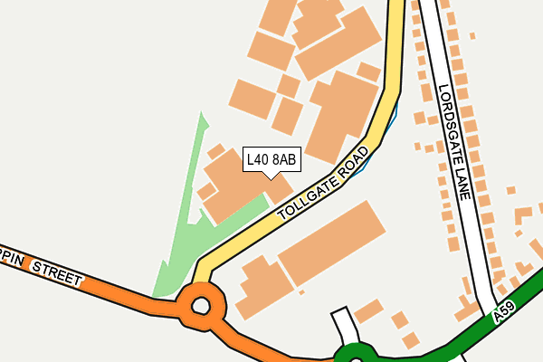
L40 8AB is located in the Burscough Town electoral ward, within the local authority district of West Lancashire and the English Parliamentary constituency of West Lancashire. The Sub Integrated Care Board (ICB) Location is NHS Lancashire and South Cumbria ICB - 02G and the police force is Lancashire. This postcode has been in use since June 2009.


GetTheData
Source: OS OpenMap – Local (Ordnance Survey)
Source: OS VectorMap District (Ordnance Survey)
Licence: Open Government Licence (requires attribution)
| Easting | 342852 |
| Northing | 410688 |
| Latitude | 53.589658 |
| Longitude | -2.864816 |
GetTheData
Source: Open Postcode Geo
Licence: Open Government Licence
| Country | England |
| Postcode District | L40 |
➜ See where L40 is on a map ➜ Where is Burscough? | |
GetTheData
Source: Land Registry Price Paid Data
Licence: Open Government Licence
Elevation or altitude of L40 8AB as distance above sea level:
| Metres | Feet | |
|---|---|---|
| Elevation | 30m | 98ft |
Elevation is measured from the approximate centre of the postcode, to the nearest point on an OS contour line from OS Terrain 50, which has contour spacing of ten vertical metres.
➜ How high above sea level am I? Find the elevation of your current position using your device's GPS.
GetTheData
Source: Open Postcode Elevation
Licence: Open Government Licence
| Ward | Burscough Town |
| Constituency | West Lancashire |
GetTheData
Source: ONS Postcode Database
Licence: Open Government Licence
| Bull And Dog (Liverpool Road South) | Burscough | 321m |
| Bull And Dog (Liverpool Road South) | Burscough | 325m |
| High Lane | Burscough | 419m |
| High Lane | Burscough | 456m |
| Red Lion (Liverpool Road South) | Burscough | 580m |
| Burscough Junction Station | 1.8km |
| Burscough Bridge Station | 2.4km |
| New Lane Station | 2.5km |
GetTheData
Source: NaPTAN
Licence: Open Government Licence
GetTheData
Source: ONS Postcode Database
Licence: Open Government Licence


➜ Get more ratings from the Food Standards Agency
GetTheData
Source: Food Standards Agency
Licence: FSA terms & conditions
| Last Collection | |||
|---|---|---|---|
| Location | Mon-Fri | Sat | Distance |
| Burscough Junction | 17:30 | 12:00 | 1,485m |
| Church Street | 17:30 | 12:00 | 2,780m |
| Aughton Post Office | 17:30 | 12:00 | 2,871m |
GetTheData
Source: Dracos
Licence: Creative Commons Attribution-ShareAlike
The below table lists the International Territorial Level (ITL) codes (formerly Nomenclature of Territorial Units for Statistics (NUTS) codes) and Local Administrative Units (LAU) codes for L40 8AB:
| ITL 1 Code | Name |
|---|---|
| TLD | North West (England) |
| ITL 2 Code | Name |
| TLD4 | Lancashire |
| ITL 3 Code | Name |
| TLD47 | Chorley and West Lancashire |
| LAU 1 Code | Name |
| E07000127 | West Lancashire |
GetTheData
Source: ONS Postcode Directory
Licence: Open Government Licence
The below table lists the Census Output Area (OA), Lower Layer Super Output Area (LSOA), and Middle Layer Super Output Area (MSOA) for L40 8AB:
| Code | Name | |
|---|---|---|
| OA | E00129343 | |
| LSOA | E01025486 | West Lancashire 004D |
| MSOA | E02005307 | West Lancashire 004 |
GetTheData
Source: ONS Postcode Directory
Licence: Open Government Licence
| L40 7UP | Admiralty Close | 150m |
| L40 7UR | Lordsgate Lane | 162m |
| L40 7ST | Lordsgate Lane | 204m |
| L40 8LD | Tollgate Road | 345m |
| L40 7SU | Liverpool Road South | 483m |
| L40 7TA | Liverpool Road South | 520m |
| L40 7SN | High Lane | 638m |
| L40 7UD | Mill Dam Close | 660m |
| L40 7TQ | Mill Dam Lane | 664m |
| L40 7GA | Blythe Meadow | 724m |
GetTheData
Source: Open Postcode Geo; Land Registry Price Paid Data
Licence: Open Government Licence