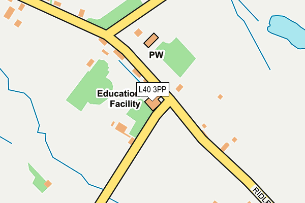
L40 3PP is located in the Croston, Mawdesley & Euxton South electoral ward, within the local authority district of Chorley and the English Parliamentary constituency of South Ribble. The Sub Integrated Care Board (ICB) Location is NHS Lancashire and South Cumbria ICB - 00X and the police force is Lancashire. This postcode has been in use since June 2001.


GetTheData
Source: OS OpenMap – Local (Ordnance Survey)
Source: OS VectorMap District (Ordnance Survey)
Licence: Open Government Licence (requires attribution)
| Easting | 350812 |
| Northing | 414544 |
| Latitude | 53.625107 |
| Longitude | -2.745186 |
GetTheData
Source: Open Postcode Geo
Licence: Open Government Licence
| Country | England |
| Postcode District | L40 |
➜ See where L40 is on a map ➜ Where is Towngate? | |
GetTheData
Source: Land Registry Price Paid Data
Licence: Open Government Licence
Elevation or altitude of L40 3PP as distance above sea level:
| Metres | Feet | |
|---|---|---|
| Elevation | 40m | 131ft |
Elevation is measured from the approximate centre of the postcode, to the nearest point on an OS contour line from OS Terrain 50, which has contour spacing of ten vertical metres.
➜ How high above sea level am I? Find the elevation of your current position using your device's GPS.
GetTheData
Source: Open Postcode Elevation
Licence: Open Government Licence
| Ward | Croston, Mawdesley & Euxton South |
| Constituency | South Ribble |
GetTheData
Source: ONS Postcode Database
Licence: Open Government Licence
| St Peter And Paul Rcps (Ridley Lane) | Mawdesley | 28m |
| Ridley Lane End (Ridley Lane) | Andertons Mill | 393m |
| Ridley Lane | Mawdesley | 469m |
| Sandersons Lane (Bentley Lane) | Andertons Mill | 503m |
| Dark Lane | Mawdesley | 726m |
| Parbold Station | 4.2km |
| Rufford Station | 4.3km |
| Hoscar Station | 5km |
GetTheData
Source: NaPTAN
Licence: Open Government Licence
GetTheData
Source: ONS Postcode Database
Licence: Open Government Licence


➜ Get more ratings from the Food Standards Agency
GetTheData
Source: Food Standards Agency
Licence: FSA terms & conditions
| Last Collection | |||
|---|---|---|---|
| Location | Mon-Fri | Sat | Distance |
| Bispham Grammar School | 16:00 | 08:00 | 1,860m |
| Heskin Post Office | 17:00 | 11:00 | 2,388m |
| 263 The Green, Eccleston | 17:15 | 11:00 | 2,512m |
GetTheData
Source: Dracos
Licence: Creative Commons Attribution-ShareAlike
The below table lists the International Territorial Level (ITL) codes (formerly Nomenclature of Territorial Units for Statistics (NUTS) codes) and Local Administrative Units (LAU) codes for L40 3PP:
| ITL 1 Code | Name |
|---|---|
| TLD | North West (England) |
| ITL 2 Code | Name |
| TLD4 | Lancashire |
| ITL 3 Code | Name |
| TLD47 | Chorley and West Lancashire |
| LAU 1 Code | Name |
| E07000118 | Chorley |
GetTheData
Source: ONS Postcode Directory
Licence: Open Government Licence
The below table lists the Census Output Area (OA), Lower Layer Super Output Area (LSOA), and Middle Layer Super Output Area (MSOA) for L40 3PP:
| Code | Name | |
|---|---|---|
| OA | E00126717 | |
| LSOA | E01024964 | Chorley 007A |
| MSOA | E02005195 | Chorley 007 |
GetTheData
Source: ONS Postcode Directory
Licence: Open Government Licence
| L40 3SX | Ridley Lane | 170m |
| L40 3TA | Back Lane East | 328m |
| L40 2RF | Ridley Lane | 386m |
| L40 2RE | Ridley Lane | 438m |
| L40 3TW | Andertons Mill | 485m |
| L40 3SF | Bradshaw Lane | 557m |
| L40 2QX | Salt Pit Lane | 593m |
| L40 3SE | Bradshaw Lane | 643m |
| L40 2QU | Dark Lane | 735m |
| PR7 5PY | Anderton Mill | 737m |
GetTheData
Source: Open Postcode Geo; Land Registry Price Paid Data
Licence: Open Government Licence