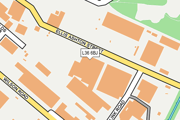
L36 6BJ is located in the St Gabriels electoral ward, within the metropolitan district of Knowsley and the English Parliamentary constituency of Knowsley. The Sub Integrated Care Board (ICB) Location is NHS Cheshire and Merseyside ICB - 01J and the police force is Merseyside. This postcode has been in use since January 1980.


GetTheData
Source: OS OpenMap – Local (Ordnance Survey)
Source: OS VectorMap District (Ordnance Survey)
Licence: Open Government Licence (requires attribution)
| Easting | 345559 |
| Northing | 390331 |
| Latitude | 53.406988 |
| Longitude | -2.820386 |
GetTheData
Source: Open Postcode Geo
Licence: Open Government Licence
| Country | England |
| Postcode District | L36 |
➜ See where L36 is on a map ➜ Where is Huyton with Roby? | |
GetTheData
Source: Land Registry Price Paid Data
Licence: Open Government Licence
Elevation or altitude of L36 6BJ as distance above sea level:
| Metres | Feet | |
|---|---|---|
| Elevation | 30m | 98ft |
Elevation is measured from the approximate centre of the postcode, to the nearest point on an OS contour line from OS Terrain 50, which has contour spacing of ten vertical metres.
➜ How high above sea level am I? Find the elevation of your current position using your device's GPS.
GetTheData
Source: Open Postcode Elevation
Licence: Open Government Licence
| Ward | St Gabriels |
| Constituency | Knowsley |
GetTheData
Source: ONS Postcode Database
Licence: Open Government Licence
| Wilson Road | Huyton Quarry | 230m |
| Wilson Road | Huyton Quarry | 248m |
| Link Road (Wilson Road) | Huyton Quarry | 263m |
| Wilson Road (Link Road) | Huyton Quarry | 264m |
| Link Road (Wilson Road) | Huyton Quarry | 275m |
| Huyton Station | 1.5km |
| Whiston Station | 1.8km |
| Prescot Station | 2.3km |
GetTheData
Source: NaPTAN
Licence: Open Government Licence
GetTheData
Source: ONS Postcode Database
Licence: Open Government Licence


➜ Get more ratings from the Food Standards Agency
GetTheData
Source: Food Standards Agency
Licence: FSA terms & conditions
| Last Collection | |||
|---|---|---|---|
| Location | Mon-Fri | Sat | Distance |
| The Boundary | 17:30 | 12:00 | 663m |
| Halsnead Avenue | 16:30 | 11:30 | 998m |
| Huyton Post Office | 17:45 | 12:00 | 1,311m |
GetTheData
Source: Dracos
Licence: Creative Commons Attribution-ShareAlike
The below table lists the International Territorial Level (ITL) codes (formerly Nomenclature of Territorial Units for Statistics (NUTS) codes) and Local Administrative Units (LAU) codes for L36 6BJ:
| ITL 1 Code | Name |
|---|---|
| TLD | North West (England) |
| ITL 2 Code | Name |
| TLD7 | Merseyside |
| ITL 3 Code | Name |
| TLD71 | East Merseyside |
| LAU 1 Code | Name |
| E08000011 | Knowsley |
GetTheData
Source: ONS Postcode Directory
Licence: Open Government Licence
The below table lists the Census Output Area (OA), Lower Layer Super Output Area (LSOA), and Middle Layer Super Output Area (MSOA) for L36 6BJ:
| Code | Name | |
|---|---|---|
| OA | E00032830 | |
| LSOA | E01006478 | Knowsley 015B |
| MSOA | E02001341 | Knowsley 015 |
GetTheData
Source: ONS Postcode Directory
Licence: Open Government Licence
| L36 6LX | West View Close | 259m |
| L36 6FB | Parkside Mansions | 269m |
| L36 6BT | West View | 299m |
| L36 6BX | West View Avenue | 313m |
| L36 6HY | Brickfields | 319m |
| L36 6DD | Hale View Road | 327m |
| L36 6AN | Wilson Road | 339m |
| L36 6BS | Granite Terrace | 345m |
| L36 6FR | Quarry Way | 375m |
| L36 6DA | Russell Road | 379m |
GetTheData
Source: Open Postcode Geo; Land Registry Price Paid Data
Licence: Open Government Licence