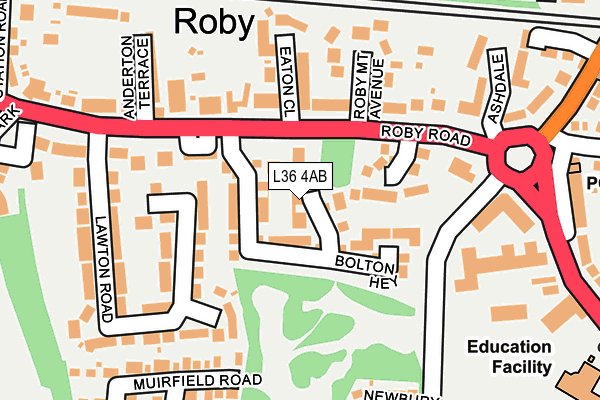
L36 4AB is located in the Roby electoral ward, within the metropolitan district of Knowsley and the English Parliamentary constituency of Knowsley. The Sub Integrated Care Board (ICB) Location is NHS Cheshire and Merseyside ICB - 01J and the police force is Merseyside. This postcode has been in use since March 2017.


GetTheData
Source: OS OpenMap – Local (Ordnance Survey)
Source: OS VectorMap District (Ordnance Survey)
Licence: Open Government Licence (requires attribution)
| Easting | 343516 |
| Northing | 390473 |
| Latitude | 53.408049 |
| Longitude | -2.851139 |
GetTheData
Source: Open Postcode Geo
Licence: Open Government Licence
| Country | England |
| Postcode District | L36 |
➜ See where L36 is on a map ➜ Where is Huyton with Roby? | |
GetTheData
Source: Land Registry Price Paid Data
Licence: Open Government Licence
| Ward | Roby |
| Constituency | Knowsley |
GetTheData
Source: ONS Postcode Database
Licence: Open Government Licence
| Waterside Park (Roby Road) | Roby | 104m |
| Anderton Terrace (Roby Road) | Roby | 185m |
| Lawton Road (Roby Road) | Roby | 244m |
| Blacklow Brow (Tarbock Road) | Blacklow Brow | 251m |
| Sandfield (Archway Road) | Blacklow Brow | 286m |
| Roby Station | 0.4km |
| Huyton Station | 0.6km |
| Broad Green Station | 2.8km |
GetTheData
Source: NaPTAN
Licence: Open Government Licence
| Percentage of properties with Next Generation Access | 100.0% |
| Percentage of properties with Superfast Broadband | 100.0% |
| Percentage of properties with Ultrafast Broadband | 100.0% |
| Percentage of properties with Full Fibre Broadband | 0.0% |
Superfast Broadband is between 30Mbps and 300Mbps
Ultrafast Broadband is > 300Mbps
| Median download speed | 18.6Mbps |
| Average download speed | 41.0Mbps |
| Maximum download speed | 200.00Mbps |
| Median upload speed | 1.1Mbps |
| Average upload speed | 3.2Mbps |
| Maximum upload speed | 7.22Mbps |
| Percentage of properties unable to receive 2Mbps | 0.0% |
| Percentage of properties unable to receive 5Mbps | 0.0% |
| Percentage of properties unable to receive 10Mbps | 0.0% |
| Percentage of properties unable to receive 30Mbps | 0.0% |
GetTheData
Source: Ofcom
Licence: Ofcom Terms of Use (requires attribution)
GetTheData
Source: ONS Postcode Database
Licence: Open Government Licence


➜ Get more ratings from the Food Standards Agency
GetTheData
Source: Food Standards Agency
Licence: FSA terms & conditions
| Last Collection | |||
|---|---|---|---|
| Location | Mon-Fri | Sat | Distance |
| Huyton Post Office | 17:45 | 12:00 | 851m |
| Gladstone Avenue | 16:15 | 12:00 | 1,325m |
| Courthey Park | 16:15 | 12:00 | 1,416m |
GetTheData
Source: Dracos
Licence: Creative Commons Attribution-ShareAlike
The below table lists the International Territorial Level (ITL) codes (formerly Nomenclature of Territorial Units for Statistics (NUTS) codes) and Local Administrative Units (LAU) codes for L36 4AB:
| ITL 1 Code | Name |
|---|---|
| TLD | North West (England) |
| ITL 2 Code | Name |
| TLD7 | Merseyside |
| ITL 3 Code | Name |
| TLD71 | East Merseyside |
| LAU 1 Code | Name |
| E08000011 | Knowsley |
GetTheData
Source: ONS Postcode Directory
Licence: Open Government Licence
The below table lists the Census Output Area (OA), Lower Layer Super Output Area (LSOA), and Middle Layer Super Output Area (MSOA) for L36 4AB:
| Code | Name | |
|---|---|---|
| OA | E00032800 | |
| LSOA | E01006476 | Knowsley 016E |
| MSOA | E02001342 | Knowsley 016 |
GetTheData
Source: ONS Postcode Directory
Licence: Open Government Licence
| L36 4RN | Waterside Park | 93m |
| L36 4PS | Colin Close | 107m |
| L36 4HN | Lawton Road | 123m |
| L36 4HE | Roby Road | 134m |
| L36 4HR | Eaton Close | 157m |
| L36 4HF | Roby Road | 162m |
| L36 4HP | Roby Mount Avenue | 180m |
| L36 4HW | Lawton Road | 185m |
| L36 4HS | Anderton Terrace | 198m |
| L36 4NA | Twickenham Drive | 203m |
GetTheData
Source: Open Postcode Geo; Land Registry Price Paid Data
Licence: Open Government Licence