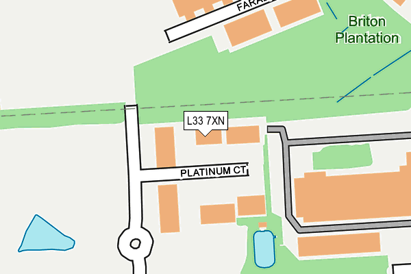
L33 7XN is located in the Northwood electoral ward, within the metropolitan district of Knowsley and the English Parliamentary constituency of Knowsley. The Sub Integrated Care Board (ICB) Location is NHS Cheshire and Merseyside ICB - 01J and the police force is Merseyside. This postcode has been in use since May 2007.


GetTheData
Source: OS OpenMap – Local (Ordnance Survey)
Source: OS VectorMap District (Ordnance Survey)
Licence: Open Government Licence (requires attribution)
| Easting | 342791 |
| Northing | 397081 |
| Latitude | 53.467345 |
| Longitude | -2.863247 |
GetTheData
Source: Open Postcode Geo
Licence: Open Government Licence
| Country | England |
| Postcode District | L33 |
➜ See where L33 is on a map ➜ Where is Kirkby? | |
GetTheData
Source: Land Registry Price Paid Data
Licence: Open Government Licence
Elevation or altitude of L33 7XN as distance above sea level:
| Metres | Feet | |
|---|---|---|
| Elevation | 30m | 98ft |
Elevation is measured from the approximate centre of the postcode, to the nearest point on an OS contour line from OS Terrain 50, which has contour spacing of ten vertical metres.
➜ How high above sea level am I? Find the elevation of your current position using your device's GPS.
GetTheData
Source: Open Postcode Elevation
Licence: Open Government Licence
| Ward | Northwood |
| Constituency | Knowsley |
GetTheData
Source: ONS Postcode Database
Licence: Open Government Licence
| Qvc (Hornhouse Lane) | Knowsley Industrial Park | 508m |
| Qvc (Hornhouse Lane) | Knowsley Industrial Park | 527m |
| Moorgate Point (Moorgate Road) | Southdene | 570m |
| Britonside Avenue (Moorgate Road) | Southdene | 602m |
| Bewley Drive (Moorgate Road) | Southdene | 633m |
| Kirkby Station | 3.4km |
| Fazakerley Station | 4.9km |
| Maghull Station | 6.3km |
GetTheData
Source: NaPTAN
Licence: Open Government Licence
GetTheData
Source: ONS Postcode Database
Licence: Open Government Licence


➜ Get more ratings from the Food Standards Agency
GetTheData
Source: Food Standards Agency
Licence: FSA terms & conditions
| Last Collection | |||
|---|---|---|---|
| Location | Mon-Fri | Sat | Distance |
| Broad Lane/Medbourne Crescent | 17:00 | 12:00 | 1,467m |
| Saxon Way/Washington Drive | 17:00 | 12:00 | 2,012m |
| Kirkby Post Office | 18:00 | 12:00 | 2,162m |
GetTheData
Source: Dracos
Licence: Creative Commons Attribution-ShareAlike
The below table lists the International Territorial Level (ITL) codes (formerly Nomenclature of Territorial Units for Statistics (NUTS) codes) and Local Administrative Units (LAU) codes for L33 7XN:
| ITL 1 Code | Name |
|---|---|
| TLD | North West (England) |
| ITL 2 Code | Name |
| TLD7 | Merseyside |
| ITL 3 Code | Name |
| TLD71 | East Merseyside |
| LAU 1 Code | Name |
| E08000011 | Knowsley |
GetTheData
Source: ONS Postcode Directory
Licence: Open Government Licence
The below table lists the Census Output Area (OA), Lower Layer Super Output Area (LSOA), and Middle Layer Super Output Area (MSOA) for L33 7XN:
| Code | Name | |
|---|---|---|
| OA | E00032517 | |
| LSOA | E01006416 | Knowsley 005A |
| MSOA | E02001331 | Knowsley 005 |
GetTheData
Source: ONS Postcode Directory
Licence: Open Government Licence
| L33 7RX | Deacon Park | 506m |
| L34 9EU | Ainsworth Lane | 515m |
| L32 6RS | Shaldon Close | 642m |
| L32 7PB | Sedburn Road | 667m |
| L32 6SW | Shaldon Grove | 672m |
| L32 7PJ | Cleadon Close | 674m |
| L32 6RT | Shaldon Road | 690m |
| L32 6SZ | Britonside Avenue | 701m |
| L32 7PN | Cleadon Road | 724m |
| L32 7PY | Bewley Drive | 725m |
GetTheData
Source: Open Postcode Geo; Land Registry Price Paid Data
Licence: Open Government Licence