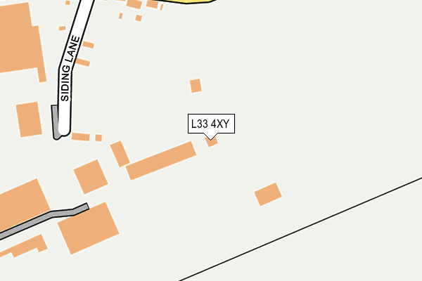
L33 4XY is located in the Rural South electoral ward, within the local authority district of West Lancashire and the English Parliamentary constituency of West Lancashire. The Sub Integrated Care Board (ICB) Location is NHS Lancashire and South Cumbria ICB - 02G and the police force is Lancashire. This postcode has been in use since June 1996.


GetTheData
Source: OS OpenMap – Local (Ordnance Survey)
Source: OS VectorMap District (Ordnance Survey)
Licence: Open Government Licence (requires attribution)
| Easting | 343640 |
| Northing | 400926 |
| Latitude | 53.501993 |
| Longitude | -2.851152 |
GetTheData
Source: Open Postcode Geo
Licence: Open Government Licence
| Country | England |
| Postcode District | L33 |
➜ See where L33 is on a map | |
GetTheData
Source: Land Registry Price Paid Data
Licence: Open Government Licence
Elevation or altitude of L33 4XY as distance above sea level:
| Metres | Feet | |
|---|---|---|
| Elevation | 40m | 131ft |
Elevation is measured from the approximate centre of the postcode, to the nearest point on an OS contour line from OS Terrain 50, which has contour spacing of ten vertical metres.
➜ How high above sea level am I? Find the elevation of your current position using your device's GPS.
GetTheData
Source: Open Postcode Elevation
Licence: Open Government Licence
| Ward | Rural South |
| Constituency | West Lancashire |
GetTheData
Source: ONS Postcode Database
Licence: Open Government Licence
| Siding Lane (Stopgate Lane) | Simonswood | 278m |
| Siding Lane (Stopgate Lane) | Simonswood | 293m |
| County Boundary (Stopgate Lane) | Tower Hill | 1,494m |
| County Boundary (Stopgate Lane) | Tower Hill | 1,495m |
| Epsom Grove (Pingwood Lane) | Tower Hill | 1,508m |
| Kirkby Station | 3.9km |
| Rainford Station | 4.4km |
| Town Green Station | 5.8km |
GetTheData
Source: NaPTAN
Licence: Open Government Licence
GetTheData
Source: ONS Postcode Database
Licence: Open Government Licence


➜ Get more ratings from the Food Standards Agency
GetTheData
Source: Food Standards Agency
Licence: FSA terms & conditions
| Last Collection | |||
|---|---|---|---|
| Location | Mon-Fri | Sat | Distance |
| Barrow Nook | 16:15 | 10:30 | 1,802m |
| Saxon Way/Washington Drive | 17:00 | 12:00 | 2,139m |
| Kirkby Post Office | 18:00 | 12:00 | 3,285m |
GetTheData
Source: Dracos
Licence: Creative Commons Attribution-ShareAlike
The below table lists the International Territorial Level (ITL) codes (formerly Nomenclature of Territorial Units for Statistics (NUTS) codes) and Local Administrative Units (LAU) codes for L33 4XY:
| ITL 1 Code | Name |
|---|---|
| TLD | North West (England) |
| ITL 2 Code | Name |
| TLD4 | Lancashire |
| ITL 3 Code | Name |
| TLD47 | Chorley and West Lancashire |
| LAU 1 Code | Name |
| E07000127 | West Lancashire |
GetTheData
Source: ONS Postcode Directory
Licence: Open Government Licence
The below table lists the Census Output Area (OA), Lower Layer Super Output Area (LSOA), and Middle Layer Super Output Area (MSOA) for L33 4XY:
| Code | Name | |
|---|---|---|
| OA | E00129306 | |
| LSOA | E01025479 | West Lancashire 008A |
| MSOA | E02005311 | West Lancashire 008 |
GetTheData
Source: ONS Postcode Directory
Licence: Open Government Licence
| L33 4YD | Siding Lane | 217m |
| L33 4YB | Stopgate Lane | 261m |
| L33 4YH | Sineacre Lane | 784m |
| L33 4YA | Stopgate Lane | 861m |
| L33 3AT | Dale Lane | 1026m |
| L39 0HR | Sineacre Lane | 1284m |
| L39 0HP | Coach Road | 1343m |
| L33 7UZ | Woodward Road | 1483m |
| L33 4YQ | Hall Lane | 1486m |
| L33 1SF | Greenside Close | 1553m |
GetTheData
Source: Open Postcode Geo; Land Registry Price Paid Data
Licence: Open Government Licence