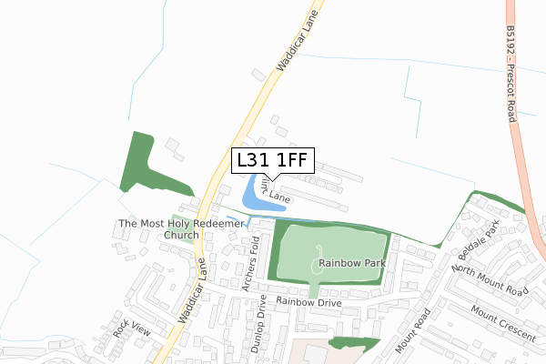
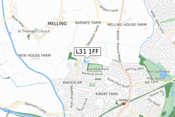
L31 1FF is located in the Molyneux electoral ward, within the metropolitan district of Sefton and the English Parliamentary constituency of Sefton Central. The Sub Integrated Care Board (ICB) Location is NHS Cheshire and Merseyside ICB - 01T and the police force is Merseyside. This postcode has been in use since November 2019.


GetTheData
Source: OS Open Zoomstack (Ordnance Survey)
Licence: Open Government Licence (requires attribution)
Attribution: Contains OS data © Crown copyright and database right 2024
Source: Open Postcode Geo
Licence: Open Government Licence (requires attribution)
Attribution: Contains OS data © Crown copyright and database right 2024; Contains Royal Mail data © Royal Mail copyright and database right 2024; Source: Office for National Statistics licensed under the Open Government Licence v.3.0
| Easting | 339779 |
| Northing | 399831 |
| Latitude | 53.491739 |
| Longitude | -2.909140 |
GetTheData
Source: Open Postcode Geo
Licence: Open Government Licence
| Country | England |
| Postcode District | L31 |
➜ See where L31 is on a map ➜ Where is Kirkby? | |
GetTheData
Source: Land Registry Price Paid Data
Licence: Open Government Licence
| Ward | Molyneux |
| Constituency | Sefton Central |
GetTheData
Source: ONS Postcode Database
Licence: Open Government Licence
67, FLINT LANE, MELLING, LIVERPOOL, L31 1FF 2021 9 SEP £233,995 |
65, FLINT LANE, MELLING, LIVERPOOL, L31 1FF 2021 9 SEP £302,995 |
63, FLINT LANE, MELLING, LIVERPOOL, L31 1FF 2021 25 AUG £302,995 |
61, FLINT LANE, MELLING, LIVERPOOL, L31 1FF 2021 18 AUG £279,995 |
59, FLINT LANE, MELLING, LIVERPOOL, L31 1FF 2021 13 AUG £279,995 |
57, FLINT LANE, MELLING, LIVERPOOL, L31 1FF 2021 11 AUG £302,995 |
51, FLINT LANE, MELLING, LIVERPOOL, L31 1FF 2021 21 MAY £247,995 |
47, FLINT LANE, MELLING, LIVERPOOL, L31 1FF 2021 5 FEB £243,995 |
49, FLINT LANE, MELLING, LIVERPOOL, L31 1FF 2020 11 DEC £224,995 |
45, FLINT LANE, MELLING, LIVERPOOL, L31 1FF 2020 27 NOV £243,995 |
GetTheData
Source: HM Land Registry Price Paid Data
Licence: Contains HM Land Registry data © Crown copyright and database right 2024. This data is licensed under the Open Government Licence v3.0.
| Waddicar Church (Waddicar Lane) | Waddicar | 232m |
| Waddicar Church (Waddicar Lane) | Waddicar | 244m |
| North Park Road (Mount Road) | Kirkby Park | 255m |
| Mount Road (North Park Road) | Kirkby Park | 280m |
| Woodland Road (Waddicar Lane) | Waddicar | 338m |
| Kirkby Station | 0.7km |
| Maghull Station | 2.2km |
| Old Roan Station | 2.8km |
GetTheData
Source: NaPTAN
Licence: Open Government Licence
GetTheData
Source: ONS Postcode Database
Licence: Open Government Licence


➜ Get more ratings from the Food Standards Agency
GetTheData
Source: Food Standards Agency
Licence: FSA terms & conditions
| Last Collection | |||
|---|---|---|---|
| Location | Mon-Fri | Sat | Distance |
| Spencers Lane | 17:00 | 12:00 | 200m |
| Waddicar Lane Post Office | 17:00 | 12:00 | 408m |
| Kirkby Post Office | 18:00 | 12:00 | 1,925m |
GetTheData
Source: Dracos
Licence: Creative Commons Attribution-ShareAlike
The below table lists the International Territorial Level (ITL) codes (formerly Nomenclature of Territorial Units for Statistics (NUTS) codes) and Local Administrative Units (LAU) codes for L31 1FF:
| ITL 1 Code | Name |
|---|---|
| TLD | North West (England) |
| ITL 2 Code | Name |
| TLD7 | Merseyside |
| ITL 3 Code | Name |
| TLD73 | Sefton |
| LAU 1 Code | Name |
| E08000014 | Sefton |
GetTheData
Source: ONS Postcode Directory
Licence: Open Government Licence
The below table lists the Census Output Area (OA), Lower Layer Super Output Area (LSOA), and Middle Layer Super Output Area (MSOA) for L31 1FF:
| Code | Name | |
|---|---|---|
| OA | E00170478 | |
| LSOA | E01007040 | Sefton 026B |
| MSOA | E02001454 | Sefton 026 |
GetTheData
Source: ONS Postcode Directory
Licence: Open Government Licence
| L31 1DH | Marc Avenue | 151m |
| L31 1BY | Rainbow Drive | 158m |
| L31 1LJ | Archers Fold | 176m |
| L31 1DJ | Martine Close | 181m |
| L31 1BZ | Rainbow Drive | 201m |
| L31 1DB | Peach Grove | 222m |
| L31 1DZ | Waddicar Lane | 236m |
| L31 1DD | Yew Tree Green | 239m |
| L31 1DR | Waddicar Lane | 252m |
| L32 2DE | Beldale Park | 283m |
GetTheData
Source: Open Postcode Geo; Land Registry Price Paid Data
Licence: Open Government Licence