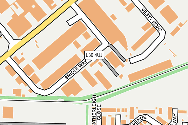
L30 4UJ is located in the Netherton and Orrell electoral ward, within the metropolitan district of Sefton and the English Parliamentary constituency of Bootle. The Sub Integrated Care Board (ICB) Location is NHS Cheshire and Merseyside ICB - 01T and the police force is Merseyside. This postcode has been in use since December 2022.


GetTheData
Source: OS OpenMap – Local (Ordnance Survey)
Source: OS VectorMap District (Ordnance Survey)
Licence: Open Government Licence (requires attribution)
| Easting | 335971 |
| Northing | 397459 |
| Latitude | 53.469971 |
| Longitude | -2.966043 |
GetTheData
Source: Open Postcode Geo
Licence: Open Government Licence
| Country | England |
| Postcode District | L30 |
➜ See where L30 is on a map | |
GetTheData
Source: Land Registry Price Paid Data
Licence: Open Government Licence
Elevation or altitude of L30 4UJ as distance above sea level:
| Metres | Feet | |
|---|---|---|
| Elevation | 30m | 98ft |
Elevation is measured from the approximate centre of the postcode, to the nearest point on an OS contour line from OS Terrain 50, which has contour spacing of ten vertical metres.
➜ How high above sea level am I? Find the elevation of your current position using your device's GPS.
GetTheData
Source: Open Postcode Elevation
Licence: Open Government Licence
| Ward | Netherton And Orrell |
| Constituency | Bootle |
GetTheData
Source: ONS Postcode Database
Licence: Open Government Licence
| Bridle Way (Bridle Road) | Netherton | 211m |
| Farriers Way (Bridle Road) | Netherton | 220m |
| Bridle Road (Farriers Way) | Netherton | 282m |
| Bridle Way (Bridle Road) | Netherton | 286m |
| Bridle Way (Bridle Road) | Netherton | 318m |
| Aintree Station | 0.8km |
| Orrell Park Station | 0.9km |
| Rice Lane Station | 1.4km |
GetTheData
Source: NaPTAN
Licence: Open Government Licence
GetTheData
Source: ONS Postcode Database
Licence: Open Government Licence


➜ Get more ratings from the Food Standards Agency
GetTheData
Source: Food Standards Agency
Licence: FSA terms & conditions
| Last Collection | |||
|---|---|---|---|
| Location | Mon-Fri | Sat | Distance |
| Wembley Gardens | 16:00 | 12:00 | 545m |
| Endbourne Road | 16:00 | 12:00 | 732m |
| Warbreck Moor/Danehurst Road | 16:30 | 12:00 | 762m |
GetTheData
Source: Dracos
Licence: Creative Commons Attribution-ShareAlike
The below table lists the International Territorial Level (ITL) codes (formerly Nomenclature of Territorial Units for Statistics (NUTS) codes) and Local Administrative Units (LAU) codes for L30 4UJ:
| ITL 1 Code | Name |
|---|---|
| TLD | North West (England) |
| ITL 2 Code | Name |
| TLD7 | Merseyside |
| ITL 3 Code | Name |
| TLD73 | Sefton |
| LAU 1 Code | Name |
| E08000014 | Sefton |
GetTheData
Source: ONS Postcode Directory
Licence: Open Government Licence
The below table lists the Census Output Area (OA), Lower Layer Super Output Area (LSOA), and Middle Layer Super Output Area (MSOA) for L30 4UJ:
| Code | Name | |
|---|---|---|
| OA | E00035715 | |
| LSOA | E01007049 | Sefton 035B |
| MSOA | E02001463 | Sefton 035 |
GetTheData
Source: ONS Postcode Directory
Licence: Open Government Licence
| L30 4UA | Bridle Way | 97m |
| L9 8HH | Heatherleigh Close | 117m |
| L9 8HQ | Meadowfield Close | 166m |
| L9 8HG | Roseworth Avenue | 204m |
| L9 8HF | Roseworth Avenue | 204m |
| L9 8HW | Parkdale Avenue | 258m |
| L30 4UE | Bridle Road | 283m |
| L9 8HP | Oakmere Close | 283m |
| L9 8HS | Ferndale Close | 285m |
| L9 8HJ | Ridgewood Way | 286m |
GetTheData
Source: Open Postcode Geo; Land Registry Price Paid Data
Licence: Open Government Licence