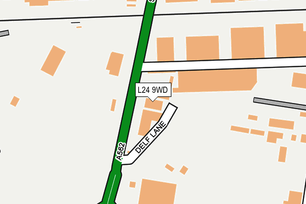
L24 9WD is located in the Speke electoral ward, within the metropolitan district of Liverpool and the English Parliamentary constituency of Garston and Halewood. The Sub Integrated Care Board (ICB) Location is NHS Cheshire and Merseyside ICB - 99A and the police force is Merseyside. This postcode has been in use since February 1990.


GetTheData
Source: OS OpenMap – Local (Ordnance Survey)
Source: OS VectorMap District (Ordnance Survey)
Licence: Open Government Licence (requires attribution)
| Easting | 342558 |
| Northing | 384240 |
| Latitude | 53.351911 |
| Longitude | -2.864413 |
GetTheData
Source: Open Postcode Geo
Licence: Open Government Licence
| Country | England |
| Postcode District | L24 |
➜ See where L24 is on a map ➜ Where is Liverpool? | |
GetTheData
Source: Land Registry Price Paid Data
Licence: Open Government Licence
Elevation or altitude of L24 9WD as distance above sea level:
| Metres | Feet | |
|---|---|---|
| Elevation | 30m | 98ft |
Elevation is measured from the approximate centre of the postcode, to the nearest point on an OS contour line from OS Terrain 50, which has contour spacing of ten vertical metres.
➜ How high above sea level am I? Find the elevation of your current position using your device's GPS.
GetTheData
Source: Open Postcode Elevation
Licence: Open Government Licence
| Ward | Speke |
| Constituency | Garston And Halewood |
GetTheData
Source: ONS Postcode Database
Licence: Open Government Licence
| Delf Lane (Speke Hall Road) | Speke | 81m |
| Delf Lane (Speke Hall Road) | Speke | 164m |
| Speke Hall Road (Speke Road) | Speke | 293m |
| Speke Hall Avenue (Speke Road) | Speke | 299m |
| Speke Boulevard (Speke Hall Avenue) | Speke | 357m |
| Hunts Cross Station | 1.1km |
| Liverpool South Parkway Station | 1.8km |
| Halewood Station | 2.7km |
GetTheData
Source: NaPTAN
Licence: Open Government Licence
GetTheData
Source: ONS Postcode Database
Licence: Open Government Licence


➜ Get more ratings from the Food Standards Agency
GetTheData
Source: Food Standards Agency
Licence: FSA terms & conditions
| Last Collection | |||
|---|---|---|---|
| Location | Mon-Fri | Sat | Distance |
| Spekehall Road | 16:30 | 12:00 | 94m |
| Bourton Road | 16:45 | 12:00 | 757m |
| The Crescent Post Office | 16:45 | 12:00 | 800m |
GetTheData
Source: Dracos
Licence: Creative Commons Attribution-ShareAlike
The below table lists the International Territorial Level (ITL) codes (formerly Nomenclature of Territorial Units for Statistics (NUTS) codes) and Local Administrative Units (LAU) codes for L24 9WD:
| ITL 1 Code | Name |
|---|---|
| TLD | North West (England) |
| ITL 2 Code | Name |
| TLD7 | Merseyside |
| ITL 3 Code | Name |
| TLD72 | Liverpool |
| LAU 1 Code | Name |
| E08000012 | Liverpool |
GetTheData
Source: ONS Postcode Directory
Licence: Open Government Licence
The below table lists the Census Output Area (OA), Lower Layer Super Output Area (LSOA), and Middle Layer Super Output Area (MSOA) for L24 9WD:
| Code | Name | |
|---|---|---|
| OA | E00034155 | |
| LSOA | E01006739 | Liverpool 058B |
| MSOA | E02001404 | Liverpool 058 |
GetTheData
Source: ONS Postcode Directory
Licence: Open Government Licence
| L24 9HW | Edwards Lane | 320m |
| L24 9HL | Goodlass Road | 325m |
| L24 9HX | Edwards Lane Industrial Estate | 394m |
| L24 9HZ | Speke Boulevard | 435m |
| L24 9HJ | Goodlass Road | 454m |
| L24 1XJ | Barnham Close | 457m |
| L24 1XH | Bognor Close | 464m |
| L24 9AD | Addenbrooke Drive | 472m |
| L24 9LW | Hansby Drive | 513m |
| L25 0PP | Barford Road | 528m |
GetTheData
Source: Open Postcode Geo; Land Registry Price Paid Data
Licence: Open Government Licence