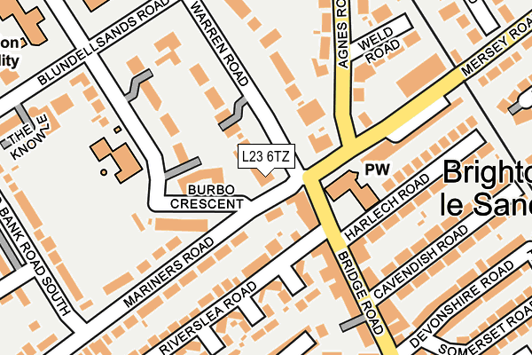
L23 6TZ is located in the Blundellsands electoral ward, within the metropolitan district of Sefton and the English Parliamentary constituency of Sefton Central. The Sub Integrated Care Board (ICB) Location is NHS Cheshire and Merseyside ICB - 01T and the police force is Merseyside. This postcode has been in use since January 1980.


GetTheData
Source: OS OpenMap – Local (Ordnance Survey)
Source: OS VectorMap District (Ordnance Survey)
Licence: Open Government Licence (requires attribution)
| Easting | 330996 |
| Northing | 399146 |
| Latitude | 53.484503 |
| Longitude | -3.041347 |
GetTheData
Source: Open Postcode Geo
Licence: Open Government Licence
| Country | England |
| Postcode District | L23 |
➜ See where L23 is on a map ➜ Where is Crosby? | |
GetTheData
Source: Land Registry Price Paid Data
Licence: Open Government Licence
Elevation or altitude of L23 6TZ as distance above sea level:
| Metres | Feet | |
|---|---|---|
| Elevation | 10m | 33ft |
Elevation is measured from the approximate centre of the postcode, to the nearest point on an OS contour line from OS Terrain 50, which has contour spacing of ten vertical metres.
➜ How high above sea level am I? Find the elevation of your current position using your device's GPS.
GetTheData
Source: Open Postcode Elevation
Licence: Open Government Licence
| Ward | Blundellsands |
| Constituency | Sefton Central |
GetTheData
Source: ONS Postcode Database
Licence: Open Government Licence
| Mariners Road (Warren Road) | Brighton Le Sands | 45m |
| St Nicholas Church (Bridge Road) | Crosby | 77m |
| Agnes Road | Brighton Le Sands | 137m |
| Cavendish Road (Bridge Road) | Crosby | 151m |
| Warren Road | Blundellsands | 253m |
| Blundellsands & Crosby Station | 0.4km |
| Waterloo (Merseyside) Station | 1.5km |
| Hall Road Station | 1.5km |
GetTheData
Source: NaPTAN
Licence: Open Government Licence
GetTheData
Source: ONS Postcode Database
Licence: Open Government Licence


➜ Get more ratings from the Food Standards Agency
GetTheData
Source: Food Standards Agency
Licence: FSA terms & conditions
| Last Collection | |||
|---|---|---|---|
| Location | Mon-Fri | Sat | Distance |
| Brighton Le Sands | 17:00 | 12:00 | 200m |
| Blundellsands Road West | 17:00 | 12:00 | 234m |
| Blundellsands Post Office | 17:00 | 12:00 | 366m |
GetTheData
Source: Dracos
Licence: Creative Commons Attribution-ShareAlike
The below table lists the International Territorial Level (ITL) codes (formerly Nomenclature of Territorial Units for Statistics (NUTS) codes) and Local Administrative Units (LAU) codes for L23 6TZ:
| ITL 1 Code | Name |
|---|---|
| TLD | North West (England) |
| ITL 2 Code | Name |
| TLD7 | Merseyside |
| ITL 3 Code | Name |
| TLD73 | Sefton |
| LAU 1 Code | Name |
| E08000014 | Sefton |
GetTheData
Source: ONS Postcode Directory
Licence: Open Government Licence
The below table lists the Census Output Area (OA), Lower Layer Super Output Area (LSOA), and Middle Layer Super Output Area (MSOA) for L23 6TZ:
| Code | Name | |
|---|---|---|
| OA | E00035179 | |
| LSOA | E01006941 | Sefton 028A |
| MSOA | E02001456 | Sefton 028 |
GetTheData
Source: ONS Postcode Directory
Licence: Open Government Licence
| L23 6TS | Nicholas Road | 97m |
| L23 6SG | Bridge Road | 101m |
| L23 6TY | Warren Road | 102m |
| L23 6TX | Burbo Crescent | 110m |
| L23 6UB | Warren Road | 134m |
| L23 6UY | Merton Grove | 151m |
| L23 6SS | Mersey Road | 175m |
| L23 6XE | Trinity Grove | 178m |
| L23 6SZ | Riverslea Road | 188m |
| L23 6ST | Agnes Road | 190m |
GetTheData
Source: Open Postcode Geo; Land Registry Price Paid Data
Licence: Open Government Licence