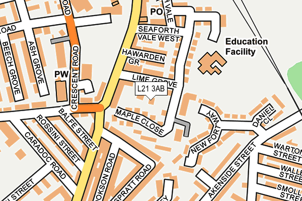
L21 3AB is located in the Linacre electoral ward, within the metropolitan district of Sefton and the English Parliamentary constituency of Bootle. The Sub Integrated Care Board (ICB) Location is NHS Cheshire and Merseyside ICB - 01T and the police force is Merseyside. This postcode has been in use since February 2017.


GetTheData
Source: OS OpenMap – Local (Ordnance Survey)
Source: OS VectorMap District (Ordnance Survey)
Licence: Open Government Licence (requires attribution)
| Easting | 333238 |
| Northing | 396752 |
| Latitude | 53.463278 |
| Longitude | -3.007057 |
GetTheData
Source: Open Postcode Geo
Licence: Open Government Licence
| Country | England |
| Postcode District | L21 |
➜ See where L21 is on a map ➜ Where is Crosby? | |
GetTheData
Source: Land Registry Price Paid Data
Licence: Open Government Licence
| Ward | Linacre |
| Constituency | Bootle |
GetTheData
Source: ONS Postcode Database
Licence: Open Government Licence
| Lime Grove (Seaforth Road) | Seaforth | 84m |
| Hawarden Grove (Seaforth Road) | Seaforth | 102m |
| Elm Road (Crescent Road) | Seaforth | 171m |
| Elm Road (Crescent Road) | Seaforth | 184m |
| Caradoc Road (Church Road) | Seaforth | 252m |
| Seaforth & Litherland Station | 0.3km |
| Bootle New Strand Station | 1.4km |
| Waterloo (Merseyside) Station | 1.8km |
GetTheData
Source: NaPTAN
Licence: Open Government Licence
| Percentage of properties with Next Generation Access | 100.0% |
| Percentage of properties with Superfast Broadband | 100.0% |
| Percentage of properties with Ultrafast Broadband | 100.0% |
| Percentage of properties with Full Fibre Broadband | 0.0% |
Superfast Broadband is between 30Mbps and 300Mbps
Ultrafast Broadband is > 300Mbps
| Percentage of properties unable to receive 2Mbps | 0.0% |
| Percentage of properties unable to receive 5Mbps | 0.0% |
| Percentage of properties unable to receive 10Mbps | 0.0% |
| Percentage of properties unable to receive 30Mbps | 0.0% |
GetTheData
Source: Ofcom
Licence: Ofcom Terms of Use (requires attribution)
GetTheData
Source: ONS Postcode Database
Licence: Open Government Licence


➜ Get more ratings from the Food Standards Agency
GetTheData
Source: Food Standards Agency
Licence: FSA terms & conditions
| Last Collection | |||
|---|---|---|---|
| Location | Mon-Fri | Sat | Distance |
| Ruthven Road | 17:00 | 12:00 | 728m |
| Ascot Avenue | 17:00 | 12:00 | 852m |
| Mereton Village | 17:00 | 12:00 | 1,566m |
GetTheData
Source: Dracos
Licence: Creative Commons Attribution-ShareAlike
The below table lists the International Territorial Level (ITL) codes (formerly Nomenclature of Territorial Units for Statistics (NUTS) codes) and Local Administrative Units (LAU) codes for L21 3AB:
| ITL 1 Code | Name |
|---|---|
| TLD | North West (England) |
| ITL 2 Code | Name |
| TLD7 | Merseyside |
| ITL 3 Code | Name |
| TLD73 | Sefton |
| LAU 1 Code | Name |
| E08000014 | Sefton |
GetTheData
Source: ONS Postcode Directory
Licence: Open Government Licence
The below table lists the Census Output Area (OA), Lower Layer Super Output Area (LSOA), and Middle Layer Super Output Area (MSOA) for L21 3AB:
| Code | Name | |
|---|---|---|
| OA | E00035503 | |
| LSOA | E01007011 | Sefton 034C |
| MSOA | E02001462 | Sefton 034 |
GetTheData
Source: ONS Postcode Directory
Licence: Open Government Licence
| L21 3TZ | Lime Grove | 47m |
| L21 3TT | Lime Grove | 79m |
| L21 4AB | Seaforth Road | 83m |
| L21 4NN | Muspratt Road | 94m |
| L21 3TS | Hawarden Grove | 97m |
| L21 4PJ | Woolfall Terrace | 110m |
| L21 3TY | Seaforth Road | 111m |
| L21 3TP | Seaforth Vale West | 114m |
| L21 4LF | Seaforth Road | 149m |
| L21 4NR | Balfe Street | 155m |
GetTheData
Source: Open Postcode Geo; Land Registry Price Paid Data
Licence: Open Government Licence