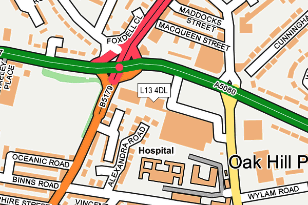
L13 4DL is located in the Old Swan West electoral ward, within the metropolitan district of Liverpool and the English Parliamentary constituency of Liverpool, Wavertree. The Sub Integrated Care Board (ICB) Location is NHS Cheshire and Merseyside ICB - 99A and the police force is Merseyside. This postcode has been in use since February 2017.


GetTheData
Source: OS OpenMap – Local (Ordnance Survey)
Source: OS VectorMap District (Ordnance Survey)
Licence: Open Government Licence (requires attribution)
| Easting | 339171 |
| Northing | 390659 |
| Latitude | 53.409238 |
| Longitude | -2.916527 |
GetTheData
Source: Open Postcode Geo
Licence: Open Government Licence
| Country | England |
| Postcode District | L13 |
➜ See where L13 is on a map ➜ Where is Liverpool? | |
GetTheData
Source: Land Registry Price Paid Data
Licence: Open Government Licence
| Ward | Old Swan West |
| Constituency | Liverpool, Wavertree |
GetTheData
Source: ONS Postcode Database
Licence: Open Government Licence
| Rathbone Road (Edge Lane) | Old Swan | 75m |
| St Oswald Street (Edge Lane) | Old Swan | 95m |
| Edge Lane (Rathbone Road) | Old Swan | 109m |
| Edge Lane Drive (Mill Lane) | Old Swan | 153m |
| Binns Road (Rathbone Road) | Old Swan | 175m |
| Wavertree Technology Park Station | 0.6km |
| Broad Green Station | 1.6km |
| Edge Hill Station | 2.1km |
GetTheData
Source: NaPTAN
Licence: Open Government Licence
GetTheData
Source: ONS Postcode Database
Licence: Open Government Licence


➜ Get more ratings from the Food Standards Agency
GetTheData
Source: Food Standards Agency
Licence: FSA terms & conditions
| Last Collection | |||
|---|---|---|---|
| Location | Mon-Fri | Sat | Distance |
| Edge Lane Drive | 16:15 | 12:00 | 135m |
| Broadgreen Road | 16:15 | 12:00 | 528m |
| Church Road | 16:00 | 12:00 | 528m |
GetTheData
Source: Dracos
Licence: Creative Commons Attribution-ShareAlike
The below table lists the International Territorial Level (ITL) codes (formerly Nomenclature of Territorial Units for Statistics (NUTS) codes) and Local Administrative Units (LAU) codes for L13 4DL:
| ITL 1 Code | Name |
|---|---|
| TLD | North West (England) |
| ITL 2 Code | Name |
| TLD7 | Merseyside |
| ITL 3 Code | Name |
| TLD72 | Liverpool |
| LAU 1 Code | Name |
| E08000012 | Liverpool |
GetTheData
Source: ONS Postcode Directory
Licence: Open Government Licence
The below table lists the Census Output Area (OA), Lower Layer Super Output Area (LSOA), and Middle Layer Super Output Area (MSOA) for L13 4DL:
| Code | Name | |
|---|---|---|
| OA | E00034026 | |
| LSOA | E01006716 | Liverpool 032E |
| MSOA | E02001378 | Liverpool 032 |
GetTheData
Source: ONS Postcode Directory
Licence: Open Government Licence
| L13 1ED | Augusta Close | 71m |
| L13 1EB | Alexandra Road | 101m |
| L13 1BN | Armour Grove | 129m |
| L13 1BE | Rathbone Road | 135m |
| L13 5TJ | Macqueen Street | 159m |
| L13 2DF | St Oswalds Street | 169m |
| L13 5TL | Maddocks Street | 181m |
| L13 1DB | Binns Road | 189m |
| L13 1BW | Wilton Grove | 190m |
| L13 1DD | Binns Road | 209m |
GetTheData
Source: Open Postcode Geo; Land Registry Price Paid Data
Licence: Open Government Licence