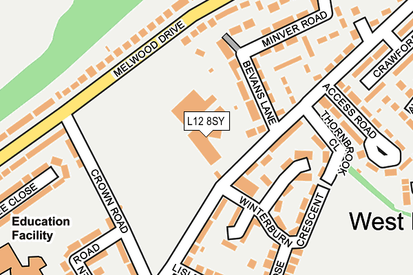
L12 8SY is located in the West Derby Deysbrook electoral ward, within the metropolitan district of Liverpool and the English Parliamentary constituency of Liverpool, West Derby. The Sub Integrated Care Board (ICB) Location is NHS Cheshire and Merseyside ICB - 99A and the police force is Merseyside. This postcode has been in use since July 1983.


GetTheData
Source: OS OpenMap – Local (Ordnance Survey)
Source: OS VectorMap District (Ordnance Survey)
Licence: Open Government Licence (requires attribution)
| Easting | 340455 |
| Northing | 393170 |
| Latitude | 53.431936 |
| Longitude | -2.897690 |
GetTheData
Source: Open Postcode Geo
Licence: Open Government Licence
| Country | England |
| Postcode District | L12 |
➜ See where L12 is on a map ➜ Where is Liverpool? | |
GetTheData
Source: Land Registry Price Paid Data
Licence: Open Government Licence
Elevation or altitude of L12 8SY as distance above sea level:
| Metres | Feet | |
|---|---|---|
| Elevation | 30m | 98ft |
Elevation is measured from the approximate centre of the postcode, to the nearest point on an OS contour line from OS Terrain 50, which has contour spacing of ten vertical metres.
➜ How high above sea level am I? Find the elevation of your current position using your device's GPS.
GetTheData
Source: Open Postcode Elevation
Licence: Open Government Licence
| Ward | West Derby Deysbrook |
| Constituency | Liverpool, West Derby |
GetTheData
Source: ONS Postcode Database
Licence: Open Government Licence
| Crown Road (Melwood Drive) | West Derby | 169m |
| Allerford Road (Melwood Drive) | West Derby | 207m |
| Crown Road (Melwood Drive) | West Derby | 213m |
| Allerford Road (Melwood Drive) | West Derby | 244m |
| Deysbrook Lane (Melwood Drive) | West Derby | 362m |
| Broad Green Station | 2.8km |
| Wavertree Technology Park Station | 3.4km |
| Roby Station | 3.7km |
GetTheData
Source: NaPTAN
Licence: Open Government Licence
GetTheData
Source: ONS Postcode Database
Licence: Open Government Licence

➜ Get more ratings from the Food Standards Agency
GetTheData
Source: Food Standards Agency
Licence: FSA terms & conditions
| Last Collection | |||
|---|---|---|---|
| Location | Mon-Fri | Sat | Distance |
| Town Row Delivery Office | 17:30 | 12:00 | 520m |
| Eaton Road North | 16:15 | 12:00 | 894m |
| Derby Lane | 17:30 | 12:00 | 1,774m |
GetTheData
Source: Dracos
Licence: Creative Commons Attribution-ShareAlike
The below table lists the International Territorial Level (ITL) codes (formerly Nomenclature of Territorial Units for Statistics (NUTS) codes) and Local Administrative Units (LAU) codes for L12 8SY:
| ITL 1 Code | Name |
|---|---|
| TLD | North West (England) |
| ITL 2 Code | Name |
| TLD7 | Merseyside |
| ITL 3 Code | Name |
| TLD72 | Liverpool |
| LAU 1 Code | Name |
| E08000012 | Liverpool |
GetTheData
Source: ONS Postcode Directory
Licence: Open Government Licence
The below table lists the Census Output Area (OA), Lower Layer Super Output Area (LSOA), and Middle Layer Super Output Area (MSOA) for L12 8SY:
| Code | Name | |
|---|---|---|
| OA | E00033537 | |
| LSOA | E01006627 | Liverpool 013C |
| MSOA | E02001359 | Liverpool 013 |
GetTheData
Source: ONS Postcode Directory
Licence: Open Government Licence
| L12 4XB | Coronation Villas | 82m |
| L12 4YX | Bevans Lane | 92m |
| L12 8RQ | Deysbrook Lane | 96m |
| L12 4XA | Bevans Lane | 113m |
| L12 8RG | Deysbrook Lane | 123m |
| L12 8RX | Springdale Close | 150m |
| L12 8RN | Melwood Drive | 177m |
| L12 4YE | Deysbrook Lane | 178m |
| L12 8RS | Crown Road | 187m |
| L12 4XD | Minver Road | 190m |
GetTheData
Source: Open Postcode Geo; Land Registry Price Paid Data
Licence: Open Government Licence