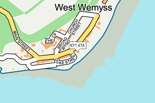
KY1 4TA is located in the Buckhaven, Methil and Wemyss Villages electoral ward, within the council area of Fife and the Scottish Parliamentary constituency of Glenrothes. The Community Health Partnership is Kirkcaldy & Levenmouth Community Health Partnership and the police force is Scotland. This postcode has been in use since January 1980.


GetTheData
Source: OS OpenMap – Local (Ordnance Survey)
Source: OS VectorMap District (Ordnance Survey)
Licence: Open Government Licence (requires attribution)
| Easting | 332680 |
| Northing | 694684 |
| Latitude | 56.140093 |
| Longitude | -3.084903 |
GetTheData
Source: Open Postcode Geo
Licence: Open Government Licence
| Country | Scotland |
| Postcode District | KY1 |
➜ See where KY1 is on a map ➜ Where is West Wemyss? | |
GetTheData
Source: Land Registry Price Paid Data
Licence: Open Government Licence
| Ward | Buckhaven, Methil And Wemyss Villages |
| Constituency | Glenrothes |
GetTheData
Source: ONS Postcode Database
Licence: Open Government Licence
| Post Office (Main Street) | West Wemyss | 33m |
| Belvedere Hotel (Main Street) | West Wemyss | 164m |
| Belvedere Hotel (Main Street) | West Wemyss | 176m |
| West Wemyss Toll (A955) | Coaltown Of Wemyss | 1,137m |
| West Wemyss Toll (A955) | Coaltown Of Wemyss | 1,155m |
| Glenrothes with Thornton Station | 4.4km |
GetTheData
Source: NaPTAN
Licence: Open Government Licence
| Percentage of properties with Next Generation Access | 100.0% |
| Percentage of properties with Superfast Broadband | 0.0% |
| Percentage of properties with Ultrafast Broadband | 0.0% |
| Percentage of properties with Full Fibre Broadband | 0.0% |
Superfast Broadband is between 30Mbps and 300Mbps
Ultrafast Broadband is > 300Mbps
| Percentage of properties unable to receive 2Mbps | 0.0% |
| Percentage of properties unable to receive 5Mbps | 0.0% |
| Percentage of properties unable to receive 10Mbps | 0.0% |
| Percentage of properties unable to receive 30Mbps | 100.0% |
GetTheData
Source: Ofcom
Licence: Ofcom Terms of Use (requires attribution)
GetTheData
Source: ONS Postcode Database
Licence: Open Government Licence


➜ Get more ratings from the Food Standards Agency
GetTheData
Source: Food Standards Agency
Licence: FSA terms & conditions
| Last Collection | |||
|---|---|---|---|
| Location | Mon-Fri | Sat | Distance |
| Pathhead Post Office | 16:00 | 12:15 | 4,180m |
| Southend Crown Hotel | 17:00 | 09:00 | 4,607m |
| Thorton Post Office | 17:15 | 12:00 | 4,811m |
GetTheData
Source: Dracos
Licence: Creative Commons Attribution-ShareAlike
The below table lists the International Territorial Level (ITL) codes (formerly Nomenclature of Territorial Units for Statistics (NUTS) codes) and Local Administrative Units (LAU) codes for KY1 4TA:
| ITL 1 Code | Name |
|---|---|
| TLM | Scotland |
| ITL 2 Code | Name |
| TLM7 | Eastern Scotland |
| ITL 3 Code | Name |
| TLM72 | Clackmannanshire and Fife |
| LAU 1 Code | Name |
| S30000042 | Fife |
GetTheData
Source: ONS Postcode Directory
Licence: Open Government Licence
The below table lists the Census Output Area (OA), Lower Layer Super Output Area (LSOA), and Middle Layer Super Output Area (MSOA) for KY1 4TA:
| Code | Name | |
|---|---|---|
| OA | S00111299 | |
| LSOA | S01009544 | Wemyss Villages |
| MSOA | S02001797 | Wemyss |
GetTheData
Source: ONS Postcode Directory
Licence: Open Government Licence