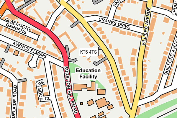
KT6 4TS is located in the St Mark's & Seething Wells electoral ward, within the London borough of Kingston upon Thames and the English Parliamentary constituency of Kingston and Surbiton. The Sub Integrated Care Board (ICB) Location is NHS South West London ICB - 36L and the police force is Metropolitan Police. This postcode has been in use since January 1980.


GetTheData
Source: OS OpenMap – Local (Ordnance Survey)
Source: OS VectorMap District (Ordnance Survey)
Licence: Open Government Licence (requires attribution)
| Easting | 518448 |
| Northing | 167882 |
| Latitude | 51.397616 |
| Longitude | -0.298765 |
GetTheData
Source: Open Postcode Geo
Licence: Open Government Licence
| Country | England |
| Postcode District | KT6 |
➜ See where KT6 is on a map ➜ Where is Surbiton? | |
GetTheData
Source: Land Registry Price Paid Data
Licence: Open Government Licence
Elevation or altitude of KT6 4TS as distance above sea level:
| Metres | Feet | |
|---|---|---|
| Elevation | 30m | 98ft |
Elevation is measured from the approximate centre of the postcode, to the nearest point on an OS contour line from OS Terrain 50, which has contour spacing of ten vertical metres.
➜ How high above sea level am I? Find the elevation of your current position using your device's GPS.
GetTheData
Source: Open Postcode Elevation
Licence: Open Government Licence
| Ward | St Mark's & Seething Wells |
| Constituency | Kingston And Surbiton |
GetTheData
Source: ONS Postcode Database
Licence: Open Government Licence
| Burney Avenue (Villiers Avenue) | Berrylands | 154m |
| Burney Avenue (Villiers Avenue) | Berrylands | 201m |
| Surbiton Hill Road Hollyfield School | Surbiton | 204m |
| Surbiton Hill Road Hollyfield School | Surbiton | 233m |
| Lamberts Rd Hollyfield School (Lamberts Road) | Surbiton | 249m |
| Surbiton Station | 0.7km |
| Berrylands Station | 1.3km |
| Kingston Station | 1.7km |
GetTheData
Source: NaPTAN
Licence: Open Government Licence
GetTheData
Source: ONS Postcode Database
Licence: Open Government Licence


➜ Get more ratings from the Food Standards Agency
GetTheData
Source: Food Standards Agency
Licence: FSA terms & conditions
| Last Collection | |||
|---|---|---|---|
| Location | Mon-Fri | Sat | Distance |
| Cranes Park | 17:30 | 12:00 | 229m |
| St Marks Hill | 17:45 | 12:15 | 288m |
| Adelaide Road | 17:45 | 12:15 | 292m |
GetTheData
Source: Dracos
Licence: Creative Commons Attribution-ShareAlike
The below table lists the International Territorial Level (ITL) codes (formerly Nomenclature of Territorial Units for Statistics (NUTS) codes) and Local Administrative Units (LAU) codes for KT6 4TS:
| ITL 1 Code | Name |
|---|---|
| TLI | London |
| ITL 2 Code | Name |
| TLI6 | Outer London - South |
| ITL 3 Code | Name |
| TLI63 | Merton, Kingston upon Thames and Sutton |
| LAU 1 Code | Name |
| E09000021 | Kingston upon Thames |
GetTheData
Source: ONS Postcode Directory
Licence: Open Government Licence
The below table lists the Census Output Area (OA), Lower Layer Super Output Area (LSOA), and Middle Layer Super Output Area (MSOA) for KT6 4TS:
| Code | Name | |
|---|---|---|
| OA | E00015049 | |
| LSOA | E01002991 | Kingston upon Thames 009E |
| MSOA | E02000606 | Kingston upon Thames 009 |
GetTheData
Source: ONS Postcode Directory
Licence: Open Government Licence
| KT5 8AQ | Cranes Park | 34m |
| KT5 8AG | Cranes Park | 43m |
| KT5 8AB | Cranes Park | 77m |
| KT6 4TR | Surbiton Hill Road | 89m |
| KT5 8AF | Cranes Park | 97m |
| KT5 8AH | Cranes Park | 103m |
| KT5 8AE | Cranes Park | 106m |
| KT5 8AU | Cranes Drive | 115m |
| KT6 4SJ | Avenue Elmers | 125m |
| KT5 8AD | Cranes Park | 126m |
GetTheData
Source: Open Postcode Geo; Land Registry Price Paid Data
Licence: Open Government Licence