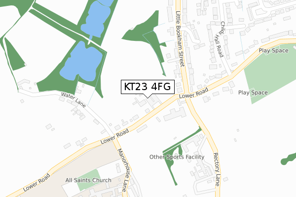
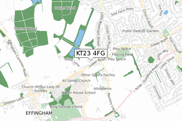
KT23 4FG is located in the Bookham West electoral ward, within the local authority district of Mole Valley and the English Parliamentary constituency of Mole Valley. The Sub Integrated Care Board (ICB) Location is NHS Surrey Heartlands ICB - 92A and the police force is Surrey. This postcode has been in use since February 2020.


GetTheData
Source: OS Open Zoomstack (Ordnance Survey)
Licence: Open Government Licence (requires attribution)
Attribution: Contains OS data © Crown copyright and database right 2025
Source: Open Postcode Geo
Licence: Open Government Licence (requires attribution)
Attribution: Contains OS data © Crown copyright and database right 2025; Contains Royal Mail data © Royal Mail copyright and database right 2025; Source: Office for National Statistics licensed under the Open Government Licence v.3.0
| Easting | 512473 |
| Northing | 154300 |
| Latitude | 51.276752 |
| Longitude | -0.388877 |
GetTheData
Source: Open Postcode Geo
Licence: Open Government Licence
| Country | England |
| Postcode District | KT23 |
➜ See where KT23 is on a map ➜ Where is Little Bookham? | |
GetTheData
Source: Land Registry Price Paid Data
Licence: Open Government Licence
| Ward | Bookham West |
| Constituency | Mole Valley |
GetTheData
Source: ONS Postcode Database
Licence: Open Government Licence
| Preston Cross (Lower Road) | Little Bookham | 109m |
| Preston Cross (Lower Road) | Little Bookham | 114m |
| Preston Cross Turn (Rectory Lane) | Little Bookham | 139m |
| Preston Cross Turn (Rectory Lane) | Little Bookham | 151m |
| Recreation Ground (Lower Road) | Little Bookham | 194m |
| Bookham Station | 1.4km |
| Effingham Junction Station | 2.7km |
| Horsley Station | 3.3km |
GetTheData
Source: NaPTAN
Licence: Open Government Licence
GetTheData
Source: ONS Postcode Database
Licence: Open Government Licence


➜ Get more ratings from the Food Standards Agency
GetTheData
Source: Food Standards Agency
Licence: FSA terms & conditions
| Last Collection | |||
|---|---|---|---|
| Location | Mon-Fri | Sat | Distance |
| Preston Cross | 17:30 | 12:00 | 174m |
| Little Bookham Post Office | 17:30 | 11:30 | 718m |
| Woodlands Road | 17:30 | 11:00 | 805m |
GetTheData
Source: Dracos
Licence: Creative Commons Attribution-ShareAlike
The below table lists the International Territorial Level (ITL) codes (formerly Nomenclature of Territorial Units for Statistics (NUTS) codes) and Local Administrative Units (LAU) codes for KT23 4FG:
| ITL 1 Code | Name |
|---|---|
| TLJ | South East (England) |
| ITL 2 Code | Name |
| TLJ2 | Surrey, East and West Sussex |
| ITL 3 Code | Name |
| TLJ26 | East Surrey |
| LAU 1 Code | Name |
| E07000210 | Mole Valley |
GetTheData
Source: ONS Postcode Directory
Licence: Open Government Licence
The below table lists the Census Output Area (OA), Lower Layer Super Output Area (LSOA), and Middle Layer Super Output Area (MSOA) for KT23 4FG:
| Code | Name | |
|---|---|---|
| OA | E00155651 | |
| LSOA | E01030519 | Mole Valley 006D |
| MSOA | E02006367 | Mole Valley 006 |
GetTheData
Source: ONS Postcode Directory
Licence: Open Government Licence
| KT23 4EF | Lower Road | 43m |
| KT23 4DX | Lower Road | 197m |
| KT23 4DU | Lower Road | 209m |
| KT23 3QQ | Water Lane | 230m |
| KT23 3QH | Water Lane | 244m |
| KT23 3QD | Childs Hall Road | 263m |
| KT23 3AL | Longmeadow | 271m |
| KT23 4ES | Manor House Lane | 284m |
| KT23 3AQ | Little Bookham Street | 293m |
| KT23 4DY | Rectory Lane | 324m |
GetTheData
Source: Open Postcode Geo; Land Registry Price Paid Data
Licence: Open Government Licence