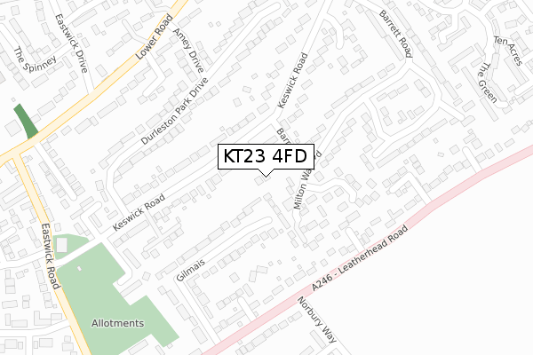
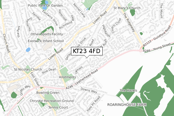
KT23 4FD is located in the Bookham East & Eastwick Park electoral ward, within the local authority district of Mole Valley and the English Parliamentary constituency of Mole Valley. The Sub Integrated Care Board (ICB) Location is NHS Surrey Heartlands ICB - 92A and the police force is Surrey. This postcode has been in use since September 2018.


GetTheData
Source: OS Open Zoomstack (Ordnance Survey)
Licence: Open Government Licence (requires attribution)
Attribution: Contains OS data © Crown copyright and database right 2025
Source: Open Postcode Geo
Licence: Open Government Licence (requires attribution)
Attribution: Contains OS data © Crown copyright and database right 2025; Contains Royal Mail data © Royal Mail copyright and database right 2025; Source: Office for National Statistics licensed under the Open Government Licence v.3.0
| Easting | 514336 |
| Northing | 154834 |
| Latitude | 51.281181 |
| Longitude | -0.362009 |
GetTheData
Source: Open Postcode Geo
Licence: Open Government Licence
| Country | England |
| Postcode District | KT23 |
➜ See where KT23 is on a map ➜ Where is Great Bookham? | |
GetTheData
Source: Land Registry Price Paid Data
Licence: Open Government Licence
| Ward | Bookham East & Eastwick Park |
| Constituency | Mole Valley |
GetTheData
Source: ONS Postcode Database
Licence: Open Government Licence
| Leatherhead Road | Great Bookham | 303m |
| Leatherhead Road | Great Bookham | 311m |
| Eastwick Drive (Lower Road) | Fetcham | 344m |
| Amey Drive (Lower Road) | Fetcham | 361m |
| Beckley Parade (Leatherhead Road) | Great Bookham | 362m |
| Bookham Station | 1.7km |
| Leatherhead Station | 2.8km |
| Box Hill & Westhumble Station | 3.8km |
GetTheData
Source: NaPTAN
Licence: Open Government Licence
| Percentage of properties with Next Generation Access | 100.0% |
| Percentage of properties with Superfast Broadband | 100.0% |
| Percentage of properties with Ultrafast Broadband | 100.0% |
| Percentage of properties with Full Fibre Broadband | 0.0% |
Superfast Broadband is between 30Mbps and 300Mbps
Ultrafast Broadband is > 300Mbps
| Percentage of properties unable to receive 2Mbps | 0.0% |
| Percentage of properties unable to receive 5Mbps | 0.0% |
| Percentage of properties unable to receive 10Mbps | 0.0% |
| Percentage of properties unable to receive 30Mbps | 0.0% |
GetTheData
Source: Ofcom
Licence: Ofcom Terms of Use (requires attribution)
GetTheData
Source: ONS Postcode Database
Licence: Open Government Licence


➜ Get more ratings from the Food Standards Agency
GetTheData
Source: Food Standards Agency
Licence: FSA terms & conditions
| Last Collection | |||
|---|---|---|---|
| Location | Mon-Fri | Sat | Distance |
| Keswick Road | 17:15 | 11:45 | 339m |
| Leatherhead Road Post Office | 17:15 | 12:00 | 426m |
| Eastwick Road | 17:45 | 11:45 | 455m |
GetTheData
Source: Dracos
Licence: Creative Commons Attribution-ShareAlike
The below table lists the International Territorial Level (ITL) codes (formerly Nomenclature of Territorial Units for Statistics (NUTS) codes) and Local Administrative Units (LAU) codes for KT23 4FD:
| ITL 1 Code | Name |
|---|---|
| TLJ | South East (England) |
| ITL 2 Code | Name |
| TLJ2 | Surrey, East and West Sussex |
| ITL 3 Code | Name |
| TLJ26 | East Surrey |
| LAU 1 Code | Name |
| E07000210 | Mole Valley |
GetTheData
Source: ONS Postcode Directory
Licence: Open Government Licence
The below table lists the Census Output Area (OA), Lower Layer Super Output Area (LSOA), and Middle Layer Super Output Area (MSOA) for KT23 4FD:
| Code | Name | |
|---|---|---|
| OA | E00155660 | |
| LSOA | E01030522 | Mole Valley 007C |
| MSOA | E02006368 | Mole Valley 007 |
GetTheData
Source: ONS Postcode Directory
Licence: Open Government Licence
| KT22 9HY | Milton Way | 102m |
| KT23 4BH | Keswick Road | 111m |
| KT22 9HW | Burney Close | 113m |
| KT23 4BG | Keswick Road | 124m |
| KT23 4RP | Gilmais | 169m |
| KT23 4BF | Lyngarth Close | 182m |
| KT22 9JT | Barrington Drive | 182m |
| KT23 4BQ | Keswick Road | 211m |
| KT23 4EB | Dale Close | 221m |
| KT23 4AJ | Durleston Park Drive | 226m |
GetTheData
Source: Open Postcode Geo; Land Registry Price Paid Data
Licence: Open Government Licence