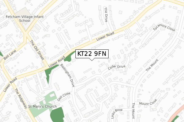
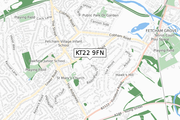
KT22 9FN is located in the Fetcham electoral ward, within the local authority district of Mole Valley and the English Parliamentary constituency of Mole Valley. The Sub Integrated Care Board (ICB) Location is NHS Surrey Heartlands ICB - 92A and the police force is Surrey. This postcode has been in use since February 2020.


GetTheData
Source: OS Open Zoomstack (Ordnance Survey)
Licence: Open Government Licence (requires attribution)
Attribution: Contains OS data © Crown copyright and database right 2025
Source: Open Postcode Geo
Licence: Open Government Licence (requires attribution)
Attribution: Contains OS data © Crown copyright and database right 2025; Contains Royal Mail data © Royal Mail copyright and database right 2025; Source: Office for National Statistics licensed under the Open Government Licence v.3.0
| Easting | 515224 |
| Northing | 155824 |
| Latitude | 51.289901 |
| Longitude | -0.348963 |
GetTheData
Source: Open Postcode Geo
Licence: Open Government Licence
| Country | England |
| Postcode District | KT22 |
➜ See where KT22 is on a map ➜ Where is Fetcham? | |
GetTheData
Source: Land Registry Price Paid Data
Licence: Open Government Licence
| Ward | Fetcham |
| Constituency | Mole Valley |
GetTheData
Source: ONS Postcode Database
Licence: Open Government Licence
1, TALMAN PLACE, FETCHAM, LEATHERHEAD, KT22 9FN 2022 11 OCT £1,200,000 |
6, TALMAN PLACE, FETCHAM, LEATHERHEAD, KT22 9FN 2021 1 JUN £1,200,000 |
5, TALMAN PLACE, FETCHAM, LEATHERHEAD, KT22 9FN 2021 14 MAY £1,025,000 |
4, TALMAN PLACE, FETCHAM, LEATHERHEAD, KT22 9FN 2021 20 JAN £1,050,000 |
2, TALMAN PLACE, FETCHAM, LEATHERHEAD, KT22 9FN 2020 14 SEP £1,050,000 |
1, TALMAN PLACE, FETCHAM, LEATHERHEAD, KT22 9FN 2020 22 JUL £1,050,000 |
3, TALMAN PLACE, FETCHAM, LEATHERHEAD, KT22 9FN 2020 27 MAY £1,020,000 |
GetTheData
Source: HM Land Registry Price Paid Data
Licence: Contains HM Land Registry data © Crown copyright and database right 2025. This data is licensed under the Open Government Licence v3.0.
| Raymead Way (Cobham Road) | Fetcham | 367m |
| Raymead Way (Cobham Road) | Fetcham | 384m |
| School Lane (Cobham Road) | Fetcham | 385m |
| School Lane (Cobham Road) | Fetcham | 495m |
| The Mount (Cobham Road) | Fetcham | 518m |
| Leatherhead Station | 1.5km |
| Bookham Station | 2.4km |
| Cobham & Stoke d'Abernon Station | 4.2km |
GetTheData
Source: NaPTAN
Licence: Open Government Licence
GetTheData
Source: ONS Postcode Database
Licence: Open Government Licence


➜ Get more ratings from the Food Standards Agency
GetTheData
Source: Food Standards Agency
Licence: FSA terms & conditions
| Last Collection | |||
|---|---|---|---|
| Location | Mon-Fri | Sat | Distance |
| Lower Road | 17:15 | 11:45 | 121m |
| 40 The Mount | 17:15 | 12:00 | 282m |
| Marden Hill | 17:15 | 11:45 | 390m |
GetTheData
Source: Dracos
Licence: Creative Commons Attribution-ShareAlike
The below table lists the International Territorial Level (ITL) codes (formerly Nomenclature of Territorial Units for Statistics (NUTS) codes) and Local Administrative Units (LAU) codes for KT22 9FN:
| ITL 1 Code | Name |
|---|---|
| TLJ | South East (England) |
| ITL 2 Code | Name |
| TLJ2 | Surrey, East and West Sussex |
| ITL 3 Code | Name |
| TLJ26 | East Surrey |
| LAU 1 Code | Name |
| E07000210 | Mole Valley |
GetTheData
Source: ONS Postcode Directory
Licence: Open Government Licence
The below table lists the Census Output Area (OA), Lower Layer Super Output Area (LSOA), and Middle Layer Super Output Area (MSOA) for KT22 9FN:
| Code | Name | |
|---|---|---|
| OA | E00155766 | |
| LSOA | E01030540 | Mole Valley 005B |
| MSOA | E02006366 | Mole Valley 005 |
GetTheData
Source: ONS Postcode Directory
Licence: Open Government Licence
| KT22 9ET | Cedar Drive | 114m |
| KT22 9EW | Lower Road | 133m |
| KT22 9ES | Badingham Drive | 135m |
| KT22 9ED | Fetcham Park Drive | 143m |
| KT22 9EL | Lower Road | 144m |
| KT22 9ER | Lower Road | 200m |
| KT22 9FL | The Croft | 202m |
| KT22 9EQ | Ferngrove Close | 214m |
| KT22 9EY | Churchill Close | 230m |
| KT22 9EN | The Drive | 240m |
GetTheData
Source: Open Postcode Geo; Land Registry Price Paid Data
Licence: Open Government Licence