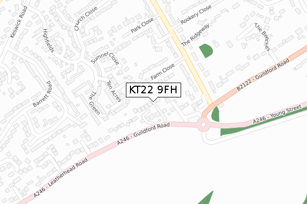
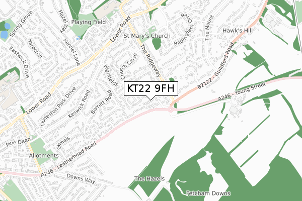
KT22 9FH is located in the Bookham East & Eastwick Park electoral ward, within the local authority district of Mole Valley and the English Parliamentary constituency of Mole Valley. The Sub Integrated Care Board (ICB) Location is NHS Surrey Heartlands ICB - 92A and the police force is Surrey. This postcode has been in use since January 2018.


GetTheData
Source: OS Open Zoomstack (Ordnance Survey)
Licence: Open Government Licence (requires attribution)
Attribution: Contains OS data © Crown copyright and database right 2025
Source: Open Postcode Geo
Licence: Open Government Licence (requires attribution)
Attribution: Contains OS data © Crown copyright and database right 2025; Contains Royal Mail data © Royal Mail copyright and database right 2025; Source: Office for National Statistics licensed under the Open Government Licence v.3.0
| Easting | 514957 |
| Northing | 155025 |
| Latitude | 51.282773 |
| Longitude | -0.353048 |
GetTheData
Source: Open Postcode Geo
Licence: Open Government Licence
| Country | England |
| Postcode District | KT22 |
➜ See where KT22 is on a map ➜ Where is Fetcham? | |
GetTheData
Source: Land Registry Price Paid Data
Licence: Open Government Licence
| Ward | Bookham East & Eastwick Park |
| Constituency | Mole Valley |
GetTheData
Source: ONS Postcode Database
Licence: Open Government Licence
4, HIGH ACRE CLOSE, FETCHAM, LEATHERHEAD, KT22 9FH 2018 14 DEC £1,260,000 |
2018 9 OCT £1,100,000 |
5, HIGH ACRE CLOSE, FETCHAM, LEATHERHEAD, KT22 9FH 2018 25 MAY £1,400,000 |
GetTheData
Source: HM Land Registry Price Paid Data
Licence: Contains HM Land Registry data © Crown copyright and database right 2025. This data is licensed under the Open Government Licence v3.0.
| The Ridgeway (Guildford Road) | Fetcham | 213m |
| The Ridgeway (Guildford Road) | Fetcham | 228m |
| Leatherhead Road | Great Bookham | 400m |
| Leatherhead Road | Great Bookham | 426m |
| Hawks Hill (Guildford Road) | Fetcham | 595m |
| Leatherhead Station | 2.3km |
| Bookham Station | 2.3km |
| Box Hill & Westhumble Station | 3.6km |
GetTheData
Source: NaPTAN
Licence: Open Government Licence
| Percentage of properties with Next Generation Access | 100.0% |
| Percentage of properties with Superfast Broadband | 100.0% |
| Percentage of properties with Ultrafast Broadband | 100.0% |
| Percentage of properties with Full Fibre Broadband | 0.0% |
Superfast Broadband is between 30Mbps and 300Mbps
Ultrafast Broadband is > 300Mbps
| Percentage of properties unable to receive 2Mbps | 0.0% |
| Percentage of properties unable to receive 5Mbps | 0.0% |
| Percentage of properties unable to receive 10Mbps | 0.0% |
| Percentage of properties unable to receive 30Mbps | 0.0% |
GetTheData
Source: Ofcom
Licence: Ofcom Terms of Use (requires attribution)
GetTheData
Source: ONS Postcode Database
Licence: Open Government Licence


➜ Get more ratings from the Food Standards Agency
GetTheData
Source: Food Standards Agency
Licence: FSA terms & conditions
| Last Collection | |||
|---|---|---|---|
| Location | Mon-Fri | Sat | Distance |
| Guildford Road | 17:45 | 11:30 | 136m |
| Keswick Road | 17:15 | 11:45 | 512m |
| Kennel Lane | 17:30 | 11:45 | 649m |
GetTheData
Source: Dracos
Licence: Creative Commons Attribution-ShareAlike
The below table lists the International Territorial Level (ITL) codes (formerly Nomenclature of Territorial Units for Statistics (NUTS) codes) and Local Administrative Units (LAU) codes for KT22 9FH:
| ITL 1 Code | Name |
|---|---|
| TLJ | South East (England) |
| ITL 2 Code | Name |
| TLJ2 | Surrey, East and West Sussex |
| ITL 3 Code | Name |
| TLJ26 | East Surrey |
| LAU 1 Code | Name |
| E07000210 | Mole Valley |
GetTheData
Source: ONS Postcode Directory
Licence: Open Government Licence
The below table lists the Census Output Area (OA), Lower Layer Super Output Area (LSOA), and Middle Layer Super Output Area (MSOA) for KT22 9FH:
| Code | Name | |
|---|---|---|
| OA | E00155759 | |
| LSOA | E01030540 | Mole Valley 005B |
| MSOA | E02006366 | Mole Valley 005 |
GetTheData
Source: ONS Postcode Directory
Licence: Open Government Licence
| KT22 9AB | Redleaf Close | 46m |
| KT22 9BW | Guildford Road | 64m |
| KT22 9BJ | Farm Close | 70m |
| KT22 9XS | Ten Acres Close | 90m |
| KT22 9XQ | Ten Acres | 117m |
| KT22 9BF | Ridgeway Close | 125m |
| KT22 9BN | The Ridgeway | 137m |
| KT22 9XE | The Green | 188m |
| KT22 9XF | Sumner Close | 201m |
| KT22 9BH | The Ridgeway | 205m |
GetTheData
Source: Open Postcode Geo; Land Registry Price Paid Data
Licence: Open Government Licence