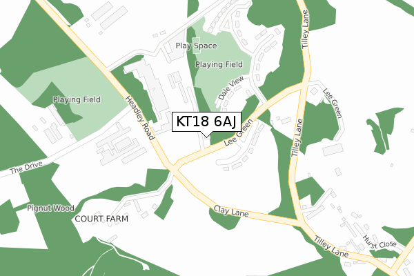
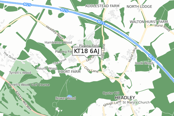
KT18 6AJ is located in the Brockham, Betchworth, Buckland, Box Hill & Headley electoral ward, within the local authority district of Mole Valley and the English Parliamentary constituency of Mole Valley. The Sub Integrated Care Board (ICB) Location is NHS Surrey Heartlands ICB - 92A and the police force is Surrey. This postcode has been in use since October 2019.


GetTheData
Source: OS Open Zoomstack (Ordnance Survey)
Licence: Open Government Licence (requires attribution)
Attribution: Contains OS data © Crown copyright and database right 2024
Source: Open Postcode Geo
Licence: Open Government Licence (requires attribution)
Attribution: Contains OS data © Crown copyright and database right 2024; Contains Royal Mail data © Royal Mail copyright and database right 2024; Source: Office for National Statistics licensed under the Open Government Licence v.3.0
| Easting | 519804 |
| Northing | 155477 |
| Latitude | 51.285838 |
| Longitude | -0.283429 |
GetTheData
Source: Open Postcode Geo
Licence: Open Government Licence
| Country | England |
| Postcode District | KT18 |
➜ See where KT18 is on a map ➜ Where is Headley? | |
GetTheData
Source: Land Registry Price Paid Data
Licence: Open Government Licence
| Ward | Brockham, Betchworth, Buckland, Box Hill & Headley |
| Constituency | Mole Valley |
GetTheData
Source: ONS Postcode Database
Licence: Open Government Licence
| Headley Court (Clay Lane) | Headley | 149m |
| Headley Court (Clay Lane) | Headley | 149m |
| Tea Rooms (Church Lane) | Headley | 573m |
| Tea Rooms (Church Lane) | Headley | 579m |
| Cock Horse (Church Lane) | Headley | 927m |
| Tadworth Station | 3.4km |
| Leatherhead Station | 3.8km |
| Tattenham Corner Station | 3.9km |
GetTheData
Source: NaPTAN
Licence: Open Government Licence
GetTheData
Source: ONS Postcode Database
Licence: Open Government Licence


➜ Get more ratings from the Food Standards Agency
GetTheData
Source: Food Standards Agency
Licence: FSA terms & conditions
| Last Collection | |||
|---|---|---|---|
| Location | Mon-Fri | Sat | Distance |
| Headley Village Store | 17:00 | 12:00 | 1,019m |
| Tothill | 16:45 | 12:00 | 1,217m |
| Reigate Road | 17:30 | 12:00 | 2,313m |
GetTheData
Source: Dracos
Licence: Creative Commons Attribution-ShareAlike
The below table lists the International Territorial Level (ITL) codes (formerly Nomenclature of Territorial Units for Statistics (NUTS) codes) and Local Administrative Units (LAU) codes for KT18 6AJ:
| ITL 1 Code | Name |
|---|---|
| TLJ | South East (England) |
| ITL 2 Code | Name |
| TLJ2 | Surrey, East and West Sussex |
| ITL 3 Code | Name |
| TLJ26 | East Surrey |
| LAU 1 Code | Name |
| E07000210 | Mole Valley |
GetTheData
Source: ONS Postcode Directory
Licence: Open Government Licence
The below table lists the Census Output Area (OA), Lower Layer Super Output Area (LSOA), and Middle Layer Super Output Area (MSOA) for KT18 6AJ:
| Code | Name | |
|---|---|---|
| OA | E00155683 | |
| LSOA | E01030524 | Mole Valley 008A |
| MSOA | E02006369 | Mole Valley 008 |
GetTheData
Source: ONS Postcode Directory
Licence: Open Government Licence
| KT18 6JS | Clay Lane | 275m |
| KT18 6EE | Tilley Lane | 295m |
| KT18 6JU | Tilley Lane | 315m |
| KT18 6DZ | Hurst Close | 440m |
| KT18 6LB | Church Lane | 584m |
| KT18 6EA | Hookwood Cottages | 693m |
| KT18 6EN | Fourfield Close | 707m |
| KT22 8QW | Tyrrells Wood | 744m |
| KT18 6LQ | Church Lane | 775m |
| KT18 6NZ | Slough Lane | 779m |
GetTheData
Source: Open Postcode Geo; Land Registry Price Paid Data
Licence: Open Government Licence