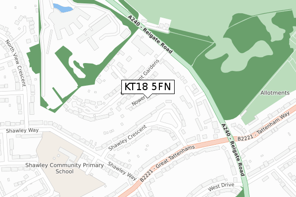
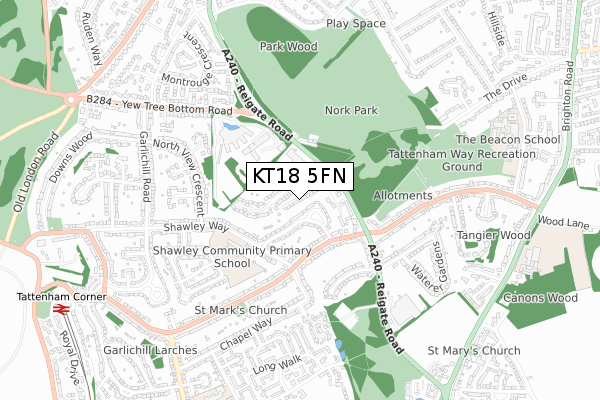
KT18 5FN is located in the Nork electoral ward, within the local authority district of Reigate and Banstead and the English Parliamentary constituency of Epsom and Ewell. The Sub Integrated Care Board (ICB) Location is NHS Surrey Heartlands ICB - 92A and the police force is Surrey. This postcode has been in use since October 2018.


GetTheData
Source: OS Open Zoomstack (Ordnance Survey)
Licence: Open Government Licence (requires attribution)
Attribution: Contains OS data © Crown copyright and database right 2024
Source: Open Postcode Geo
Licence: Open Government Licence (requires attribution)
Attribution: Contains OS data © Crown copyright and database right 2024; Contains Royal Mail data © Royal Mail copyright and database right 2024; Source: Office for National Statistics licensed under the Open Government Licence v.3.0
| Easting | 523594 |
| Northing | 158593 |
| Latitude | 51.313034 |
| Longitude | -0.228030 |
GetTheData
Source: Open Postcode Geo
Licence: Open Government Licence
| Country | England |
| Postcode District | KT18 |
➜ See where KT18 is on a map ➜ Where is Great Burgh? | |
GetTheData
Source: Land Registry Price Paid Data
Licence: Open Government Licence
| Ward | Nork |
| Constituency | Epsom And Ewell |
GetTheData
Source: ONS Postcode Database
Licence: Open Government Licence
3, NOWER CLOSE, EPSOM DOWNS, EPSOM, KT18 5FN 2022 4 APR £885,000 |
11, NOWER CLOSE, EPSOM DOWNS, EPSOM, KT18 5FN 2020 4 NOV £750,000 |
1A, NOWER CLOSE, EPSOM DOWNS, EPSOM, KT18 5FN 2020 3 SEP £893,000 |
2019 11 NOV £830,000 |
6, NOWER CLOSE, EPSOM DOWNS, EPSOM, KT18 5FN 2019 18 JUL £818,500 |
2, NOWER CLOSE, EPSOM DOWNS, EPSOM, KT18 5FN 2019 28 JUN £900,000 |
11, NOWER CLOSE, EPSOM DOWNS, EPSOM, KT18 5FN 2019 28 JUN £700,000 |
1A, NOWER CLOSE, EPSOM DOWNS, EPSOM, KT18 5FN 2019 24 MAY £890,000 |
9, NOWER CLOSE, EPSOM DOWNS, EPSOM, KT18 5FN 2019 30 JAN £861,500 |
1, NOWER CLOSE, EPSOM DOWNS, EPSOM, KT18 5FN 2018 28 NOV £920,000 |
GetTheData
Source: HM Land Registry Price Paid Data
Licence: Contains HM Land Registry data © Crown copyright and database right 2024. This data is licensed under the Open Government Licence v3.0.
| Shawley Crescent (Great Tattenhams) | Burgh Heath | 214m |
| Chapel Way (Great Tattenhams) | Burgh Heath | 237m |
| Shawley Crescent (Great Tattenhams) | Burgh Heath | 238m |
| Chapel Way (Great Tattenhams) | Burgh Heath | 265m |
| The Parade (Tattenham Way) | Burgh Heath | 360m |
| Tattenham Corner Station | 1.1km |
| Epsom Downs Station | 1.4km |
| Banstead Station | 2.1km |
GetTheData
Source: NaPTAN
Licence: Open Government Licence
| Percentage of properties with Next Generation Access | 100.0% |
| Percentage of properties with Superfast Broadband | 100.0% |
| Percentage of properties with Ultrafast Broadband | 0.0% |
| Percentage of properties with Full Fibre Broadband | 0.0% |
Superfast Broadband is between 30Mbps and 300Mbps
Ultrafast Broadband is > 300Mbps
| Median download speed | 34.0Mbps |
| Average download speed | 39.3Mbps |
| Maximum download speed | 77.49Mbps |
| Median upload speed | 10.0Mbps |
| Average upload speed | 10.1Mbps |
| Maximum upload speed | 19.53Mbps |
| Percentage of properties unable to receive 2Mbps | 0.0% |
| Percentage of properties unable to receive 5Mbps | 0.0% |
| Percentage of properties unable to receive 10Mbps | 0.0% |
| Percentage of properties unable to receive 30Mbps | 0.0% |
GetTheData
Source: Ofcom
Licence: Ofcom Terms of Use (requires attribution)
GetTheData
Source: ONS Postcode Database
Licence: Open Government Licence


➜ Get more ratings from the Food Standards Agency
GetTheData
Source: Food Standards Agency
Licence: FSA terms & conditions
| Last Collection | |||
|---|---|---|---|
| Location | Mon-Fri | Sat | Distance |
| Shawley Way | 17:30 | 12:00 | 274m |
| Upland Way | 17:15 | 12:00 | 598m |
| Garlichill Road | 17:30 | 12:00 | 639m |
GetTheData
Source: Dracos
Licence: Creative Commons Attribution-ShareAlike
The below table lists the International Territorial Level (ITL) codes (formerly Nomenclature of Territorial Units for Statistics (NUTS) codes) and Local Administrative Units (LAU) codes for KT18 5FN:
| ITL 1 Code | Name |
|---|---|
| TLJ | South East (England) |
| ITL 2 Code | Name |
| TLJ2 | Surrey, East and West Sussex |
| ITL 3 Code | Name |
| TLJ26 | East Surrey |
| LAU 1 Code | Name |
| E07000211 | Reigate and Banstead |
GetTheData
Source: ONS Postcode Directory
Licence: Open Government Licence
The below table lists the Census Output Area (OA), Lower Layer Super Output Area (LSOA), and Middle Layer Super Output Area (MSOA) for KT18 5FN:
| Code | Name | |
|---|---|---|
| OA | E00156091 | |
| LSOA | E01030606 | Reigate and Banstead 003A |
| MSOA | E02006377 | Reigate and Banstead 003 |
GetTheData
Source: ONS Postcode Directory
Licence: Open Government Licence
| KT18 5PQ | Shawley Crescent | 59m |
| KT18 5XF | Claremount Gardens | 116m |
| KT18 5PH | Shawley Crescent | 125m |
| KT18 5XA | Reigate Road | 132m |
| KT18 5XN | Claremount Close | 151m |
| KT20 5PQ | Home Farm Close | 175m |
| KT18 5SB | Great Tattenhams | 184m |
| KT18 5PG | Shawley Way | 237m |
| KT18 5RF | Great Tattenhams | 238m |
| KT20 5PF | Reigate Road | 243m |
GetTheData
Source: Open Postcode Geo; Land Registry Price Paid Data
Licence: Open Government Licence