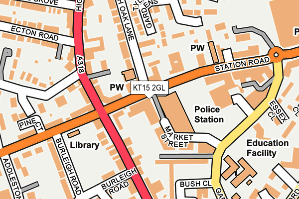
KT15 2GL is located in the Addlestone South electoral ward, within the local authority district of Runnymede and the English Parliamentary constituency of Runnymede and Weybridge. The Sub Integrated Care Board (ICB) Location is NHS Surrey Heartlands ICB - 92A and the police force is Surrey. This postcode has been in use since April 2017.


GetTheData
Source: OS OpenMap – Local (Ordnance Survey)
Source: OS VectorMap District (Ordnance Survey)
Licence: Open Government Licence (requires attribution)
| Easting | 505087 |
| Northing | 164605 |
| Latitude | 51.370789 |
| Longitude | -0.491695 |
GetTheData
Source: Open Postcode Geo
Licence: Open Government Licence
| Country | England |
| Postcode District | KT15 |
➜ See where KT15 is on a map ➜ Where is Addlestone? | |
GetTheData
Source: Land Registry Price Paid Data
Licence: Open Government Licence
| Ward | Addlestone South |
| Constituency | Runnymede And Weybridge |
GetTheData
Source: ONS Postcode Database
Licence: Open Government Licence
| Crouch Oak Lane (Station Road) | Addlestone | 25m |
| Dukes Court | Addlestone | 78m |
| Church Road | Addlestone | 160m |
| Holly Tree (High Street) | Addlestone | 167m |
| Tesco (Station Road) | Addlestone | 212m |
| Addlestone Station | 0.6km |
| Chertsey Station | 2.2km |
| Byfleet & New Haw Station | 2.4km |
GetTheData
Source: NaPTAN
Licence: Open Government Licence
GetTheData
Source: ONS Postcode Database
Licence: Open Government Licence


➜ Get more ratings from the Food Standards Agency
GetTheData
Source: Food Standards Agency
Licence: FSA terms & conditions
| Last Collection | |||
|---|---|---|---|
| Location | Mon-Fri | Sat | Distance |
| Addlestone Cross Roads | 17:30 | 12:15 | 167m |
| Addlestone Delivery Office 76 Station Road | 17:30 | 13:00 | 176m |
| Addlestone Delivery Office | 17:30 | 13:00 | 176m |
GetTheData
Source: Dracos
Licence: Creative Commons Attribution-ShareAlike
The below table lists the International Territorial Level (ITL) codes (formerly Nomenclature of Territorial Units for Statistics (NUTS) codes) and Local Administrative Units (LAU) codes for KT15 2GL:
| ITL 1 Code | Name |
|---|---|
| TLJ | South East (England) |
| ITL 2 Code | Name |
| TLJ2 | Surrey, East and West Sussex |
| ITL 3 Code | Name |
| TLJ25 | West Surrey |
| LAU 1 Code | Name |
| E07000212 | Runnymede |
GetTheData
Source: ONS Postcode Directory
Licence: Open Government Licence
The below table lists the Census Output Area (OA), Lower Layer Super Output Area (LSOA), and Middle Layer Super Output Area (MSOA) for KT15 2GL:
| Code | Name | |
|---|---|---|
| OA | E00156302 | |
| LSOA | E01030645 | Runnymede 009A |
| MSOA | E02006401 | Runnymede 009 |
GetTheData
Source: ONS Postcode Directory
Licence: Open Government Licence
| KT15 2AL | Station Road | 40m |
| KT15 2NT | Crouch Oak Lane | 46m |
| KT15 1PQ | Brighton Road | 61m |
| KT15 1PF | Brighton Road | 104m |
| KT15 1UQ | High Street | 112m |
| KT15 1PJ | Brighton Road | 117m |
| KT15 1TL | High Street | 118m |
| KT15 1RN | Church Road | 128m |
| KT15 2NL | Middlesex Court | 137m |
| KT15 1TN | High Street | 140m |
GetTheData
Source: Open Postcode Geo; Land Registry Price Paid Data
Licence: Open Government Licence