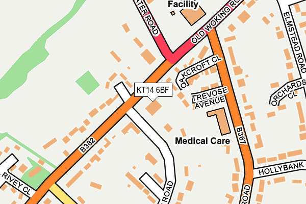
KT14 6BF lies on Woodlands Road in West Byfleet. KT14 6BF is located in the Pyrford electoral ward, within the local authority district of Woking and the English Parliamentary constituency of Woking. The Sub Integrated Care Board (ICB) Location is NHS Surrey Heartlands ICB - 92A and the police force is Surrey. This postcode has been in use since September 2008.


GetTheData
Source: OS OpenMap – Local (Ordnance Survey)
Source: OS VectorMap District (Ordnance Survey)
Licence: Open Government Licence (requires attribution)
| Easting | 503832 |
| Northing | 160405 |
| Latitude | 51.333269 |
| Longitude | -0.510961 |
GetTheData
Source: Open Postcode Geo
Licence: Open Government Licence
| Street | Woodlands Road |
| Town/City | West Byfleet |
| Country | England |
| Postcode District | KT14 |
➜ See where KT14 is on a map ➜ Where is Pyrford? | |
GetTheData
Source: Land Registry Price Paid Data
Licence: Open Government Licence
Elevation or altitude of KT14 6BF as distance above sea level:
| Metres | Feet | |
|---|---|---|
| Elevation | 30m | 98ft |
Elevation is measured from the approximate centre of the postcode, to the nearest point on an OS contour line from OS Terrain 50, which has contour spacing of ten vertical metres.
➜ How high above sea level am I? Find the elevation of your current position using your device's GPS.
GetTheData
Source: Open Postcode Elevation
Licence: Open Government Licence
| Ward | Pyrford |
| Constituency | Woking |
GetTheData
Source: ONS Postcode Database
Licence: Open Government Licence
FLAT 2, WOODHAYES, WOODLANDS ROAD, WEST BYFLEET, KT14 6BF 2010 26 OCT £80,600 |
GetTheData
Source: HM Land Registry Price Paid Data
Licence: Contains HM Land Registry data © Crown copyright and database right 2025. This data is licensed under the Open Government Licence v3.0.
| West Byfleet Golf Club (Sheerwater Road) | West Byfleet | 209m |
| West Byfleet Golf Club (Sheerwater Road) | West Byfleet | 239m |
| Elmstead Road (Old Woking Road) | West Byfleet | 275m |
| Oakcroft Road | West Byfleet | 288m |
| Elmstead Road (Old Woking Road) | West Byfleet | 310m |
| West Byfleet Station | 0.8km |
| Byfleet & New Haw Station | 2.8km |
| Woking Station | 3.6km |
GetTheData
Source: NaPTAN
Licence: Open Government Licence
| Percentage of properties with Next Generation Access | 100.0% |
| Percentage of properties with Superfast Broadband | 100.0% |
| Percentage of properties with Ultrafast Broadband | 100.0% |
| Percentage of properties with Full Fibre Broadband | 0.0% |
Superfast Broadband is between 30Mbps and 300Mbps
Ultrafast Broadband is > 300Mbps
| Percentage of properties unable to receive 2Mbps | 0.0% |
| Percentage of properties unable to receive 5Mbps | 0.0% |
| Percentage of properties unable to receive 10Mbps | 0.0% |
| Percentage of properties unable to receive 30Mbps | 0.0% |
GetTheData
Source: Ofcom
Licence: Ofcom Terms of Use (requires attribution)
Estimated total energy consumption in KT14 6BF by fuel type, 2015.
| Consumption (kWh) | 52,827 |
|---|---|
| Meter count | 11 |
| Mean (kWh/meter) | 4,802 |
| Median (kWh/meter) | 5,655 |
| Consumption (kWh) | 78,779 |
|---|---|
| Meter count | 12 |
| Mean (kWh/meter) | 6,565 |
| Median (kWh/meter) | 5,495 |
GetTheData
Source: Postcode level gas estimates: 2015 (experimental)
Source: Postcode level electricity estimates: 2015 (experimental)
Licence: Open Government Licence
GetTheData
Source: ONS Postcode Database
Licence: Open Government Licence


➜ Get more ratings from the Food Standards Agency
GetTheData
Source: Food Standards Agency
Licence: FSA terms & conditions
| Last Collection | |||
|---|---|---|---|
| Location | Mon-Fri | Sat | Distance |
| Coldharbour Road | 17:15 | 12:15 | 267m |
| Madeira Road | 17:15 | 12:30 | 319m |
| Elmstead Road | 17:15 | 12:15 | 354m |
GetTheData
Source: Dracos
Licence: Creative Commons Attribution-ShareAlike
The below table lists the International Territorial Level (ITL) codes (formerly Nomenclature of Territorial Units for Statistics (NUTS) codes) and Local Administrative Units (LAU) codes for KT14 6BF:
| ITL 1 Code | Name |
|---|---|
| TLJ | South East (England) |
| ITL 2 Code | Name |
| TLJ2 | Surrey, East and West Sussex |
| ITL 3 Code | Name |
| TLJ25 | West Surrey |
| LAU 1 Code | Name |
| E07000217 | Woking |
GetTheData
Source: ONS Postcode Directory
Licence: Open Government Licence
The below table lists the Census Output Area (OA), Lower Layer Super Output Area (LSOA), and Middle Layer Super Output Area (MSOA) for KT14 6BF:
| Code | Name | |
|---|---|---|
| OA | E00158034 | |
| LSOA | E01031002 | Woking 002C |
| MSOA | E02006457 | Woking 002 |
GetTheData
Source: ONS Postcode Directory
Licence: Open Government Licence
| KT14 6HT | Fairford Close | 93m |
| KT14 6JQ | Oakcroft Close | 97m |
| KT14 6HW | Trevose Avenue | 105m |
| KT14 6HY | Old Woking Road | 156m |
| KT14 6AA | Sheerwater Road | 159m |
| KT14 6JT | Berkeley Gardens | 167m |
| KT14 6JG | Oakcroft Road | 178m |
| KT14 6JW | Woodlands Road | 195m |
| KT14 6HU | Old Woking Road | 199m |
| KT14 6HZ | Old Woking Road | 250m |
GetTheData
Source: Open Postcode Geo; Land Registry Price Paid Data
Licence: Open Government Licence