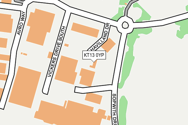
KT13 0YP lies on De Havilland Drive in Weybridge. KT13 0YP is located in the Weybridge St George's Hill electoral ward, within the local authority district of Elmbridge and the English Parliamentary constituency of Runnymede and Weybridge. The Sub Integrated Care Board (ICB) Location is NHS Surrey Heartlands ICB - 92A and the police force is Surrey. This postcode has been in use since January 1995.


GetTheData
Source: OS OpenMap – Local (Ordnance Survey)
Source: OS VectorMap District (Ordnance Survey)
Licence: Open Government Licence (requires attribution)
| Easting | 506379 |
| Northing | 161917 |
| Latitude | 51.346389 |
| Longitude | -0.473964 |
GetTheData
Source: Open Postcode Geo
Licence: Open Government Licence
| Street | De Havilland Drive |
| Town/City | Weybridge |
| Country | England |
| Postcode District | KT13 |
➜ See where KT13 is on a map ➜ Where is Brooklands? | |
GetTheData
Source: Land Registry Price Paid Data
Licence: Open Government Licence
Elevation or altitude of KT13 0YP as distance above sea level:
| Metres | Feet | |
|---|---|---|
| Elevation | 20m | 66ft |
Elevation is measured from the approximate centre of the postcode, to the nearest point on an OS contour line from OS Terrain 50, which has contour spacing of ten vertical metres.
➜ How high above sea level am I? Find the elevation of your current position using your device's GPS.
GetTheData
Source: Open Postcode Elevation
Licence: Open Government Licence
| Ward | Weybridge St George's Hill |
| Constituency | Runnymede And Weybridge |
GetTheData
Source: ONS Postcode Database
Licence: Open Government Licence
| Marks And Spencers (Brooklands Shopping Centre) | Brooklands | 241m |
| Barnes Wallis Drive | Byfleet | 349m |
| Barnes Wallis Drive | Byfleet | 374m |
| Chertsey Road (Oyster Lane) | Brooklands | 425m |
| Chertsey Road (Oyster Lane) | Brooklands | 433m |
| Byfleet & New Haw Station | 0.6km |
| Weybridge Station | 2.1km |
| West Byfleet Station | 2.3km |
GetTheData
Source: NaPTAN
Licence: Open Government Licence
GetTheData
Source: ONS Postcode Database
Licence: Open Government Licence


➜ Get more ratings from the Food Standards Agency
GetTheData
Source: Food Standards Agency
Licence: FSA terms & conditions
| Last Collection | |||
|---|---|---|---|
| Location | Mon-Fri | Sat | Distance |
| Barnes Wallace Drive | 18:30 | 11:30 | 237m |
| Vickers Drive North | 249m | ||
| Oyster Lane | 18:45 | 12:00 | 416m |
GetTheData
Source: Dracos
Licence: Creative Commons Attribution-ShareAlike
The below table lists the International Territorial Level (ITL) codes (formerly Nomenclature of Territorial Units for Statistics (NUTS) codes) and Local Administrative Units (LAU) codes for KT13 0YP:
| ITL 1 Code | Name |
|---|---|
| TLJ | South East (England) |
| ITL 2 Code | Name |
| TLJ2 | Surrey, East and West Sussex |
| ITL 3 Code | Name |
| TLJ25 | West Surrey |
| LAU 1 Code | Name |
| E07000207 | Elmbridge |
GetTheData
Source: ONS Postcode Directory
Licence: Open Government Licence
The below table lists the Census Output Area (OA), Lower Layer Super Output Area (LSOA), and Middle Layer Super Output Area (MSOA) for KT13 0YP:
| Code | Name | |
|---|---|---|
| OA | E00154793 | |
| LSOA | E01030347 | Elmbridge 016B |
| MSOA | E02006332 | Elmbridge 016 |
GetTheData
Source: ONS Postcode Directory
Licence: Open Government Licence
| KT13 0UJ | Vickers Drive South | 234m |
| KT14 7JG | Oyster Lane | 400m |
| KT14 7JF | Oyster Lane | 410m |
| KT14 7HZ | Oyster Lane | 412m |
| KT13 0YU | Vickers Drive North | 426m |
| KT14 7JD | Dawson Road | 454m |
| KT14 6HJ | Dunfee Way | 471m |
| KT14 7JB | Caillard Road | 473m |
| KT14 7JQ | Oyster Lane | 483m |
| KT14 7HR | Oyster Lane | 496m |
GetTheData
Source: Open Postcode Geo; Land Registry Price Paid Data
Licence: Open Government Licence