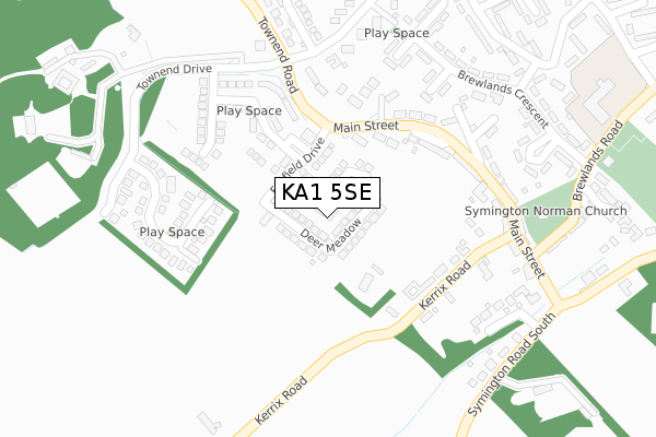
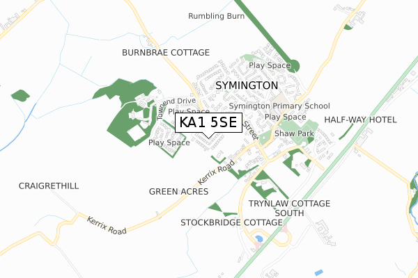
KA1 5SE is located in the Kyle electoral ward, within the council area of South Ayrshire and the Scottish Parliamentary constituency of Central Ayrshire. The Community Health Partnership is South Ayrshire Community Health Partnership and the police force is Scotland. This postcode has been in use since July 2018.


GetTheData
Source: OS Open Zoomstack (Ordnance Survey)
Licence: Open Government Licence (requires attribution)
Attribution: Contains OS data © Crown copyright and database right 2025
Source: Open Postcode Geo
Licence: Open Government Licence (requires attribution)
Attribution: Contains OS data © Crown copyright and database right 2025; Contains Royal Mail data © Royal Mail copyright and database right 2025; Source: Office for National Statistics licensed under the Open Government Licence v.3.0
| Easting | 238121 |
| Northing | 631436 |
| Latitude | 55.549678 |
| Longitude | -4.567571 |
GetTheData
Source: Open Postcode Geo
Licence: Open Government Licence
| Country | Scotland |
| Postcode District | KA1 |
➜ See where KA1 is on a map ➜ Where is Symington? | |
GetTheData
Source: Land Registry Price Paid Data
Licence: Open Government Licence
| Ward | Kyle |
| Constituency | Central Ayrshire |
GetTheData
Source: ONS Postcode Database
Licence: Open Government Licence
| Main Street (Symington Road) | Symington | 386m |
| Main Street (Symington Road) | Symington | 387m |
| Turning Circle (Symington Road North) | Symington | 537m |
| Quarry Road (A77 Kilmarnock Road) | Symington | 1,059m |
| Symington Road North (A77 Kilmarnock Road) | Symington | 1,129m |
| Prestwick Intl Airport Station | 5.4km |
GetTheData
Source: NaPTAN
Licence: Open Government Licence
GetTheData
Source: ONS Postcode Database
Licence: Open Government Licence


➜ Get more ratings from the Food Standards Agency
GetTheData
Source: Food Standards Agency
Licence: FSA terms & conditions
| Last Collection | |||
|---|---|---|---|
| Location | Mon-Fri | Sat | Distance |
| Bogend Toll | 15:15 | 08:00 | 1,711m |
| Post Office | 16:00 | 11:30 | 3,392m |
| Adamton Est | 10:00 | 09:00 | 3,743m |
GetTheData
Source: Dracos
Licence: Creative Commons Attribution-ShareAlike
The below table lists the International Territorial Level (ITL) codes (formerly Nomenclature of Territorial Units for Statistics (NUTS) codes) and Local Administrative Units (LAU) codes for KA1 5SE:
| ITL 1 Code | Name |
|---|---|
| TLM | Scotland |
| ITL 2 Code | Name |
| TLM9 | Southern Scotland |
| ITL 3 Code | Name |
| TLM94 | South Ayrshire |
| LAU 1 Code | Name |
| S30000024 | South Ayrshire |
GetTheData
Source: ONS Postcode Directory
Licence: Open Government Licence
The below table lists the Census Output Area (OA), Lower Layer Super Output Area (LSOA), and Middle Layer Super Output Area (MSOA) for KA1 5SE:
| Code | Name | |
|---|---|---|
| OA | S00129142 | |
| LSOA | S01012542 | Dundonald, Loans and Symington - 01 |
| MSOA | S02002350 | Dundonald, Loans and Symington |
GetTheData
Source: ONS Postcode Directory
Licence: Open Government Licence