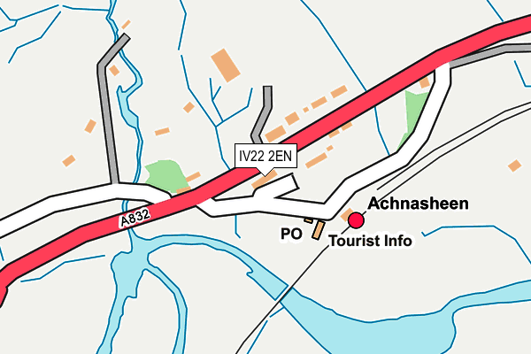
IV22 2EN is located in the Wester Ross, Strathpeffer and Lochalsh electoral ward, within the council area of Highland and the Scottish Parliamentary constituency of Ross, Skye and Lochaber. The Community Health Partnership is Highland Health and Social Care Partnership and the police force is Scotland. This postcode has been in use since April 1982.


GetTheData
Source: OS OpenMap – Local (Ordnance Survey)
Source: OS VectorMap District (Ordnance Survey)
Licence: Open Government Licence (requires attribution)
| Easting | 216305 |
| Northing | 858571 |
| Latitude | 57.579715 |
| Longitude | -5.074008 |
GetTheData
Source: Open Postcode Geo
Licence: Open Government Licence
| Country | Scotland |
| Postcode District | IV22 |
➜ See where IV22 is on a map ➜ Where is Achnasheen? | |
GetTheData
Source: Land Registry Price Paid Data
Licence: Open Government Licence
| Ward | Wester Ross, Strathpeffer And Lochalsh |
| Constituency | Ross, Skye And Lochaber |
GetTheData
Source: ONS Postcode Database
Licence: Open Government Licence
| Station (Minor Road) | Achnasheen | 88m |
| School Rd End (A832) | Achnasheen | 101m |
| School Rd End (A832) | Achnasheen | 102m |
| Ledgowan Lodge Hotel (A890) | Achnasheen | 872m |
| Ledgowan Lodge Hotel (A890) | Achnasheen | 880m |
| Achnasheen Station | 0.1km |
GetTheData
Source: NaPTAN
Licence: Open Government Licence
GetTheData
Source: ONS Postcode Database
Licence: Open Government Licence


➜ Get more ratings from the Food Standards Agency
GetTheData
Source: Food Standards Agency
Licence: FSA terms & conditions
| Last Collection | |||
|---|---|---|---|
| Location | Mon-Fri | Sat | Distance |
| Achnasheen Post Office | 17:00 | 11:30 | 100m |
GetTheData
Source: Dracos
Licence: Creative Commons Attribution-ShareAlike
The below table lists the International Territorial Level (ITL) codes (formerly Nomenclature of Territorial Units for Statistics (NUTS) codes) and Local Administrative Units (LAU) codes for IV22 2EN:
| ITL 1 Code | Name |
|---|---|
| TLM | Scotland |
| ITL 2 Code | Name |
| TLM6 | Highlands and Islands |
| ITL 3 Code | Name |
| TLM61 | Caithness and Sutherland, and Ross and Cromarty |
| LAU 1 Code | Name |
| S30000028 | Ross and Cromarty |
GetTheData
Source: ONS Postcode Directory
Licence: Open Government Licence
The below table lists the Census Output Area (OA), Lower Layer Super Output Area (LSOA), and Middle Layer Super Output Area (MSOA) for IV22 2EN:
| Code | Name | |
|---|---|---|
| OA | S00117974 | |
| LSOA | S01010698 | Ross and Cromarty Central - 04 |
| MSOA | S02002013 | Ross and Cromarty Central |
GetTheData
Source: ONS Postcode Directory
Licence: Open Government Licence