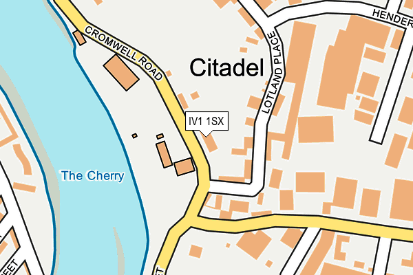
IV1 1SX is located in the Inverness Millburn electoral ward, within the council area of Highland and the Scottish Parliamentary constituency of Inverness, Nairn, Badenoch and Strathspey. The Community Health Partnership is Highland Health and Social Care Partnership and the police force is Scotland. This postcode has been in use since January 1980.


GetTheData
Source: OS OpenMap – Local (Ordnance Survey)
Source: OS VectorMap District (Ordnance Survey)
Licence: Open Government Licence (requires attribution)
| Easting | 266519 |
| Northing | 846284 |
| Latitude | 57.487053 |
| Longitude | -4.228285 |
GetTheData
Source: Open Postcode Geo
Licence: Open Government Licence
| Country | Scotland |
| Postcode District | IV1 |
➜ See where IV1 is on a map ➜ Where is Inverness? | |
GetTheData
Source: Land Registry Price Paid Data
Licence: Open Government Licence
| Ward | Inverness Millburn |
| Constituency | Inverness, Nairn, Badenoch And Strathspey |
GetTheData
Source: ONS Postcode Database
Licence: Open Government Licence
| Henderson Road (Lotland Street) | Longman | 204m |
| Nelson Street (Grant Street) | Merkinch | 461m |
| Inverness College (Longman Road) | Longman | 461m |
| Nelson Street (Grant Street) | Merkinch | 469m |
| Pumpgate Street (Lower Kessock St) | Merkinch | 497m |
| Inverness Station | 0.9km |
GetTheData
Source: NaPTAN
Licence: Open Government Licence
GetTheData
Source: ONS Postcode Database
Licence: Open Government Licence


➜ Get more ratings from the Food Standards Agency
GetTheData
Source: Food Standards Agency
Licence: FSA terms & conditions
| Last Collection | |||
|---|---|---|---|
| Location | Mon-Fri | Sat | Distance |
| Innes Street | 17:45 | 11:00 | 440m |
| Seafield Road | 18:30 | 12:30 | 462m |
| Henderson Drive | 18:30 | 12:30 | 462m |
GetTheData
Source: Dracos
Licence: Creative Commons Attribution-ShareAlike
The below table lists the International Territorial Level (ITL) codes (formerly Nomenclature of Territorial Units for Statistics (NUTS) codes) and Local Administrative Units (LAU) codes for IV1 1SX:
| ITL 1 Code | Name |
|---|---|
| TLM | Scotland |
| ITL 2 Code | Name |
| TLM6 | Highlands and Islands |
| ITL 3 Code | Name |
| TLM62 | Inverness and Nairn, Moray, and Badenoch and Strathspey |
| LAU 1 Code | Name |
| S30000030 | Inverness and Nairn |
GetTheData
Source: ONS Postcode Directory
Licence: Open Government Licence
The below table lists the Census Output Area (OA), Lower Layer Super Output Area (LSOA), and Middle Layer Super Output Area (MSOA) for IV1 1SX:
| Code | Name | |
|---|---|---|
| OA | S00118267 | |
| LSOA | S01010619 | Inverness Central, Raigmore and Longman - 01 |
| MSOA | S02001998 | Inverness Central, Raigmore and Longman |
GetTheData
Source: ONS Postcode Directory
Licence: Open Government Licence