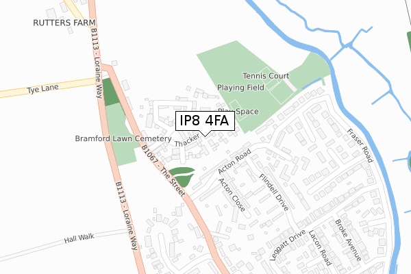
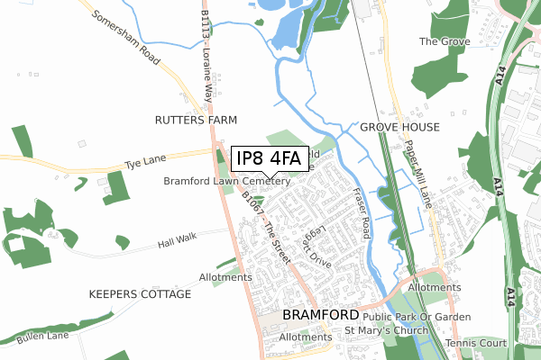
IP8 4FA is located in the Bramford electoral ward, within the local authority district of Mid Suffolk and the English Parliamentary constituency of Central Suffolk and North Ipswich. The Sub Integrated Care Board (ICB) Location is NHS Suffolk and North East Essex ICB - 06L and the police force is Suffolk. This postcode has been in use since September 2018.


GetTheData
Source: OS Open Zoomstack (Ordnance Survey)
Licence: Open Government Licence (requires attribution)
Attribution: Contains OS data © Crown copyright and database right 2025
Source: Open Postcode Geo
Licence: Open Government Licence (requires attribution)
Attribution: Contains OS data © Crown copyright and database right 2025; Contains Royal Mail data © Royal Mail copyright and database right 2025; Source: Office for National Statistics licensed under the Open Government Licence v.3.0
| Easting | 612185 |
| Northing | 246990 |
| Latitude | 52.080599 |
| Longitude | 1.095254 |
GetTheData
Source: Open Postcode Geo
Licence: Open Government Licence
| Country | England |
| Postcode District | IP8 |
➜ See where IP8 is on a map ➜ Where is Bramford? | |
GetTheData
Source: Land Registry Price Paid Data
Licence: Open Government Licence
| Ward | Bramford |
| Constituency | Central Suffolk And North Ipswich |
GetTheData
Source: ONS Postcode Database
Licence: Open Government Licence
34, THACKER CLOSE, BRAMFORD, IPSWICH, IP8 4FA 2020 25 NOV £425,000 |
42, THACKER CLOSE, BRAMFORD, IPSWICH, IP8 4FA 2020 2 NOV £410,000 |
40, THACKER CLOSE, BRAMFORD, IPSWICH, IP8 4FA 2020 30 OCT £417,500 |
36, THACKER CLOSE, BRAMFORD, IPSWICH, IP8 4FA 2020 24 JUL £410,000 |
46, THACKER CLOSE, BRAMFORD, IPSWICH, IP8 4FA 2020 3 APR £304,995 |
44, THACKER CLOSE, BRAMFORD, IPSWICH, IP8 4FA 2020 27 MAR £309,995 |
38, THACKER CLOSE, BRAMFORD, IPSWICH, IP8 4FA 2020 26 MAR £407,495 |
12, THACKER CLOSE, BRAMFORD, IPSWICH, IP8 4FA 2020 6 MAR £304,995 |
32, THACKER CLOSE, BRAMFORD, IPSWICH, IP8 4FA 2020 28 FEB £409,995 |
28, THACKER CLOSE, BRAMFORD, IPSWICH, IP8 4FA 2020 14 FEB £379,995 |
GetTheData
Source: HM Land Registry Price Paid Data
Licence: Contains HM Land Registry data © Crown copyright and database right 2025. This data is licensed under the Open Government Licence v3.0.
| Cemetery (The Street) | Bramford | 169m |
| Cemetery (The Street) | Bramford | 187m |
| Acton Road (The Street) | Bramford | 227m |
| Acton Road (The Street) | Bramford | 240m |
| Angel (The Street) | Bramford | 356m |
| Ipswich Station | 4.7km |
| Westerfield Station | 4.8km |
GetTheData
Source: NaPTAN
Licence: Open Government Licence
| Percentage of properties with Next Generation Access | 100.0% |
| Percentage of properties with Superfast Broadband | 100.0% |
| Percentage of properties with Ultrafast Broadband | 38.9% |
| Percentage of properties with Full Fibre Broadband | 38.9% |
Superfast Broadband is between 30Mbps and 300Mbps
Ultrafast Broadband is > 300Mbps
| Percentage of properties unable to receive 2Mbps | 0.0% |
| Percentage of properties unable to receive 5Mbps | 0.0% |
| Percentage of properties unable to receive 10Mbps | 0.0% |
| Percentage of properties unable to receive 30Mbps | 0.0% |
GetTheData
Source: Ofcom
Licence: Ofcom Terms of Use (requires attribution)
GetTheData
Source: ONS Postcode Database
Licence: Open Government Licence


➜ Get more ratings from the Food Standards Agency
GetTheData
Source: Food Standards Agency
Licence: FSA terms & conditions
| Last Collection | |||
|---|---|---|---|
| Location | Mon-Fri | Sat | Distance |
| 78 Fitzgerald Road | 16:45 | 09:30 | 769m |
| Paper Mill Lne Nr. Fisons | 17:15 | 09:30 | 1,009m |
| Goddard Road | 18:30 | 11:00 | 1,434m |
GetTheData
Source: Dracos
Licence: Creative Commons Attribution-ShareAlike
The below table lists the International Territorial Level (ITL) codes (formerly Nomenclature of Territorial Units for Statistics (NUTS) codes) and Local Administrative Units (LAU) codes for IP8 4FA:
| ITL 1 Code | Name |
|---|---|
| TLH | East |
| ITL 2 Code | Name |
| TLH1 | East Anglia |
| ITL 3 Code | Name |
| TLH14 | Suffolk CC |
| LAU 1 Code | Name |
| E07000203 | Mid Suffolk |
GetTheData
Source: ONS Postcode Directory
Licence: Open Government Licence
The below table lists the Census Output Area (OA), Lower Layer Super Output Area (LSOA), and Middle Layer Super Output Area (MSOA) for IP8 4FA:
| Code | Name | |
|---|---|---|
| OA | E00153109 | |
| LSOA | E01030044 | Mid Suffolk 012B |
| MSOA | E02006272 | Mid Suffolk 012 |
GetTheData
Source: ONS Postcode Directory
Licence: Open Government Licence
| IP8 4EN | Acton Road | 97m |
| IP8 4EW | Acton Road | 113m |
| IP8 4DY | The Street | 128m |
| IP8 4EL | Acton Road | 155m |
| IP8 4JY | The Row | 199m |
| IP8 4ER | Acton Close | 199m |
| IP8 4HU | Acton Road | 207m |
| IP8 4HZ | Acton Road | 226m |
| IP8 4ES | Flindell Drive | 230m |
| IP8 4HT | Acton Gardens | 284m |
GetTheData
Source: Open Postcode Geo; Land Registry Price Paid Data
Licence: Open Government Licence