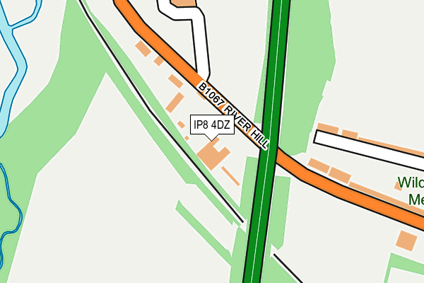
IP8 4DZ is located in the Whitehouse electoral ward, within the local authority district of Ipswich and the English Parliamentary constituency of Central Suffolk and North Ipswich. The Sub Integrated Care Board (ICB) Location is NHS Suffolk and North East Essex ICB - 06L and the police force is Suffolk. This postcode has been in use since November 2010.


GetTheData
Source: OS OpenMap – Local (Ordnance Survey)
Source: OS VectorMap District (Ordnance Survey)
Licence: Open Government Licence (requires attribution)
| Easting | 613207 |
| Northing | 245926 |
| Latitude | 52.070655 |
| Longitude | 1.109481 |
GetTheData
Source: Open Postcode Geo
Licence: Open Government Licence
| Country | England |
| Postcode District | IP8 |
➜ See where IP8 is on a map ➜ Where is Ipswich? | |
GetTheData
Source: Land Registry Price Paid Data
Licence: Open Government Licence
Elevation or altitude of IP8 4DZ as distance above sea level:
| Metres | Feet | |
|---|---|---|
| Elevation | 20m | 66ft |
Elevation is measured from the approximate centre of the postcode, to the nearest point on an OS contour line from OS Terrain 50, which has contour spacing of ten vertical metres.
➜ How high above sea level am I? Find the elevation of your current position using your device's GPS.
GetTheData
Source: Open Postcode Elevation
Licence: Open Government Licence
| Ward | Whitehouse |
| Constituency | Central Suffolk And North Ipswich |
GetTheData
Source: ONS Postcode Database
Licence: Open Government Licence
| Bridge (Bramford Road) | Westbourne | 120m |
| Bridge (Bramford Road) | Westbourne | 124m |
| Weaver Close (Bramford Road) | Westbourne | 322m |
| Weaver Close (Bramford Road) | Westbourne | 358m |
| Spinner Close (Bramford Road) | Westbourne | 483m |
| Ipswich Station | 3.3km |
| Westerfield Station | 4km |
GetTheData
Source: NaPTAN
Licence: Open Government Licence
GetTheData
Source: ONS Postcode Database
Licence: Open Government Licence


➜ Get more ratings from the Food Standards Agency
GetTheData
Source: Food Standards Agency
Licence: FSA terms & conditions
| Last Collection | |||
|---|---|---|---|
| Location | Mon-Fri | Sat | Distance |
| Adair Road Post Office | 17:45 | 12:05 | 620m |
| 78 Fitzgerald Road | 16:45 | 09:30 | 822m |
| Boss Hall Industrial Estate | 18:30 | 11:45 | 1,288m |
GetTheData
Source: Dracos
Licence: Creative Commons Attribution-ShareAlike
The below table lists the International Territorial Level (ITL) codes (formerly Nomenclature of Territorial Units for Statistics (NUTS) codes) and Local Administrative Units (LAU) codes for IP8 4DZ:
| ITL 1 Code | Name |
|---|---|
| TLH | East |
| ITL 2 Code | Name |
| TLH1 | East Anglia |
| ITL 3 Code | Name |
| TLH14 | Suffolk CC |
| LAU 1 Code | Name |
| E07000202 | Ipswich |
GetTheData
Source: ONS Postcode Directory
Licence: Open Government Licence
The below table lists the Census Output Area (OA), Lower Layer Super Output Area (LSOA), and Middle Layer Super Output Area (MSOA) for IP8 4DZ:
| Code | Name | |
|---|---|---|
| OA | E00153043 | |
| LSOA | E01030028 | Ipswich 003B |
| MSOA | E02006247 | Ipswich 003 |
GetTheData
Source: ONS Postcode Directory
Licence: Open Government Licence
| IP8 4BB | River Hill | 98m |
| IP1 5BH | Bramford Road | 228m |
| IP1 5HQ | Henniker Road | 280m |
| IP1 5QH | Lotus Close | 380m |
| IP1 5RB | Weaver Close | 393m |
| IP1 5HL | Pearl Road | 394m |
| IP1 5HH | Henniker Road | 395m |
| IP1 5HZ | Eldred Close | 415m |
| IP1 5HN | Diamond Close | 422m |
| IP1 5QG | Morgan Drive | 441m |
GetTheData
Source: Open Postcode Geo; Land Registry Price Paid Data
Licence: Open Government Licence