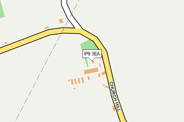
IP8 3EA is located in the Copdock & Washbrook electoral ward, within the local authority district of Babergh and the English Parliamentary constituency of South Suffolk. The Sub Integrated Care Board (ICB) Location is NHS Suffolk and North East Essex ICB - 06L and the police force is Suffolk. This postcode has been in use since January 1980.


GetTheData
Source: OS OpenMap – Local (Ordnance Survey)
Source: OS VectorMap District (Ordnance Survey)
Licence: Open Government Licence (requires attribution)
| Easting | 609164 |
| Northing | 245344 |
| Latitude | 52.066956 |
| Longitude | 1.050196 |
GetTheData
Source: Open Postcode Geo
Licence: Open Government Licence
| Country | England |
| Postcode District | IP8 |
➜ See where IP8 is on a map ➜ Where is Burstallhill? | |
GetTheData
Source: Land Registry Price Paid Data
Licence: Open Government Licence
Elevation or altitude of IP8 3EA as distance above sea level:
| Metres | Feet | |
|---|---|---|
| Elevation | 50m | 164ft |
Elevation is measured from the approximate centre of the postcode, to the nearest point on an OS contour line from OS Terrain 50, which has contour spacing of ten vertical metres.
➜ How high above sea level am I? Find the elevation of your current position using your device's GPS.
GetTheData
Source: Open Postcode Elevation
Licence: Open Government Licence
| Ward | Copdock & Washbrook |
| Constituency | South Suffolk |
GetTheData
Source: ONS Postcode Database
Licence: Open Government Licence
| Brook (Flowton Road) | Flowton Brook | 794m |
| Brook (Flowton Road) | Flowton Brook | 802m |
| Post Office (Church Hill) | Burstall | 1,291m |
| Post Office (Church Hill) | Burstall | 1,298m |
| Village Sign (High Street) | Flowton | 1,737m |
GetTheData
Source: NaPTAN
Licence: Open Government Licence
GetTheData
Source: ONS Postcode Database
Licence: Open Government Licence


➜ Get more ratings from the Food Standards Agency
GetTheData
Source: Food Standards Agency
Licence: FSA terms & conditions
| Last Collection | |||
|---|---|---|---|
| Location | Mon-Fri | Sat | Distance |
| 2 Sycamore Close | 17:30 | 11:45 | 2,767m |
| Lower Street | 16:45 | 09:45 | 3,142m |
| Corner Farmhouse, The Street | 14:30 | 07:30 | 3,202m |
GetTheData
Source: Dracos
Licence: Creative Commons Attribution-ShareAlike
The below table lists the International Territorial Level (ITL) codes (formerly Nomenclature of Territorial Units for Statistics (NUTS) codes) and Local Administrative Units (LAU) codes for IP8 3EA:
| ITL 1 Code | Name |
|---|---|
| TLH | East |
| ITL 2 Code | Name |
| TLH1 | East Anglia |
| ITL 3 Code | Name |
| TLH14 | Suffolk CC |
| LAU 1 Code | Name |
| E07000200 | Babergh |
GetTheData
Source: ONS Postcode Directory
Licence: Open Government Licence
The below table lists the Census Output Area (OA), Lower Layer Super Output Area (LSOA), and Middle Layer Super Output Area (MSOA) for IP8 3EA:
| Code | Name | |
|---|---|---|
| OA | E00152245 | |
| LSOA | E01029877 | Babergh 005A |
| MSOA | E02006231 | Babergh 005 |
GetTheData
Source: ONS Postcode Directory
Licence: Open Government Licence
| IP8 3DZ | Orchard Lands | 102m |
| IP8 3ED | Burstall Hill | 407m |
| IP8 3DY | Hillside Cottage | 729m |
| IP8 3DU | Church Hill | 827m |
| IP8 4LJ | The Channel | 830m |
| IP8 3DT | Cranfield Park | 879m |
| IP8 3DS | Church Cottage | 932m |
| IP8 3ER | Kenney Close | 995m |
| IP8 3DP | 1035m | |
| IP8 3ES | Grange Drive | 1042m |
GetTheData
Source: Open Postcode Geo; Land Registry Price Paid Data
Licence: Open Government Licence