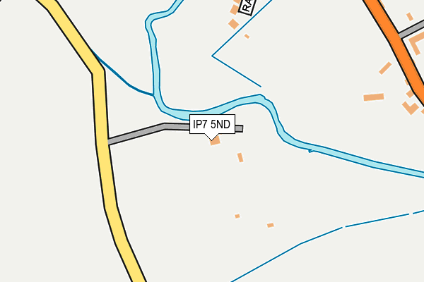
IP7 5ND is located in the Hadleigh South electoral ward, within the local authority district of Babergh and the English Parliamentary constituency of South Suffolk. The Sub Integrated Care Board (ICB) Location is NHS Suffolk and North East Essex ICB - 06L and the police force is Suffolk. This postcode has been in use since January 1980.


GetTheData
Source: OS OpenMap – Local (Ordnance Survey)
Source: OS VectorMap District (Ordnance Survey)
Licence: Open Government Licence (requires attribution)
| Easting | 602855 |
| Northing | 241529 |
| Latitude | 52.035060 |
| Longitude | 0.956053 |
GetTheData
Source: Open Postcode Geo
Licence: Open Government Licence
| Country | England |
| Postcode District | IP7 |
➜ See where IP7 is on a map ➜ Where is Hadleigh? | |
GetTheData
Source: Land Registry Price Paid Data
Licence: Open Government Licence
Elevation or altitude of IP7 5ND as distance above sea level:
| Metres | Feet | |
|---|---|---|
| Elevation | 20m | 66ft |
Elevation is measured from the approximate centre of the postcode, to the nearest point on an OS contour line from OS Terrain 50, which has contour spacing of ten vertical metres.
➜ How high above sea level am I? Find the elevation of your current position using your device's GPS.
GetTheData
Source: Open Postcode Elevation
Licence: Open Government Licence
| Ward | Hadleigh South |
| Constituency | South Suffolk |
GetTheData
Source: ONS Postcode Database
Licence: Open Government Licence
PUMP HOUSE, LAYHAM ROAD, LAYHAM, IPSWICH, IP7 5ND 2018 16 NOV £750,000 |
GetTheData
Source: HM Land Registry Price Paid Data
Licence: Contains HM Land Registry data © Crown copyright and database right 2025. This data is licensed under the Open Government Licence v3.0.
| Clopton Gardens (Station Road) | Hadleigh | 726m |
| Clopton Gardens (Station Road) | Hadleigh | 734m |
| Woodthorpe Road | Hadleigh | 773m |
| Sydney Brown Court | Hadleigh | 797m |
| Sydney Brown Court | Hadleigh | 802m |
GetTheData
Source: NaPTAN
Licence: Open Government Licence
GetTheData
Source: ONS Postcode Database
Licence: Open Government Licence


➜ Get more ratings from the Food Standards Agency
GetTheData
Source: Food Standards Agency
Licence: FSA terms & conditions
| Last Collection | |||
|---|---|---|---|
| Location | Mon-Fri | Sat | Distance |
| Lady Lane Ind Est | 17:30 | 11:45 | 1,913m |
| Red Hill | 14:00 | 09:45 | 2,624m |
| 1 Whatfield Road | 15:30 | 09:00 | 3,001m |
GetTheData
Source: Dracos
Licence: Creative Commons Attribution-ShareAlike
The below table lists the International Territorial Level (ITL) codes (formerly Nomenclature of Territorial Units for Statistics (NUTS) codes) and Local Administrative Units (LAU) codes for IP7 5ND:
| ITL 1 Code | Name |
|---|---|
| TLH | East |
| ITL 2 Code | Name |
| TLH1 | East Anglia |
| ITL 3 Code | Name |
| TLH14 | Suffolk CC |
| LAU 1 Code | Name |
| E07000200 | Babergh |
GetTheData
Source: ONS Postcode Directory
Licence: Open Government Licence
The below table lists the Census Output Area (OA), Lower Layer Super Output Area (LSOA), and Middle Layer Super Output Area (MSOA) for IP7 5ND:
| Code | Name | |
|---|---|---|
| OA | E00152339 | |
| LSOA | E01029895 | Babergh 004D |
| MSOA | E02006230 | Babergh 004 |
GetTheData
Source: ONS Postcode Directory
Licence: Open Government Licence
| IP7 5AX | Raven Way | 234m |
| IP7 5AZ | Benton Street | 284m |
| IP7 5AY | Benton Street | 305m |
| IP7 5BA | Cranworth Road | 441m |
| IP7 5HD | Dunton Grove | 453m |
| IP7 5AR | Benton Street | 488m |
| IP7 5AT | Benton Street | 489m |
| IP7 5JP | Hook Lane | 508m |
| IP7 5JR | Benton End | 512m |
| IP7 5NB | Layham Road | 538m |
GetTheData
Source: Open Postcode Geo; Land Registry Price Paid Data
Licence: Open Government Licence