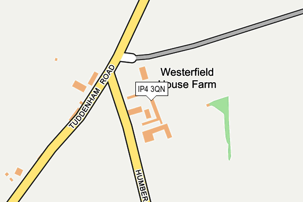
IP4 3QN is located in the Rushmere electoral ward, within the local authority district of Ipswich and the English Parliamentary constituency of Ipswich. The Sub Integrated Care Board (ICB) Location is NHS Suffolk and North East Essex ICB - 06L and the police force is Suffolk. This postcode has been in use since November 2009.


GetTheData
Source: OS OpenMap – Local (Ordnance Survey)
Source: OS VectorMap District (Ordnance Survey)
Licence: Open Government Licence (requires attribution)
| Easting | 618328 |
| Northing | 247050 |
| Latitude | 52.078737 |
| Longitude | 1.184766 |
GetTheData
Source: Open Postcode Geo
Licence: Open Government Licence
| Country | England |
| Postcode District | IP4 |
➜ See where IP4 is on a map | |
GetTheData
Source: Land Registry Price Paid Data
Licence: Open Government Licence
Elevation or altitude of IP4 3QN as distance above sea level:
| Metres | Feet | |
|---|---|---|
| Elevation | 50m | 164ft |
Elevation is measured from the approximate centre of the postcode, to the nearest point on an OS contour line from OS Terrain 50, which has contour spacing of ten vertical metres.
➜ How high above sea level am I? Find the elevation of your current position using your device's GPS.
GetTheData
Source: Open Postcode Elevation
Licence: Open Government Licence
| Ward | Rushmere |
| Constituency | Ipswich |
GetTheData
Source: ONS Postcode Database
Licence: Open Government Licence
| Inverness Road | Rushmere | 400m |
| Inverness Road | Rushmere | 408m |
| Millennium Cemetery | Red House Farm | 432m |
| Millennium Cemetery | Red House Farm | 456m |
| Humber Doucy Lane | Rushmere | 548m |
| Westerfield Station | 1.3km |
| Derby Road (Ipswich) Station | 3.1km |
| Ipswich Station | 4.2km |
GetTheData
Source: NaPTAN
Licence: Open Government Licence
GetTheData
Source: ONS Postcode Database
Licence: Open Government Licence


➜ Get more ratings from the Food Standards Agency
GetTheData
Source: Food Standards Agency
Licence: FSA terms & conditions
| Last Collection | |||
|---|---|---|---|
| Location | Mon-Fri | Sat | Distance |
| 309 Sidegate Ln | 17:30 | 12:05 | 689m |
| 65 Colchester Road | 17:30 | 12:00 | 1,050m |
| 158 Colchester Road | 17:30 | 12:00 | 1,051m |
GetTheData
Source: Dracos
Licence: Creative Commons Attribution-ShareAlike
The below table lists the International Territorial Level (ITL) codes (formerly Nomenclature of Territorial Units for Statistics (NUTS) codes) and Local Administrative Units (LAU) codes for IP4 3QN:
| ITL 1 Code | Name |
|---|---|
| TLH | East |
| ITL 2 Code | Name |
| TLH1 | East Anglia |
| ITL 3 Code | Name |
| TLH14 | Suffolk CC |
| LAU 1 Code | Name |
| E07000202 | Ipswich |
GetTheData
Source: ONS Postcode Directory
Licence: Open Government Licence
The below table lists the Census Output Area (OA), Lower Layer Super Output Area (LSOA), and Middle Layer Super Output Area (MSOA) for IP4 3QN:
| Code | Name | |
|---|---|---|
| OA | E00152881 | |
| LSOA | E01030001 | Ipswich 004E |
| MSOA | E02006248 | Ipswich 004 |
GetTheData
Source: ONS Postcode Directory
Licence: Open Government Licence
| IP4 3QE | Humber Doucy Lane | 250m |
| IP4 3QH | Tuddenham Road | 251m |
| IP4 3QD | Humber Doucy Lane | 314m |
| IP6 9DA | 448m | |
| IP4 3DS | Sherborne Avenue | 463m |
| IP4 3EA | Inverness Road | 482m |
| IP4 3EB | Inverness Road | 509m |
| IP5 1DU | Tuddenham Lane | 558m |
| IP4 3QA | Humber Doucy Lane | 580m |
| IP4 3DR | Sherborne Avenue | 601m |
GetTheData
Source: Open Postcode Geo; Land Registry Price Paid Data
Licence: Open Government Licence