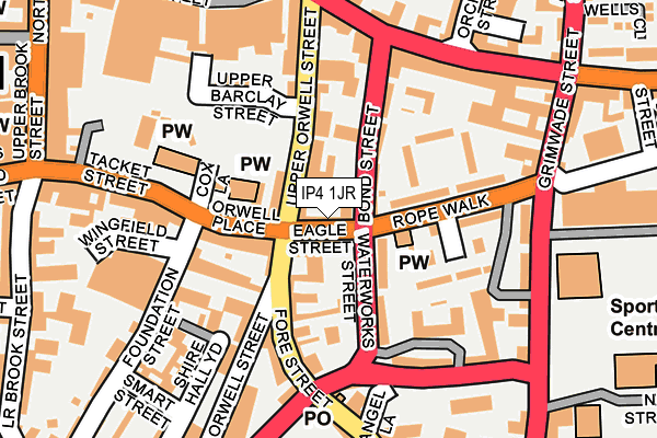
IP4 1JR is located in the Alexandra electoral ward, within the local authority district of Ipswich and the English Parliamentary constituency of Ipswich. The Sub Integrated Care Board (ICB) Location is NHS Suffolk and North East Essex ICB - 06L and the police force is Suffolk. This postcode has been in use since May 2017.


GetTheData
Source: OS OpenMap – Local (Ordnance Survey)
Source: OS VectorMap District (Ordnance Survey)
Licence: Open Government Licence (requires attribution)
| Easting | 617794 |
| Northing | 244537 |
| Latitude | 52.056403 |
| Longitude | 1.175415 |
GetTheData
Source: Open Postcode Geo
Licence: Open Government Licence
| Country | England |
| Postcode District | IP4 |
➜ See where IP4 is on a map ➜ Where is Ipswich? | |
GetTheData
Source: Land Registry Price Paid Data
Licence: Open Government Licence
| Ward | Alexandra |
| Constituency | Ipswich |
GetTheData
Source: ONS Postcode Database
Licence: Open Government Licence
| Viaduct (Spring Road) | Ipswich | 136m |
| Viaduct (Spring Road) | Ipswich | 162m |
| St Johns Road (Spring Road) | Ipswich | 210m |
| St Johns Road (Spring Road) | Ipswich | 247m |
| Nottidge Road (Spring Road) | Ipswich | 340m |
| Derby Road (Ipswich) Station | 0.8km |
| Ipswich Station | 2.2km |
| Westerfield Station | 2.8km |
GetTheData
Source: NaPTAN
Licence: Open Government Licence
GetTheData
Source: ONS Postcode Database
Licence: Open Government Licence


➜ Get more ratings from the Food Standards Agency
GetTheData
Source: Food Standards Agency
Licence: FSA terms & conditions
| Last Collection | |||
|---|---|---|---|
| Location | Mon-Fri | Sat | Distance |
| Spring Road | 17:30 | 12:00 | 241m |
| Ruskin Road | 17:30 | 12:15 | 385m |
| 6 Spring Road | 17:30 | 12:00 | 412m |
GetTheData
Source: Dracos
Licence: Creative Commons Attribution-ShareAlike
The below table lists the International Territorial Level (ITL) codes (formerly Nomenclature of Territorial Units for Statistics (NUTS) codes) and Local Administrative Units (LAU) codes for IP4 1JR:
| ITL 1 Code | Name |
|---|---|
| TLH | East |
| ITL 2 Code | Name |
| TLH1 | East Anglia |
| ITL 3 Code | Name |
| TLH14 | Suffolk CC |
| LAU 1 Code | Name |
| E07000202 | Ipswich |
GetTheData
Source: ONS Postcode Directory
Licence: Open Government Licence
The below table lists the Census Output Area (OA), Lower Layer Super Output Area (LSOA), and Middle Layer Super Output Area (MSOA) for IP4 1JR:
| Code | Name | |
|---|---|---|
| OA | E00152703 | |
| LSOA | E01029960 | Ipswich 007C |
| MSOA | E02006251 | Ipswich 007 |
GetTheData
Source: ONS Postcode Directory
Licence: Open Government Licence
| IP4 1PE | Woodville Road | 51m |
| IP4 1PG | Tennyson Road | 112m |
| IP4 1PD | Woodville Road | 132m |
| IP4 1PJ | Clifford Road | 140m |
| IP4 5NU | Springhurst Close | 143m |
| IP4 1PH | Wellesley Road | 154m |
| IP4 5BB | Weymouth Road | 154m |
| IP4 2RR | Spring Road | 155m |
| IP4 5NT | Spring Road | 179m |
| IP4 5JY | Cornwallis Terrace | 183m |
GetTheData
Source: Open Postcode Geo; Land Registry Price Paid Data
Licence: Open Government Licence