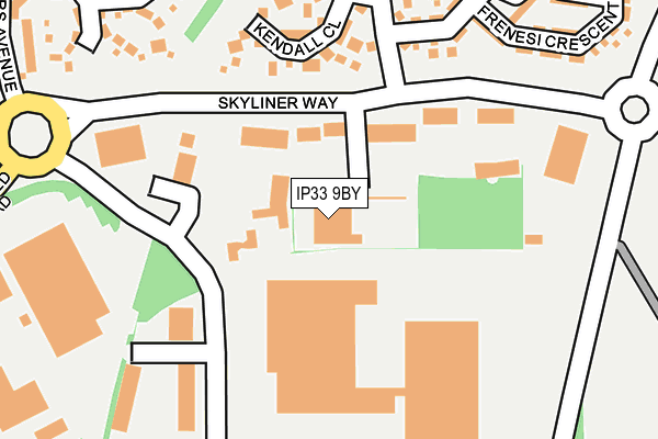
IP33 9BY is located in the Moreton Hall electoral ward, within the local authority district of West Suffolk and the English Parliamentary constituency of Bury St Edmunds. The Sub Integrated Care Board (ICB) Location is NHS Suffolk and North East Essex ICB - 07K and the police force is Suffolk. This postcode has been in use since November 2006.


GetTheData
Source: OS OpenMap – Local (Ordnance Survey)
Source: OS VectorMap District (Ordnance Survey)
Licence: Open Government Licence (requires attribution)
| Easting | 588065 |
| Northing | 264013 |
| Latitude | 52.242165 |
| Longitude | 0.753105 |
GetTheData
Source: Open Postcode Geo
Licence: Open Government Licence
| Country | England |
| Postcode District | IP33 |
➜ See where IP33 is on a map ➜ Where is Bury St Edmunds? | |
GetTheData
Source: Land Registry Price Paid Data
Licence: Open Government Licence
Elevation or altitude of IP33 9BY as distance above sea level:
| Metres | Feet | |
|---|---|---|
| Elevation | 60m | 197ft |
Elevation is measured from the approximate centre of the postcode, to the nearest point on an OS contour line from OS Terrain 50, which has contour spacing of ten vertical metres.
➜ How high above sea level am I? Find the elevation of your current position using your device's GPS.
GetTheData
Source: Open Postcode Elevation
Licence: Open Government Licence
| Ward | Moreton Hall |
| Constituency | Bury St Edmunds |
GetTheData
Source: ONS Postcode Database
Licence: Open Government Licence
| Roundabout (Skyliner Way) | Moreton Hall | 155m |
| Mead Road | Moreton Hall | 184m |
| Mead Road (Primack Road) | Moreton Hall | 193m |
| Bunting Road | Moreton Hall | 378m |
| Sybil Andrews Academy | Moreton Hall | 420m |
| Bury St Edmunds Station | 3km |
| Thurston Station | 3.9km |
GetTheData
Source: NaPTAN
Licence: Open Government Licence
GetTheData
Source: ONS Postcode Database
Licence: Open Government Licence


➜ Get more ratings from the Food Standards Agency
GetTheData
Source: Food Standards Agency
Licence: FSA terms & conditions
| Last Collection | |||
|---|---|---|---|
| Location | Mon-Fri | Sat | Distance |
| Skyliner Way | 18:00 | 12:00 | 55m |
| Skyliner Way | 18:00 | 12:30 | 58m |
| Modrovers Avenue | 16:45 | 11:30 | 398m |
GetTheData
Source: Dracos
Licence: Creative Commons Attribution-ShareAlike
The below table lists the International Territorial Level (ITL) codes (formerly Nomenclature of Territorial Units for Statistics (NUTS) codes) and Local Administrative Units (LAU) codes for IP33 9BY:
| ITL 1 Code | Name |
|---|---|
| TLH | East |
| ITL 2 Code | Name |
| TLH1 | East Anglia |
| ITL 3 Code | Name |
| TLH14 | Suffolk CC |
| LAU 1 Code | Name |
| E07000245 | West Suffolk |
GetTheData
Source: ONS Postcode Directory
Licence: Open Government Licence
The below table lists the Census Output Area (OA), Lower Layer Super Output Area (LSOA), and Middle Layer Super Output Area (MSOA) for IP33 9BY:
| Code | Name | |
|---|---|---|
| OA | E00153602 | |
| LSOA | E01033050 | St Edmundsbury 005G |
| MSOA | E02006277 | St Edmundsbury 005 |
GetTheData
Source: ONS Postcode Directory
Licence: Open Government Licence
| IP32 7YA | Skyliner Way | 88m |
| IP32 7AR | Kempson Way | 167m |
| IP32 7PQ | Kendall Close | 171m |
| IP32 7PL | Selway Drive | 251m |
| IP32 7PP | Frenesi Crescent | 277m |
| IP32 7GJ | Cowslip Close | 284m |
| IP32 7PS | Todd Way | 287m |
| IP32 7PE | Mead Road | 304m |
| IP32 7PG | Daisy Avenue | 325m |
| IP32 7PH | Daisy Avenue | 332m |
GetTheData
Source: Open Postcode Geo; Land Registry Price Paid Data
Licence: Open Government Licence