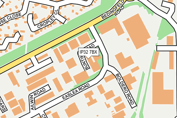
IP32 7BX is located in the Moreton Hall electoral ward, within the local authority district of West Suffolk and the English Parliamentary constituency of Bury St Edmunds. The Sub Integrated Care Board (ICB) Location is NHS Suffolk and North East Essex ICB - 07K and the police force is Suffolk. This postcode has been in use since June 1981.


GetTheData
Source: OS OpenMap – Local (Ordnance Survey)
Source: OS VectorMap District (Ordnance Survey)
Licence: Open Government Licence (requires attribution)
| Easting | 587654 |
| Northing | 263855 |
| Latitude | 52.240886 |
| Longitude | 0.747005 |
GetTheData
Source: Open Postcode Geo
Licence: Open Government Licence
| Country | England |
| Postcode District | IP32 |
➜ See where IP32 is on a map ➜ Where is Bury St Edmunds? | |
GetTheData
Source: Land Registry Price Paid Data
Licence: Open Government Licence
Elevation or altitude of IP32 7BX as distance above sea level:
| Metres | Feet | |
|---|---|---|
| Elevation | 60m | 197ft |
Elevation is measured from the approximate centre of the postcode, to the nearest point on an OS contour line from OS Terrain 50, which has contour spacing of ten vertical metres.
➜ How high above sea level am I? Find the elevation of your current position using your device's GPS.
GetTheData
Source: Open Postcode Elevation
Licence: Open Government Licence
| Ward | Moreton Hall |
| Constituency | Bury St Edmunds |
GetTheData
Source: ONS Postcode Database
Licence: Open Government Licence
| Bunting Road | Moreton Hall | 78m |
| Matalan (Bedingfeld Way) | Moreton Hall | 107m |
| Matalan (Bedingfeld Way) | Moreton Hall | 123m |
| La Fitness | Moreton Hall | 130m |
| Drovers Avenue (Orttewell Road) | Moreton Hall | 254m |
| Bury St Edmunds Station | 2.7km |
| Thurston Station | 4.3km |
GetTheData
Source: NaPTAN
Licence: Open Government Licence
| Median download speed | 40.0Mbps |
| Average download speed | 31.6Mbps |
| Maximum download speed | 58.67Mbps |
| Median upload speed | 7.0Mbps |
| Average upload speed | 5.6Mbps |
| Maximum upload speed | 10.00Mbps |
GetTheData
Source: Ofcom
Licence: Ofcom Terms of Use (requires attribution)
Estimated total energy consumption in IP32 7BX by fuel type, 2015.
| Consumption (kWh) | 287,772 |
|---|---|
| Meter count | 13 |
| Mean (kWh/meter) | 22,136 |
| Median (kWh/meter) | 14,121 |
GetTheData
Source: Postcode level gas estimates: 2015 (experimental)
Source: Postcode level electricity estimates: 2015 (experimental)
Licence: Open Government Licence
GetTheData
Source: ONS Postcode Database
Licence: Open Government Licence


➜ Get more ratings from the Food Standards Agency
GetTheData
Source: Food Standards Agency
Licence: FSA terms & conditions
| Last Collection | |||
|---|---|---|---|
| Location | Mon-Fri | Sat | Distance |
| Bedingfield Way | 17:00 | 11:30 | 212m |
| Modrovers Avenue | 16:45 | 11:30 | 427m |
| Skyliner Way | 18:00 | 12:00 | 494m |
GetTheData
Source: Dracos
Licence: Creative Commons Attribution-ShareAlike
The below table lists the International Territorial Level (ITL) codes (formerly Nomenclature of Territorial Units for Statistics (NUTS) codes) and Local Administrative Units (LAU) codes for IP32 7BX:
| ITL 1 Code | Name |
|---|---|
| TLH | East |
| ITL 2 Code | Name |
| TLH1 | East Anglia |
| ITL 3 Code | Name |
| TLH14 | Suffolk CC |
| LAU 1 Code | Name |
| E07000245 | West Suffolk |
GetTheData
Source: ONS Postcode Directory
Licence: Open Government Licence
The below table lists the Census Output Area (OA), Lower Layer Super Output Area (LSOA), and Middle Layer Super Output Area (MSOA) for IP32 7BX:
| Code | Name | |
|---|---|---|
| OA | E00153606 | |
| LSOA | E01030129 | St Edmundsbury 005D |
| MSOA | E02006277 | St Edmundsbury 005 |
GetTheData
Source: ONS Postcode Directory
Licence: Open Government Licence
| IP32 7BY | Easlea Road | 136m |
| IP32 7BS | Boldero Road | 141m |
| IP32 7EU | Cropley Close | 204m |
| IP32 7ES | Heldhaw Road | 218m |
| IP32 7AR | Kempson Way | 282m |
| IP32 7EX | Browse Close | 306m |
| IP32 7EH | Sebert Road | 311m |
| IP32 7JU | Cranesbill Drive | 341m |
| IP32 7NN | Coltsfoot Crescent | 364m |
| IP32 7GJ | Cowslip Close | 373m |
GetTheData
Source: Open Postcode Geo; Land Registry Price Paid Data
Licence: Open Government Licence