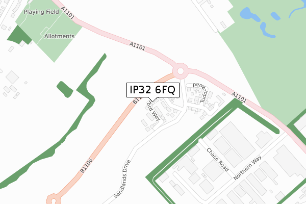
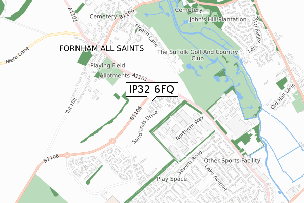
IP32 6FQ is located in the St Olaves electoral ward, within the local authority district of West Suffolk and the English Parliamentary constituency of Bury St Edmunds. The Sub Integrated Care Board (ICB) Location is NHS Suffolk and North East Essex ICB - 07K and the police force is Suffolk. This postcode has been in use since April 2020.


GetTheData
Source: OS Open Zoomstack (Ordnance Survey)
Licence: Open Government Licence (requires attribution)
Attribution: Contains OS data © Crown copyright and database right 2025
Source: Open Postcode Geo
Licence: Open Government Licence (requires attribution)
Attribution: Contains OS data © Crown copyright and database right 2025; Contains Royal Mail data © Royal Mail copyright and database right 2025; Source: Office for National Statistics licensed under the Open Government Licence v.3.0
| Easting | 583925 |
| Northing | 266666 |
| Latitude | 52.267404 |
| Longitude | 0.694013 |
GetTheData
Source: Open Postcode Geo
Licence: Open Government Licence
| Country | England |
| Postcode District | IP32 |
➜ See where IP32 is on a map ➜ Where is Bury St Edmunds? | |
GetTheData
Source: Land Registry Price Paid Data
Licence: Open Government Licence
| Ward | St Olaves |
| Constituency | Bury St Edmunds |
GetTheData
Source: ONS Postcode Database
Licence: Open Government Licence
| Lake Avenue (Severn Road) | Mildenhall Road Estate | 508m |
| Lake Avenue (Severn Road) | Mildenhall Road Estate | 518m |
| Summers Road (Beard Road) | Howard Estate | 606m |
| Lambdin Road | Bury St Edmunds | 618m |
| Lambdin Road | Bury St Edmunds | 627m |
| Bury St Edmunds Station | 2km |
GetTheData
Source: NaPTAN
Licence: Open Government Licence
GetTheData
Source: ONS Postcode Database
Licence: Open Government Licence


➜ Get more ratings from the Food Standards Agency
GetTheData
Source: Food Standards Agency
Licence: FSA terms & conditions
| Last Collection | |||
|---|---|---|---|
| Location | Mon-Fri | Sat | Distance |
| Northern Way | 16:45 | 11:30 | 521m |
| Post Office, Sth Pde, Lake Ave | 17:00 | 11:30 | 788m |
| Post Office, St. Olaves Prcnt | 17:00 | 11:30 | 942m |
GetTheData
Source: Dracos
Licence: Creative Commons Attribution-ShareAlike
The below table lists the International Territorial Level (ITL) codes (formerly Nomenclature of Territorial Units for Statistics (NUTS) codes) and Local Administrative Units (LAU) codes for IP32 6FQ:
| ITL 1 Code | Name |
|---|---|
| TLH | East |
| ITL 2 Code | Name |
| TLH1 | East Anglia |
| ITL 3 Code | Name |
| TLH14 | Suffolk CC |
| LAU 1 Code | Name |
| E07000245 | West Suffolk |
GetTheData
Source: ONS Postcode Directory
Licence: Open Government Licence
The below table lists the Census Output Area (OA), Lower Layer Super Output Area (LSOA), and Middle Layer Super Output Area (MSOA) for IP32 6FQ:
| Code | Name | |
|---|---|---|
| OA | E00153460 | |
| LSOA | E01030103 | St Edmundsbury 004A |
| MSOA | E02006276 | St Edmundsbury 004 |
GetTheData
Source: ONS Postcode Directory
Licence: Open Government Licence
| IP32 6NL | Coppice End | 401m |
| IP32 6TG | Cumberland Avenue | 443m |
| IP32 6TH | Durham Close | 478m |
| IP32 6NF | Severn Road | 511m |
| IP32 6TF | Warwick Drive | 516m |
| IP32 6QZ | Clay Road | 535m |
| IP32 6NE | Severn Road | 543m |
| IP28 6LF | Tut Hill | 546m |
| IP32 6NG | Severn Road | 549m |
| IP32 6DU | Prince Charles Avenue | 560m |
GetTheData
Source: Open Postcode Geo; Land Registry Price Paid Data
Licence: Open Government Licence