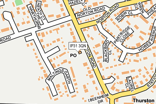
IP31 3QN is located in the Thurston electoral ward, within the local authority district of Mid Suffolk and the English Parliamentary constituency of Bury St Edmunds. The Sub Integrated Care Board (ICB) Location is NHS Suffolk and North East Essex ICB - 07K and the police force is Suffolk. This postcode has been in use since March 2022.


GetTheData
Source: OS OpenMap – Local (Ordnance Survey)
Source: OS VectorMap District (Ordnance Survey)
Licence: Open Government Licence (requires attribution)
| Easting | 596856 |
| Northing | 265937 |
| Latitude | 52.256387 |
| Longitude | 0.882843 |
GetTheData
Source: Open Postcode Geo
Licence: Open Government Licence
| Country | England |
| Postcode District | IP31 |
➜ See where IP31 is on a map ➜ Where is Norton? | |
GetTheData
Source: Land Registry Price Paid Data
Licence: Open Government Licence
Elevation or altitude of IP31 3QN as distance above sea level:
| Metres | Feet | |
|---|---|---|
| Elevation | 50m | 164ft |
Elevation is measured from the approximate centre of the postcode, to the nearest point on an OS contour line from OS Terrain 50, which has contour spacing of ten vertical metres.
➜ How high above sea level am I? Find the elevation of your current position using your device's GPS.
GetTheData
Source: Open Postcode Elevation
Licence: Open Government Licence
| Ward | Thurston |
| Constituency | Bury St Edmunds |
GetTheData
Source: ONS Postcode Database
Licence: Open Government Licence
5, WOODS PIGHTLE, NORTON, BURY ST EDMUNDS, IP31 3QN 2025 7 FEB £587,500 |
6, WOODS PIGHTLE, NORTON, BURY ST EDMUNDS, IP31 3QN 2022 14 APR £495,000 |
2, WOODS PIGHTLE, NORTON, BURY ST EDMUNDS, IP31 3QN 2022 8 APR £585,000 |
7, WOODS PIGHTLE, NORTON, BURY ST EDMUNDS, IP31 3QN 2022 1 APR £675,000 |
1, WOODS PIGHTLE, NORTON, BURY ST EDMUNDS, IP31 3QN 2022 1 APR £595,000 |
8, WOODS PIGHTLE, NORTON, BURY ST EDMUNDS, IP31 3QN 2022 25 MAR £600,000 |
3, WOODS PIGHTLE, NORTON, BURY ST EDMUNDS, IP31 3QN 2022 25 MAR £585,000 |
5, WOODS PIGHTLE, NORTON, BURY ST EDMUNDS, IP31 3QN 2022 18 MAR £520,000 |
4, WOODS PIGHTLE, NORTON, BURY ST EDMUNDS, IP31 3QN 2022 18 MAR £575,000 |
GetTheData
Source: HM Land Registry Price Paid Data
Licence: Contains HM Land Registry data © Crown copyright and database right 2025. This data is licensed under the Open Government Licence v3.0.
| Prospect Road (Ashfield Road) | Norton | 141m |
| Prospect Road (Ashfield Road) | Norton | 150m |
| Manor Farm | Norton Little Green | 949m |
| Manor Farm | Norton Little Green | 949m |
| War Memorial (The Street) | Norton | 1,096m |
| Elmswell Station | 2.9km |
GetTheData
Source: NaPTAN
Licence: Open Government Licence
GetTheData
Source: ONS Postcode Database
Licence: Open Government Licence


➜ Get more ratings from the Food Standards Agency
GetTheData
Source: Food Standards Agency
Licence: FSA terms & conditions
| Last Collection | |||
|---|---|---|---|
| Location | Mon-Fri | Sat | Distance |
| The Rectory | 16:45 | 10:45 | 2,201m |
| St. George Road | 16:00 | 10:15 | 2,449m |
| Hunston Green | 16:00 | 11:15 | 2,463m |
GetTheData
Source: Dracos
Licence: Creative Commons Attribution-ShareAlike
The below table lists the International Territorial Level (ITL) codes (formerly Nomenclature of Territorial Units for Statistics (NUTS) codes) and Local Administrative Units (LAU) codes for IP31 3QN:
| ITL 1 Code | Name |
|---|---|
| TLH | East |
| ITL 2 Code | Name |
| TLH1 | East Anglia |
| ITL 3 Code | Name |
| TLH14 | Suffolk CC |
| LAU 1 Code | Name |
| E07000203 | Mid Suffolk |
GetTheData
Source: ONS Postcode Directory
Licence: Open Government Licence
The below table lists the Census Output Area (OA), Lower Layer Super Output Area (LSOA), and Middle Layer Super Output Area (MSOA) for IP31 3QN:
| Code | Name | |
|---|---|---|
| OA | E00153154 | |
| LSOA | E01030049 | Mid Suffolk 004B |
| MSOA | E02006264 | Mid Suffolk 004 |
GetTheData
Source: ONS Postcode Directory
Licence: Open Government Licence
| IP31 3NR | The Horseshoes | 80m |
| IP31 3NJ | Ashfield Road | 97m |
| IP31 3NH | Prospect Road | 245m |
| IP31 3NF | Ashfield Road | 348m |
| IP31 3NB | Church Lane | 724m |
| IP31 3NP | Manor View | 762m |
| IP31 3NA | The Street | 875m |
| IP31 3NY | The Post Mill | 903m |
| IP31 3LZ | School Close | 977m |
| IP31 3NN | Ashfield Road | 1030m |
GetTheData
Source: Open Postcode Geo; Land Registry Price Paid Data
Licence: Open Government Licence