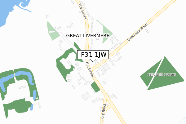
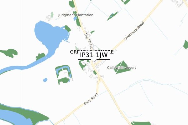
IP31 1JW is located in the Pakenham & Troston electoral ward, within the local authority district of West Suffolk and the English Parliamentary constituency of Bury St Edmunds. The Sub Integrated Care Board (ICB) Location is NHS Suffolk and North East Essex ICB - 06L and the police force is Suffolk. This postcode has been in use since April 2020.


GetTheData
Source: OS Open Zoomstack (Ordnance Survey)
Licence: Open Government Licence (requires attribution)
Attribution: Contains OS data © Crown copyright and database right 2025
Source: Open Postcode Geo
Licence: Open Government Licence (requires attribution)
Attribution: Contains OS data © Crown copyright and database right 2025; Contains Royal Mail data © Royal Mail copyright and database right 2025; Source: Office for National Statistics licensed under the Open Government Licence v.3.0
| Easting | 585045 |
| Northing | 269101 |
| Latitude | 52.288896 |
| Longitude | 0.711742 |
GetTheData
Source: Open Postcode Geo
Licence: Open Government Licence
| Country | England |
| Postcode District | IP31 |
➜ See where IP31 is on a map | |
GetTheData
Source: Land Registry Price Paid Data
Licence: Open Government Licence
| Ward | Pakenham & Troston |
| Constituency | Bury St Edmunds |
GetTheData
Source: ONS Postcode Database
Licence: Open Government Licence
| Timworth Farm (A143) | Timworth | 391m |
| Timworth Farm (A143) | Timworth | 395m |
| Green (The Street) | Timworth Green | 1,050m |
| Green (The Street) | Timworth Green | 1,055m |
| Parklands Green (Park Avenue) | Fornham St Genevieve | 1,397m |
| Bury St Edmunds Station | 3.9km |
GetTheData
Source: NaPTAN
Licence: Open Government Licence
GetTheData
Source: ONS Postcode Database
Licence: Open Government Licence


➜ Get more ratings from the Food Standards Agency
GetTheData
Source: Food Standards Agency
Licence: FSA terms & conditions
| Last Collection | |||
|---|---|---|---|
| Location | Mon-Fri | Sat | Distance |
| Timworth Green | 16:30 | 12:00 | 1,051m |
| The Street | 16:45 | 11:00 | 1,645m |
| Culford Road | 16:00 | 07:30 | 1,755m |
GetTheData
Source: Dracos
Licence: Creative Commons Attribution-ShareAlike
The below table lists the International Territorial Level (ITL) codes (formerly Nomenclature of Territorial Units for Statistics (NUTS) codes) and Local Administrative Units (LAU) codes for IP31 1JW:
| ITL 1 Code | Name |
|---|---|
| TLH | East |
| ITL 2 Code | Name |
| TLH1 | East Anglia |
| ITL 3 Code | Name |
| TLH14 | Suffolk CC |
| LAU 1 Code | Name |
| E07000245 | West Suffolk |
GetTheData
Source: ONS Postcode Directory
Licence: Open Government Licence
The below table lists the Census Output Area (OA), Lower Layer Super Output Area (LSOA), and Middle Layer Super Output Area (MSOA) for IP31 1JW:
| Code | Name | |
|---|---|---|
| OA | E00153621 | |
| LSOA | E01030133 | St Edmundsbury 002D |
| MSOA | E02006274 | St Edmundsbury 002 |
GetTheData
Source: ONS Postcode Directory
Licence: Open Government Licence
| IP31 1HT | Dairy Lane | 428m |
| IP28 6TT | Fornham Park | 1085m |
| IP28 6TQ | South Lodge Drive | 1304m |
| IP28 6DT | 1347m | |
| IP28 6DX | 1356m | |
| IP31 1NQ | The Street | 1374m |
| IP28 6UH | Parklands Green | 1378m |
| IP28 6BY | Oak Close | 1405m |
| IP28 6JH | Fornham Park | 1453m |
| IP28 6EA | Benyon Gardens | 1468m |
GetTheData
Source: Open Postcode Geo; Land Registry Price Paid Data
Licence: Open Government Licence