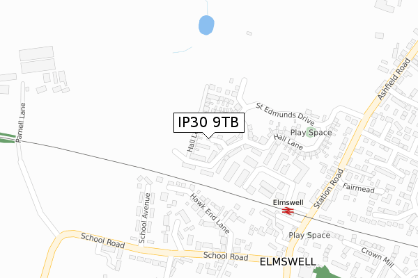
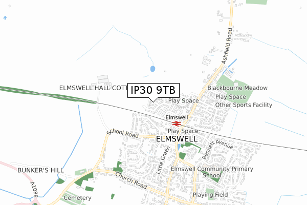
IP30 9TB is located in the Elmswell & Woolpit electoral ward, within the local authority district of Mid Suffolk and the English Parliamentary constituency of Bury St Edmunds. The Sub Integrated Care Board (ICB) Location is NHS Suffolk and North East Essex ICB - 07K and the police force is Suffolk. This postcode has been in use since January 2019.


GetTheData
Source: OS Open Zoomstack (Ordnance Survey)
Licence: Open Government Licence (requires attribution)
Attribution: Contains OS data © Crown copyright and database right 2025
Source: Open Postcode Geo
Licence: Open Government Licence (requires attribution)
Attribution: Contains OS data © Crown copyright and database right 2025; Contains Royal Mail data © Royal Mail copyright and database right 2025; Source: Office for National Statistics licensed under the Open Government Licence v.3.0
| Easting | 598782 |
| Northing | 264160 |
| Latitude | 52.239740 |
| Longitude | 0.909978 |
GetTheData
Source: Open Postcode Geo
Licence: Open Government Licence
| Country | England |
| Postcode District | IP30 |
➜ See where IP30 is on a map ➜ Where is Elmswell? | |
GetTheData
Source: Land Registry Price Paid Data
Licence: Open Government Licence
| Ward | Elmswell & Woolpit |
| Constituency | Bury St Edmunds |
GetTheData
Source: ONS Postcode Database
Licence: Open Government Licence
2, MONKS PATH, ELMSWELL, BURY ST EDMUNDS, IP30 9TB 2019 29 MAR £314,995 |
GetTheData
Source: HM Land Registry Price Paid Data
Licence: Contains HM Land Registry data © Crown copyright and database right 2025. This data is licensed under the Open Government Licence v3.0.
| Old Schools Court (School Road) | Elmswell | 308m |
| Shop Corner (School Road) | Elmswell | 326m |
| Old Schools Court (School Road) | Elmswell | 329m |
| Shop Corner (School Road) | Elmswell | 331m |
| Shop Corner (Station Road) | Elmswell | 355m |
| Elmswell Station | 0.3km |
GetTheData
Source: NaPTAN
Licence: Open Government Licence
| Percentage of properties with Next Generation Access | 100.0% |
| Percentage of properties with Superfast Broadband | 100.0% |
| Percentage of properties with Ultrafast Broadband | 57.7% |
| Percentage of properties with Full Fibre Broadband | 57.7% |
Superfast Broadband is between 30Mbps and 300Mbps
Ultrafast Broadband is > 300Mbps
| Percentage of properties unable to receive 2Mbps | 0.0% |
| Percentage of properties unable to receive 5Mbps | 0.0% |
| Percentage of properties unable to receive 10Mbps | 0.0% |
| Percentage of properties unable to receive 30Mbps | 0.0% |
GetTheData
Source: Ofcom
Licence: Ofcom Terms of Use (requires attribution)
GetTheData
Source: ONS Postcode Database
Licence: Open Government Licence


➜ Get more ratings from the Food Standards Agency
GetTheData
Source: Food Standards Agency
Licence: FSA terms & conditions
| Last Collection | |||
|---|---|---|---|
| Location | Mon-Fri | Sat | Distance |
| Borley Green | 16:15 | 09:30 | 3,285m |
| The Rectory | 16:45 | 10:45 | 3,325m |
| Hunston Green | 16:00 | 11:15 | 4,397m |
GetTheData
Source: Dracos
Licence: Creative Commons Attribution-ShareAlike
The below table lists the International Territorial Level (ITL) codes (formerly Nomenclature of Territorial Units for Statistics (NUTS) codes) and Local Administrative Units (LAU) codes for IP30 9TB:
| ITL 1 Code | Name |
|---|---|
| TLH | East |
| ITL 2 Code | Name |
| TLH1 | East Anglia |
| ITL 3 Code | Name |
| TLH14 | Suffolk CC |
| LAU 1 Code | Name |
| E07000203 | Mid Suffolk |
GetTheData
Source: ONS Postcode Directory
Licence: Open Government Licence
The below table lists the Census Output Area (OA), Lower Layer Super Output Area (LSOA), and Middle Layer Super Output Area (MSOA) for IP30 9TB:
| Code | Name | |
|---|---|---|
| OA | E00153149 | |
| LSOA | E01030050 | Mid Suffolk 004C |
| MSOA | E02006264 | Mid Suffolk 004 |
GetTheData
Source: ONS Postcode Directory
Licence: Open Government Licence
| IP30 9HR | 174m | |
| IP30 9ED | Hawk End Lane | 180m |
| IP30 9BW | Farm Meadow | 199m |
| IP30 9HB | The Granary | 232m |
| IP30 9EG | School Road | 257m |
| IP30 9EH | School Avenue | 265m |
| IP30 9HU | Bakers Mill | 280m |
| IP30 9HA | Station Road | 303m |
| IP30 9EQ | School Road | 327m |
| IP30 9HD | Station Road | 333m |
GetTheData
Source: Open Postcode Geo; Land Registry Price Paid Data
Licence: Open Government Licence