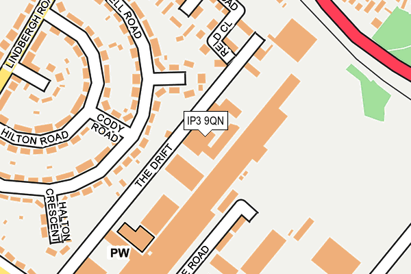
IP3 9QN is located in the Priory Heath electoral ward, within the local authority district of Ipswich and the English Parliamentary constituency of Ipswich. The Sub Integrated Care Board (ICB) Location is NHS Suffolk and North East Essex ICB - 06L and the police force is Suffolk. This postcode has been in use since October 2008.


GetTheData
Source: OS OpenMap – Local (Ordnance Survey)
Source: OS VectorMap District (Ordnance Survey)
Licence: Open Government Licence (requires attribution)
| Easting | 619530 |
| Northing | 242353 |
| Latitude | 52.036099 |
| Longitude | 1.199262 |
GetTheData
Source: Open Postcode Geo
Licence: Open Government Licence
| Country | England |
| Postcode District | IP3 |
➜ See where IP3 is on a map ➜ Where is Ipswich? | |
GetTheData
Source: Land Registry Price Paid Data
Licence: Open Government Licence
Elevation or altitude of IP3 9QN as distance above sea level:
| Metres | Feet | |
|---|---|---|
| Elevation | 40m | 131ft |
Elevation is measured from the approximate centre of the postcode, to the nearest point on an OS contour line from OS Terrain 50, which has contour spacing of ten vertical metres.
➜ How high above sea level am I? Find the elevation of your current position using your device's GPS.
GetTheData
Source: Open Postcode Elevation
Licence: Open Government Licence
| Ward | Priory Heath |
| Constituency | Ipswich |
GetTheData
Source: ONS Postcode Database
Licence: Open Government Licence
| Brook Car Sales (Felixstowe Road) | Warren Heath | 260m |
| Brook Car Sales (Felixstowe Road) | Warren Heath | 292m |
| Cranwell Crescent (Lindbergh Road) | Priory Heath | 299m |
| Cranwell Crescent (Lindbergh Road) | Priory Heath | 307m |
| Warren Heath Road (Felixstowe Road) | St Augustines | 318m |
| Derby Road (Ipswich) Station | 2km |
| Ipswich Station | 4.1km |
| Westerfield Station | 5.5km |
GetTheData
Source: NaPTAN
Licence: Open Government Licence
| Median download speed | 13.7Mbps |
| Average download speed | 12.9Mbps |
| Maximum download speed | 15.43Mbps |
| Median upload speed | 1.1Mbps |
| Average upload speed | 1.1Mbps |
| Maximum upload speed | 1.24Mbps |
GetTheData
Source: Ofcom
Licence: Ofcom Terms of Use (requires attribution)
GetTheData
Source: ONS Postcode Database
Licence: Open Government Licence


➜ Get more ratings from the Food Standards Agency
GetTheData
Source: Food Standards Agency
Licence: FSA terms & conditions
| Last Collection | |||
|---|---|---|---|
| Location | Mon-Fri | Sat | Distance |
| Warren Heath P.o. 478 Felixstowe | 18:30 | 12:15 | 658m |
| Murrells Road | 17:30 | 12:10 | 695m |
| Reynolds Road Post Office | 17:30 | 12:15 | 719m |
GetTheData
Source: Dracos
Licence: Creative Commons Attribution-ShareAlike
The below table lists the International Territorial Level (ITL) codes (formerly Nomenclature of Territorial Units for Statistics (NUTS) codes) and Local Administrative Units (LAU) codes for IP3 9QN:
| ITL 1 Code | Name |
|---|---|
| TLH | East |
| ITL 2 Code | Name |
| TLH1 | East Anglia |
| ITL 3 Code | Name |
| TLH14 | Suffolk CC |
| LAU 1 Code | Name |
| E07000202 | Ipswich |
GetTheData
Source: ONS Postcode Directory
Licence: Open Government Licence
The below table lists the Census Output Area (OA), Lower Layer Super Output Area (LSOA), and Middle Layer Super Output Area (MSOA) for IP3 9QN:
| Code | Name | |
|---|---|---|
| OA | E00152872 | |
| LSOA | E01033131 | Ipswich 014G |
| MSOA | E02006258 | Ipswich 014 |
GetTheData
Source: ONS Postcode Directory
Licence: Open Government Licence
| IP3 9RF | Uxbridge Crescent | 79m |
| IP3 9RG | Cody Road | 153m |
| IP3 9QR | The Drift | 177m |
| IP3 9RE | Campbell Road | 183m |
| IP3 9RH | Hilton Road | 212m |
| IP3 9QY | Cranwell Crescent | 225m |
| IP3 9RJ | Campbell Road | 234m |
| IP3 9RQ | Hilton Road | 247m |
| IP3 8SY | Felixstowe Road | 270m |
| IP3 9RL | Halton Crescent | 277m |
GetTheData
Source: Open Postcode Geo; Land Registry Price Paid Data
Licence: Open Government Licence