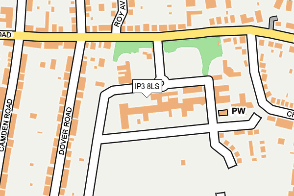
IP3 8LS is located in the St John's electoral ward, within the local authority district of Ipswich and the English Parliamentary constituency of Ipswich. The Sub Integrated Care Board (ICB) Location is NHS Suffolk and North East Essex ICB - 06L and the police force is Suffolk. This postcode has been in use since July 2017.


GetTheData
Source: OS OpenMap – Local (Ordnance Survey)
Source: OS VectorMap District (Ordnance Survey)
Licence: Open Government Licence (requires attribution)
| Easting | 619002 |
| Northing | 243947 |
| Latitude | 52.050631 |
| Longitude | 1.192627 |
GetTheData
Source: Open Postcode Geo
Licence: Open Government Licence
| Country | England |
| Postcode District | IP3 |
➜ See where IP3 is on a map ➜ Where is Ipswich? | |
GetTheData
Source: Land Registry Price Paid Data
Licence: Open Government Licence
| Ward | St John's |
| Constituency | Ipswich |
GetTheData
Source: ONS Postcode Database
Licence: Open Government Licence
| St Clements Hospital (Foxhall Road) | California | 134m |
| St Clements Hospital (Foxhall Road) | California | 144m |
| Chilton Road (Foxhall Road) | California | 178m |
| Chilton Road (Foxhall Road) | California | 249m |
| Camden Road (Foxhall Road) | California | 261m |
| Derby Road (Ipswich) Station | 0.7km |
| Ipswich Station | 3.3km |
| Westerfield Station | 3.8km |
GetTheData
Source: NaPTAN
Licence: Open Government Licence
GetTheData
Source: ONS Postcode Database
Licence: Open Government Licence


➜ Get more ratings from the Food Standards Agency
GetTheData
Source: Food Standards Agency
Licence: FSA terms & conditions
| Last Collection | |||
|---|---|---|---|
| Location | Mon-Fri | Sat | Distance |
| Heath Road Post Office | 18:30 | 13:00 | 575m |
| 65 Bixley Road | 17:30 | 12:20 | 687m |
| 64 Chilton Road | 17:30 | 12:20 | 708m |
GetTheData
Source: Dracos
Licence: Creative Commons Attribution-ShareAlike
The below table lists the International Territorial Level (ITL) codes (formerly Nomenclature of Territorial Units for Statistics (NUTS) codes) and Local Administrative Units (LAU) codes for IP3 8LS:
| ITL 1 Code | Name |
|---|---|
| TLH | East |
| ITL 2 Code | Name |
| TLH1 | East Anglia |
| ITL 3 Code | Name |
| TLH14 | Suffolk CC |
| LAU 1 Code | Name |
| E07000202 | Ipswich |
GetTheData
Source: ONS Postcode Directory
Licence: Open Government Licence
The below table lists the Census Output Area (OA), Lower Layer Super Output Area (LSOA), and Middle Layer Super Output Area (MSOA) for IP3 8LS:
| Code | Name | |
|---|---|---|
| OA | E00152919 | |
| LSOA | E01030005 | Ipswich 008D |
| MSOA | E02006252 | Ipswich 008 |
GetTheData
Source: ONS Postcode Directory
Licence: Open Government Licence
| IP3 8LW | Foxhall Road | 145m |
| IP3 8JG | Foxhall Road | 154m |
| IP3 8JQ | Dover Road | 183m |
| IP3 8LL | Foxhall Road | 188m |
| IP3 8LT | Foxhall Road | 197m |
| IP3 8JP | The Pippins | 216m |
| IP3 8LN | Roy Avenue | 217m |
| IP3 8LR | Foxhall Road | 220m |
| IP3 8JF | Foxhall Road | 238m |
| IP3 8JH | Dover Road | 246m |
GetTheData
Source: Open Postcode Geo; Land Registry Price Paid Data
Licence: Open Government Licence