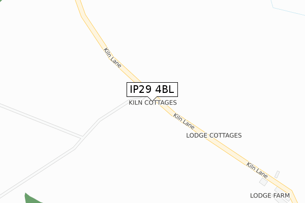
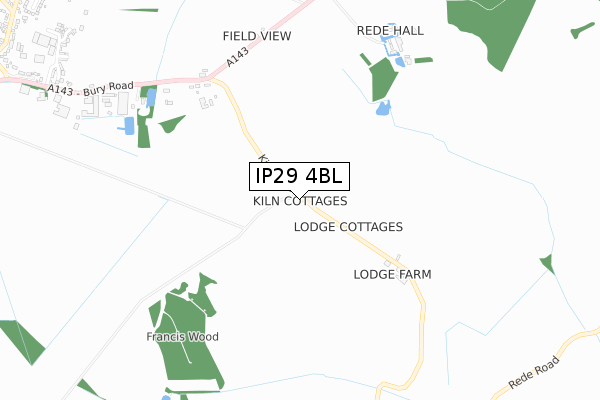
IP29 4BL is located in the Chedburgh & Chevington electoral ward, within the local authority district of West Suffolk and the English Parliamentary constituency of West Suffolk. The Sub Integrated Care Board (ICB) Location is NHS Suffolk and North East Essex ICB - 07K and the police force is Suffolk. This postcode has been in use since December 2018.


GetTheData
Source: OS Open Zoomstack (Ordnance Survey)
Licence: Open Government Licence (requires attribution)
Attribution: Contains OS data © Crown copyright and database right 2025
Source: Open Postcode Geo
Licence: Open Government Licence (requires attribution)
Attribution: Contains OS data © Crown copyright and database right 2025; Contains Royal Mail data © Royal Mail copyright and database right 2025; Source: Office for National Statistics licensed under the Open Government Licence v.3.0
| Easting | 580174 |
| Northing | 257027 |
| Latitude | 52.182078 |
| Longitude | 0.633977 |
GetTheData
Source: Open Postcode Geo
Licence: Open Government Licence
| Country | England |
| Postcode District | IP29 |
➜ See where IP29 is on a map | |
GetTheData
Source: Land Registry Price Paid Data
Licence: Open Government Licence
| Ward | Chedburgh & Chevington |
| Constituency | West Suffolk |
GetTheData
Source: ONS Postcode Database
Licence: Open Government Licence
| Bus Shelter (Rede Road) | Rede | 1,253m |
| Bus Shelter (Rede Road) | Rede | 1,266m |
| Bus Shelter (The Green) | Chedburgh | 1,358m |
| Bus Shelter (The Green) | Chedburgh | 1,363m |
| Majors Close (Chevington Road) | Chedburgh | 1,638m |
GetTheData
Source: NaPTAN
Licence: Open Government Licence
GetTheData
Source: ONS Postcode Database
Licence: Open Government Licence
| Last Collection | |||
|---|---|---|---|
| Location | Mon-Fri | Sat | Distance |
| Ruffins House | 16:00 | 09:00 | 1,980m |
| New Road | 16:00 | 09:30 | 3,161m |
| Clopton Hall | 16:00 | 08:30 | 3,842m |
GetTheData
Source: Dracos
Licence: Creative Commons Attribution-ShareAlike
The below table lists the International Territorial Level (ITL) codes (formerly Nomenclature of Territorial Units for Statistics (NUTS) codes) and Local Administrative Units (LAU) codes for IP29 4BL:
| ITL 1 Code | Name |
|---|---|
| TLH | East |
| ITL 2 Code | Name |
| TLH1 | East Anglia |
| ITL 3 Code | Name |
| TLH14 | Suffolk CC |
| LAU 1 Code | Name |
| E07000245 | West Suffolk |
GetTheData
Source: ONS Postcode Directory
Licence: Open Government Licence
The below table lists the Census Output Area (OA), Lower Layer Super Output Area (LSOA), and Middle Layer Super Output Area (MSOA) for IP29 4BL:
| Code | Name | |
|---|---|---|
| OA | E00153441 | |
| LSOA | E01030100 | St Edmundsbury 008B |
| MSOA | E02006280 | St Edmundsbury 008 |
GetTheData
Source: ONS Postcode Directory
Licence: Open Government Licence
| IP29 4BQ | Lodge Cottages | 234m |
| IP29 4UG | 884m | |
| IP29 4UQ | Bury Road | 986m |
| IP29 4BG | Church Close | 1088m |
| IP29 4BE | 1191m | |
| IP29 4AZ | 1276m | |
| IP29 4UE | The Green | 1280m |
| IP29 4UJ | Chestnut Crescent | 1352m |
| IP29 4UH | The Street | 1407m |
| IP29 4UT | Queens Lane | 1419m |
GetTheData
Source: Open Postcode Geo; Land Registry Price Paid Data
Licence: Open Government Licence