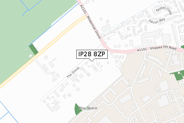
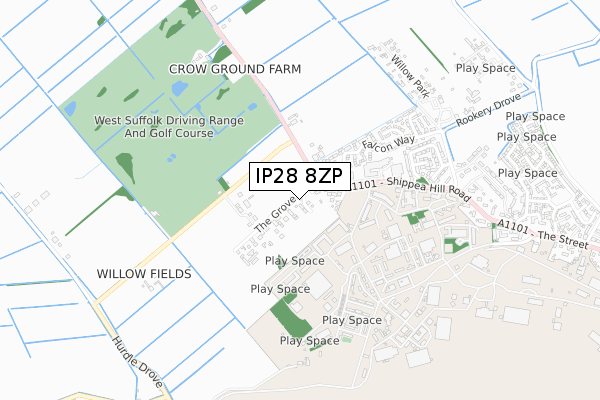
IP28 8ZP is located in the The Rows electoral ward, within the local authority district of West Suffolk and the English Parliamentary constituency of West Suffolk. The Sub Integrated Care Board (ICB) Location is NHS Suffolk and North East Essex ICB - 07K and the police force is Suffolk. This postcode has been in use since March 2019.


GetTheData
Source: OS Open Zoomstack (Ordnance Survey)
Licence: Open Government Licence (requires attribution)
Attribution: Contains OS data © Crown copyright and database right 2024
Source: Open Postcode Geo
Licence: Open Government Licence (requires attribution)
Attribution: Contains OS data © Crown copyright and database right 2024; Contains Royal Mail data © Royal Mail copyright and database right 2024; Source: Office for National Statistics licensed under the Open Government Licence v.3.0
| Easting | 567931 |
| Northing | 277868 |
| Latitude | 52.373132 |
| Longitude | 0.465454 |
GetTheData
Source: Open Postcode Geo
Licence: Open Government Licence
| Country | England |
| Postcode District | IP28 |
➜ See where IP28 is on a map ➜ Where is Mildenhall? | |
GetTheData
Source: Land Registry Price Paid Data
Licence: Open Government Licence
| Ward | The Rows |
| Constituency | West Suffolk |
GetTheData
Source: ONS Postcode Database
Licence: Open Government Licence
1, MIAS WAY, BECK ROW, BURY ST EDMUNDS, IP28 8ZP 2020 5 JUN £440,000 |
2, MIAS WAY, BECK ROW, BURY ST EDMUNDS, IP28 8ZP 2019 3 MAY £440,000 |
4, MIAS WAY, BECK ROW, BURY ST EDMUNDS, IP28 8ZP 2019 3 MAY £400,000 |
1, MIAS WAY, BECK ROW, BURY ST EDMUNDS, IP28 8ZP 2019 22 FEB £435,000 |
GetTheData
Source: HM Land Registry Price Paid Data
Licence: Contains HM Land Registry data © Crown copyright and database right 2024. This data is licensed under the Open Government Licence v3.0.
| Moss Edge Farm (Mildenhall Drove) | Beck Row | 266m |
| Moss Edge Farm (Mildenhall Drove) | Beck Row | 270m |
| Rookery Drove (Shippea Hill Road) | Beck Row | 585m |
| Rookery Drove (Shippea Hill Road) | Beck Row | 593m |
| Barleycorn Way (The Street) | Beck Row | 1,053m |
GetTheData
Source: NaPTAN
Licence: Open Government Licence
| Percentage of properties with Next Generation Access | 100.0% |
| Percentage of properties with Superfast Broadband | 100.0% |
| Percentage of properties with Ultrafast Broadband | 0.0% |
| Percentage of properties with Full Fibre Broadband | 0.0% |
Superfast Broadband is between 30Mbps and 300Mbps
Ultrafast Broadband is > 300Mbps
| Percentage of properties unable to receive 2Mbps | 0.0% |
| Percentage of properties unable to receive 5Mbps | 0.0% |
| Percentage of properties unable to receive 10Mbps | 0.0% |
| Percentage of properties unable to receive 30Mbps | 0.0% |
GetTheData
Source: Ofcom
Licence: Ofcom Terms of Use (requires attribution)
GetTheData
Source: ONS Postcode Database
Licence: Open Government Licence


➜ Get more ratings from the Food Standards Agency
GetTheData
Source: Food Standards Agency
Licence: FSA terms & conditions
| Last Collection | |||
|---|---|---|---|
| Location | Mon-Fri | Sat | Distance |
| The Street | 11:00 | 11:15 | 797m |
| Holmsey Green | 15:30 | 09:15 | 1,631m |
| Chiswick Avenue | 17:00 | 09:00 | 3,618m |
GetTheData
Source: Dracos
Licence: Creative Commons Attribution-ShareAlike
The below table lists the International Territorial Level (ITL) codes (formerly Nomenclature of Territorial Units for Statistics (NUTS) codes) and Local Administrative Units (LAU) codes for IP28 8ZP:
| ITL 1 Code | Name |
|---|---|
| TLH | East |
| ITL 2 Code | Name |
| TLH1 | East Anglia |
| ITL 3 Code | Name |
| TLH14 | Suffolk CC |
| LAU 1 Code | Name |
| E07000245 | West Suffolk |
GetTheData
Source: ONS Postcode Directory
Licence: Open Government Licence
The below table lists the Census Output Area (OA), Lower Layer Super Output Area (LSOA), and Middle Layer Super Output Area (MSOA) for IP28 8ZP:
| Code | Name | |
|---|---|---|
| OA | E00173919 | |
| LSOA | E01032523 | Forest Heath 003F |
| MSOA | E02006240 | Forest Heath 003 |
GetTheData
Source: ONS Postcode Directory
Licence: Open Government Licence
| IP28 8DP | The Grove | 119m |
| IP28 8DQ | York Close | 121m |
| IP28 8DW | Stock Corner | 163m |
| IP28 8EL | Falcon Way | 379m |
| IP28 8EP | Kestrel Close | 489m |
| IP28 8HN | Plover Close | 526m |
| IP28 8HL | Blackbird Road | 536m |
| IP28 8DJ | Donegal Park | 578m |
| IP28 8HW | Heron Close | 582m |
| IP28 8FB | Harrier Way | 596m |
GetTheData
Source: Open Postcode Geo; Land Registry Price Paid Data
Licence: Open Government Licence