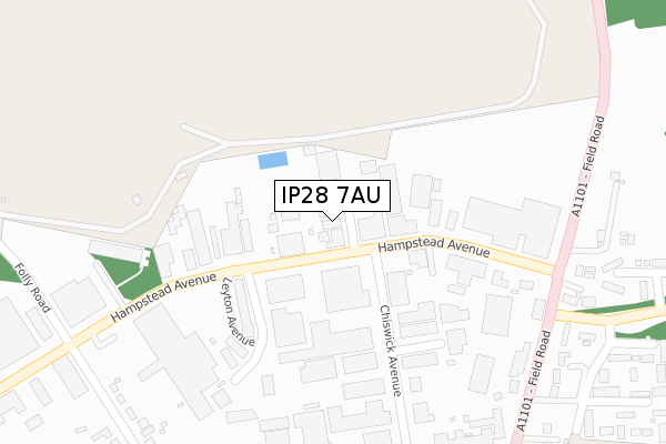
IP28 7AU is located in the Mildenhall Kingsway & Market electoral ward, within the local authority district of West Suffolk and the English Parliamentary constituency of West Suffolk. The Sub Integrated Care Board (ICB) Location is NHS Suffolk and North East Essex ICB - 07K and the police force is Suffolk. This postcode has been in use since November 2020.


GetTheData
Source: OS Open Zoomstack (Ordnance Survey)
Licence: Open Government Licence (requires attribution)
Attribution: Contains OS data © Crown copyright and database right 2025
Source: Open Postcode Geo
Licence: Open Government Licence (requires attribution)
Attribution: Contains OS data © Crown copyright and database right 2025; Contains Royal Mail data © Royal Mail copyright and database right 2025; Source: Office for National Statistics licensed under the Open Government Licence v.3.0
| Easting | 571195 |
| Northing | 274906 |
| Latitude | 52.345520 |
| Longitude | 0.511842 |
GetTheData
Source: Open Postcode Geo
Licence: Open Government Licence
| Country | England |
| Postcode District | IP28 |
➜ See where IP28 is on a map ➜ Where is Mildenhall? | |
GetTheData
Source: Land Registry Price Paid Data
Licence: Open Government Licence
| Ward | Mildenhall Kingsway & Market |
| Constituency | West Suffolk |
GetTheData
Source: ONS Postcode Database
Licence: Open Government Licence
4, BRECK GARDENS, MILDENHALL, BURY ST EDMUNDS, IP28 7AU 2024 3 MAY £445,000 |
7, BRECK GARDENS, MILDENHALL, BURY ST EDMUNDS, IP28 7AU 2022 6 MAY £380,000 |
4, BRECK GARDENS, MILDENHALL, BURY ST EDMUNDS, IP28 7AU 2021 12 MAR £425,000 |
3, BRECK GARDENS, MILDENHALL, BURY ST EDMUNDS, IP28 7AU 2021 29 JAN £281,250 |
6, BRECK GARDENS, MILDENHALL, BURY ST EDMUNDS, IP28 7AU 2021 29 JAN £435,000 |
5, BRECK GARDENS, MILDENHALL, BURY ST EDMUNDS, IP28 7AU 2021 20 JAN £290,000 |
GetTheData
Source: HM Land Registry Price Paid Data
Licence: Contains HM Land Registry data © Crown copyright and database right 2025. This data is licensed under the Open Government Licence v3.0.
| Queensway | Mildenhall | 151m |
| Queensway | Mildenhall | 155m |
| Folly Road (North Terrace) | Mildenhall | 183m |
| Folly Road (North Terrace) | Mildenhall | 198m |
| Wakes Avenue (Hereward Avenue) | Mildenhall | 231m |
GetTheData
Source: NaPTAN
Licence: Open Government Licence
GetTheData
Source: ONS Postcode Database
Licence: Open Government Licence


➜ Get more ratings from the Food Standards Agency
GetTheData
Source: Food Standards Agency
Licence: FSA terms & conditions
| Last Collection | |||
|---|---|---|---|
| Location | Mon-Fri | Sat | Distance |
| North Terrace | 11:00 | 10:15 | 137m |
| Fleming Avenue | 11:00 | 10:15 | 149m |
| King Street | 17:00 | 10:00 | 259m |
GetTheData
Source: Dracos
Licence: Creative Commons Attribution-ShareAlike
The below table lists the International Territorial Level (ITL) codes (formerly Nomenclature of Territorial Units for Statistics (NUTS) codes) and Local Administrative Units (LAU) codes for IP28 7AU:
| ITL 1 Code | Name |
|---|---|
| TLH | East |
| ITL 2 Code | Name |
| TLH1 | East Anglia |
| ITL 3 Code | Name |
| TLH14 | Suffolk CC |
| LAU 1 Code | Name |
| E07000245 | West Suffolk |
GetTheData
Source: ONS Postcode Directory
Licence: Open Government Licence
The below table lists the Census Output Area (OA), Lower Layer Super Output Area (LSOA), and Middle Layer Super Output Area (MSOA) for IP28 7AU:
| Code | Name | |
|---|---|---|
| OA | E00152627 | |
| LSOA | E01029946 | Forest Heath 004D |
| MSOA | E02006241 | Forest Heath 004 |
GetTheData
Source: ONS Postcode Directory
Licence: Open Government Licence
| IP28 7AA | North Terrace | 54m |
| IP28 7GY | Pound Meadow Court | 78m |
| IP28 7AB | North Terrace | 126m |
| IP28 7HN | Kingsway | 146m |
| IP28 7ER | Police Station Square | 156m |
| IP28 7LW | Hereward Avenue | 163m |
| IP28 7EW | Queensway | 172m |
| IP28 7EJ | High Street | 175m |
| IP28 7ET | The Shrublands | 183m |
| IP28 7LN | Croft Place | 194m |
GetTheData
Source: Open Postcode Geo; Land Registry Price Paid Data
Licence: Open Government Licence