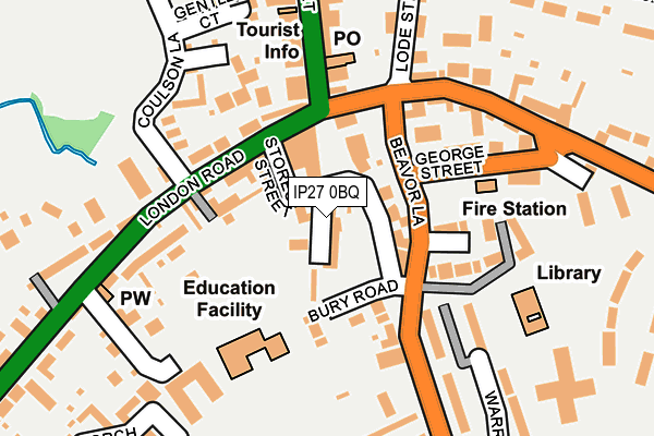
IP27 0BQ is located in the Brandon Central electoral ward, within the local authority district of West Suffolk and the English Parliamentary constituency of West Suffolk. The Sub Integrated Care Board (ICB) Location is NHS Suffolk and North East Essex ICB - 07K and the police force is Suffolk. This postcode has been in use since May 2021.


GetTheData
Source: OS OpenMap – Local (Ordnance Survey)
Source: OS VectorMap District (Ordnance Survey)
Licence: Open Government Licence (requires attribution)
| Easting | 578413 |
| Northing | 286428 |
| Latitude | 52.446698 |
| Longitude | 0.623820 |
GetTheData
Source: Open Postcode Geo
Licence: Open Government Licence
| Country | England |
| Postcode District | IP27 |
➜ See where IP27 is on a map ➜ Where is Brandon? | |
GetTheData
Source: Land Registry Price Paid Data
Licence: Open Government Licence
Elevation or altitude of IP27 0BQ as distance above sea level:
| Metres | Feet | |
|---|---|---|
| Elevation | 10m | 33ft |
Elevation is measured from the approximate centre of the postcode, to the nearest point on an OS contour line from OS Terrain 50, which has contour spacing of ten vertical metres.
➜ How high above sea level am I? Find the elevation of your current position using your device's GPS.
GetTheData
Source: Open Postcode Elevation
Licence: Open Government Licence
| Ward | Brandon Central |
| Constituency | West Suffolk |
GetTheData
Source: ONS Postcode Database
Licence: Open Government Licence
| Car Park (George Street) | Brandon | 109m |
| Old Forge Court (London Road) | Brandon | 121m |
| Old Forge Court (London Road) | Brandon | 134m |
| Lode Street (B1107) | Brandon | 172m |
| Ladram House (High Street) | Brandon | 189m |
| Brandon Station | 0.8km |
GetTheData
Source: NaPTAN
Licence: Open Government Licence
GetTheData
Source: ONS Postcode Database
Licence: Open Government Licence


➜ Get more ratings from the Food Standards Agency
GetTheData
Source: Food Standards Agency
Licence: FSA terms & conditions
| Last Collection | |||
|---|---|---|---|
| Location | Mon-Fri | Sat | Distance |
| Royal Mail, 14 High Street | 17:30 | 12:00 | 152m |
| London Road | 16:40 | 11:00 | 262m |
| Pinewood Drive | 16:25 | 11:00 | 380m |
GetTheData
Source: Dracos
Licence: Creative Commons Attribution-ShareAlike
The below table lists the International Territorial Level (ITL) codes (formerly Nomenclature of Territorial Units for Statistics (NUTS) codes) and Local Administrative Units (LAU) codes for IP27 0BQ:
| ITL 1 Code | Name |
|---|---|
| TLH | East |
| ITL 2 Code | Name |
| TLH1 | East Anglia |
| ITL 3 Code | Name |
| TLH14 | Suffolk CC |
| LAU 1 Code | Name |
| E07000245 | West Suffolk |
GetTheData
Source: ONS Postcode Directory
Licence: Open Government Licence
The below table lists the Census Output Area (OA), Lower Layer Super Output Area (LSOA), and Middle Layer Super Output Area (MSOA) for IP27 0BQ:
| Code | Name | |
|---|---|---|
| OA | E00152512 | |
| LSOA | E01029927 | Forest Heath 001B |
| MSOA | E02006238 | Forest Heath 001 |
GetTheData
Source: ONS Postcode Directory
Licence: Open Government Licence
| IP27 0AE | Stores Street | 54m |
| IP27 0AA | Market Hill | 70m |
| IP27 0BU | Bury Road | 86m |
| IP27 0AG | London Road | 89m |
| IP27 0HS | London Road | 120m |
| IP27 0BX | George Street | 148m |
| IP27 0GY | Suffolk Court | 161m |
| IP27 0BS | Thetford Road | 162m |
| IP27 0EL | London Road | 191m |
| IP27 0AQ | High Street | 204m |
GetTheData
Source: Open Postcode Geo; Land Registry Price Paid Data
Licence: Open Government Licence