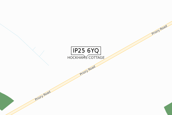
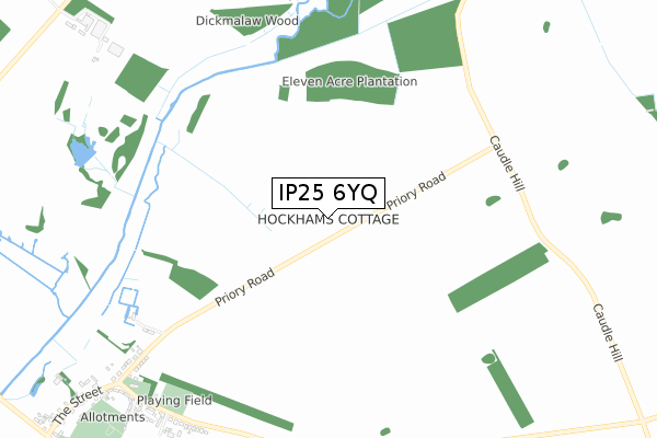
IP25 6YQ is located in the Ashill electoral ward, within the local authority district of Breckland and the English Parliamentary constituency of South West Norfolk. The Sub Integrated Care Board (ICB) Location is NHS Norfolk and Waveney ICB - 26A and the police force is Norfolk. This postcode has been in use since May 2019.


GetTheData
Source: OS Open Zoomstack (Ordnance Survey)
Licence: Open Government Licence (requires attribution)
Attribution: Contains OS data © Crown copyright and database right 2025
Source: Open Postcode Geo
Licence: Open Government Licence (requires attribution)
Attribution: Contains OS data © Crown copyright and database right 2025; Contains Royal Mail data © Royal Mail copyright and database right 2025; Source: Office for National Statistics licensed under the Open Government Licence v.3.0
| Easting | 585955 |
| Northing | 302387 |
| Latitude | 52.587494 |
| Longitude | 0.743575 |
GetTheData
Source: Open Postcode Geo
Licence: Open Government Licence
| Country | England |
| Postcode District | IP25 |
➜ See where IP25 is on a map | |
GetTheData
Source: Land Registry Price Paid Data
Licence: Open Government Licence
| Ward | Ashill |
| Constituency | South West Norfolk |
GetTheData
Source: ONS Postcode Database
Licence: Open Government Licence
| Village Hall (Watton Road) | Great Cressingham | 922m |
| Village Hall (Watton Road) | Great Cressingham | 924m |
| Church (St. Michaels Crescent) | Great Cressingham | 1,003m |
| Church (St. Michaels Crescent) | Great Cressingham | 1,010m |
| The Street | Great Cressingham | 1,300m |
GetTheData
Source: NaPTAN
Licence: Open Government Licence
| Percentage of properties with Next Generation Access | 100.0% |
| Percentage of properties with Superfast Broadband | 0.0% |
| Percentage of properties with Ultrafast Broadband | 0.0% |
| Percentage of properties with Full Fibre Broadband | 0.0% |
Superfast Broadband is between 30Mbps and 300Mbps
Ultrafast Broadband is > 300Mbps
| Percentage of properties unable to receive 2Mbps | 0.0% |
| Percentage of properties unable to receive 5Mbps | 0.0% |
| Percentage of properties unable to receive 10Mbps | 0.0% |
| Percentage of properties unable to receive 30Mbps | 100.0% |
GetTheData
Source: Ofcom
Licence: Ofcom Terms of Use (requires attribution)
GetTheData
Source: ONS Postcode Database
Licence: Open Government Licence


➜ Get more ratings from the Food Standards Agency
GetTheData
Source: Food Standards Agency
Licence: FSA terms & conditions
| Last Collection | |||
|---|---|---|---|
| Location | Mon-Fri | Sat | Distance |
| Priory Drive | 15:00 | 08:30 | 977m |
| Moat Farm, Cressingham Road | 09:30 | 09:30 | 2,443m |
| White Horse Corner | 15:00 | 08:00 | 2,790m |
GetTheData
Source: Dracos
Licence: Creative Commons Attribution-ShareAlike
The below table lists the International Territorial Level (ITL) codes (formerly Nomenclature of Territorial Units for Statistics (NUTS) codes) and Local Administrative Units (LAU) codes for IP25 6YQ:
| ITL 1 Code | Name |
|---|---|
| TLH | East |
| ITL 2 Code | Name |
| TLH1 | East Anglia |
| ITL 3 Code | Name |
| TLH17 | Breckland and South Norfolk |
| LAU 1 Code | Name |
| E07000143 | Breckland |
GetTheData
Source: ONS Postcode Directory
Licence: Open Government Licence
The below table lists the Census Output Area (OA), Lower Layer Super Output Area (LSOA), and Middle Layer Super Output Area (MSOA) for IP25 6YQ:
| Code | Name | |
|---|---|---|
| OA | E00169903 | |
| LSOA | E01026444 | Breckland 012B |
| MSOA | E02005514 | Breckland 012 |
GetTheData
Source: ONS Postcode Directory
Licence: Open Government Licence
| IP25 6NJ | Priory Drove | 936m |
| IP25 6NQ | Watton Road | 967m |
| IP25 6NH | St Michaels Crescent | 1023m |
| IP25 6DY | The Buttlands | 1030m |
| IP25 6NL | The Street | 1220m |
| IP25 6NP | Chalk Hill | 1353m |
| IP25 6NN | Water End | 1445m |
| PE37 8DR | 1833m | |
| PE37 8DS | 1882m | |
| IP25 7BY | Cressingham Road | 2211m |
GetTheData
Source: Open Postcode Geo; Land Registry Price Paid Data
Licence: Open Government Licence