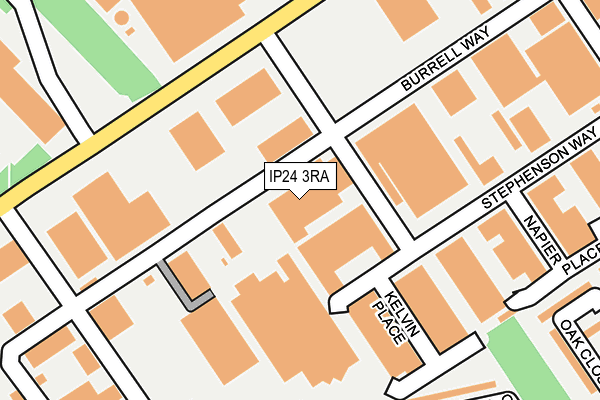
IP24 3RA lies on Burrell Way in Thetford. IP24 3RA is located in the Thetford Burrell electoral ward, within the local authority district of Breckland and the English Parliamentary constituency of South West Norfolk. The Sub Integrated Care Board (ICB) Location is NHS Norfolk and Waveney ICB - 26A and the police force is Norfolk. This postcode has been in use since March 2017.


GetTheData
Source: OS OpenMap – Local (Ordnance Survey)
Source: OS VectorMap District (Ordnance Survey)
Licence: Open Government Licence (requires attribution)
| Easting | 585706 |
| Northing | 282026 |
| Latitude | 52.404742 |
| Longitude | 0.728560 |
GetTheData
Source: Open Postcode Geo
Licence: Open Government Licence
| Street | Burrell Way |
| Town/City | Thetford |
| Country | England |
| Postcode District | IP24 |
➜ See where IP24 is on a map ➜ Where is Thetford? | |
GetTheData
Source: Land Registry Price Paid Data
Licence: Open Government Licence
| Ward | Thetford Burrell |
| Constituency | South West Norfolk |
GetTheData
Source: ONS Postcode Database
Licence: Open Government Licence
| Ash Close (Elm Road) | Thetford | 330m |
| Fir Road | Thetford | 356m |
| Sainsburys (London Road) | Thetford | 459m |
| Elm Road | Thetford | 469m |
| Elm Road (Fir Road) | Thetford | 478m |
| Thetford Station | 2km |
GetTheData
Source: NaPTAN
Licence: Open Government Licence
GetTheData
Source: ONS Postcode Database
Licence: Open Government Licence


➜ Get more ratings from the Food Standards Agency
GetTheData
Source: Food Standards Agency
Licence: FSA terms & conditions
| Last Collection | |||
|---|---|---|---|
| Location | Mon-Fri | Sat | Distance |
| Kimms Belt | 17:15 | 12:00 | 463m |
| Post Office, 15 Pine Close | 17:15 | 12:00 | 597m |
| 103 Canons Walk | 17:00 | 12:00 | 873m |
GetTheData
Source: Dracos
Licence: Creative Commons Attribution-ShareAlike
The below table lists the International Territorial Level (ITL) codes (formerly Nomenclature of Territorial Units for Statistics (NUTS) codes) and Local Administrative Units (LAU) codes for IP24 3RA:
| ITL 1 Code | Name |
|---|---|
| TLH | East |
| ITL 2 Code | Name |
| TLH1 | East Anglia |
| ITL 3 Code | Name |
| TLH17 | Breckland and South Norfolk |
| LAU 1 Code | Name |
| E07000143 | Breckland |
GetTheData
Source: ONS Postcode Directory
Licence: Open Government Licence
The below table lists the Census Output Area (OA), Lower Layer Super Output Area (LSOA), and Middle Layer Super Output Area (MSOA) for IP24 3RA:
| Code | Name | |
|---|---|---|
| OA | E00134546 | |
| LSOA | E01026478 | Breckland 017E |
| MSOA | E02005519 | Breckland 017 |
GetTheData
Source: ONS Postcode Directory
Licence: Open Government Licence
| IP24 3QS | Burrell Way | 135m |
| IP24 3HD | Almond Grove | 270m |
| IP24 3HQ | Ash Close | 315m |
| IP24 3EZ | Oak Close | 319m |
| IP24 3HG | Ash Close | 336m |
| IP24 3HF | Elm Road | 343m |
| IP24 3HB | Fir Road | 364m |
| IP24 3EY | Fir Road | 373m |
| IP24 3HA | Fir Road | 377m |
| IP24 3EU | Rowan Close | 391m |
GetTheData
Source: Open Postcode Geo; Land Registry Price Paid Data
Licence: Open Government Licence