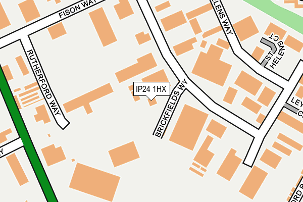
IP24 1HX is located in the Thetford Priory electoral ward, within the local authority district of Breckland and the English Parliamentary constituency of South West Norfolk. The Sub Integrated Care Board (ICB) Location is NHS Norfolk and Waveney ICB - 26A and the police force is Norfolk. This postcode has been in use since June 1997.


GetTheData
Source: OS OpenMap – Local (Ordnance Survey)
Source: OS VectorMap District (Ordnance Survey)
Licence: Open Government Licence (requires attribution)
| Easting | 586782 |
| Northing | 284253 |
| Latitude | 52.424355 |
| Longitude | 0.745575 |
GetTheData
Source: Open Postcode Geo
Licence: Open Government Licence
| Country | England |
| Postcode District | IP24 |
➜ See where IP24 is on a map ➜ Where is Thetford? | |
GetTheData
Source: Land Registry Price Paid Data
Licence: Open Government Licence
Elevation or altitude of IP24 1HX as distance above sea level:
| Metres | Feet | |
|---|---|---|
| Elevation | 40m | 131ft |
Elevation is measured from the approximate centre of the postcode, to the nearest point on an OS contour line from OS Terrain 50, which has contour spacing of ten vertical metres.
➜ How high above sea level am I? Find the elevation of your current position using your device's GPS.
GetTheData
Source: Open Postcode Elevation
Licence: Open Government Licence
| Ward | Thetford Priory |
| Constituency | South West Norfolk |
GetTheData
Source: ONS Postcode Database
Licence: Open Government Licence
| Barclay Close (Anne Bartholomew Road) | Thetford | 439m |
| Edith Cavell Close (Anne Bartholomew Road) | Thetford | 483m |
| Fairfields (Croxton Road) | Thetford | 517m |
| Leisure Centre (Croxton Road) | Thetford | 517m |
| Fairfields (Croxton Road) | Thetford | 519m |
| Thetford Station | 0.6km |
GetTheData
Source: NaPTAN
Licence: Open Government Licence
GetTheData
Source: ONS Postcode Database
Licence: Open Government Licence


➜ Get more ratings from the Food Standards Agency
GetTheData
Source: Food Standards Agency
Licence: FSA terms & conditions
| Last Collection | |||
|---|---|---|---|
| Location | Mon-Fri | Sat | Distance |
| Fisons Way | 17:45 | 11:45 | 296m |
| Croxton Road | 17:30 | 11:45 | 555m |
| Monksgate | 17:30 | 11:45 | 620m |
GetTheData
Source: Dracos
Licence: Creative Commons Attribution-ShareAlike
The below table lists the International Territorial Level (ITL) codes (formerly Nomenclature of Territorial Units for Statistics (NUTS) codes) and Local Administrative Units (LAU) codes for IP24 1HX:
| ITL 1 Code | Name |
|---|---|
| TLH | East |
| ITL 2 Code | Name |
| TLH1 | East Anglia |
| ITL 3 Code | Name |
| TLH17 | Breckland and South Norfolk |
| LAU 1 Code | Name |
| E07000143 | Breckland |
GetTheData
Source: ONS Postcode Directory
Licence: Open Government Licence
The below table lists the Census Output Area (OA), Lower Layer Super Output Area (LSOA), and Middle Layer Super Output Area (MSOA) for IP24 1HX:
| Code | Name | |
|---|---|---|
| OA | E00169886 | |
| LSOA | E01026466 | Breckland 015B |
| MSOA | E02005517 | Breckland 015 |
GetTheData
Source: ONS Postcode Directory
Licence: Open Government Licence
| IP24 1HA | Rutherford Way | 147m |
| IP24 1HZ | Howlett Way | 165m |
| IP24 1NB | Mundford Road | 270m |
| IP24 1TQ | Catherine Howard Close | 367m |
| IP24 1FH | Stanford Road | 367m |
| IP24 1HU | Telford Way | 379m |
| IP24 1ES | Buckenham Way | 390m |
| IP24 1FD | Sturston Close | 392m |
| IP24 1FE | Tottington Close | 435m |
| IP24 1TJ | Edith Cavell Close | 456m |
GetTheData
Source: Open Postcode Geo; Land Registry Price Paid Data
Licence: Open Government Licence